
Mt. Kawanori (川苔山, 1,363 m) is one of the most complete full-day hikes inside Tokyo. It sits in Okutama, at the western edge of the city, and the standard route strings together a forestry road, a narrow gorge trail, Hyakuhiro Falls, an open summit and a long descent to a different railway station. You finish where you did not start, which is part of the appeal and also the reason this hike needs more planning than a loop.
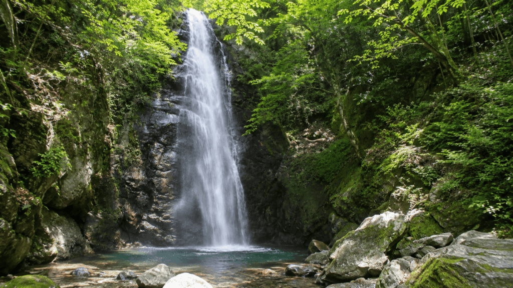
For a first visit, I usually suggest starting at Kawanoribashi and walking the route in one direction: bus from Okutama Station, forestry road to Hosokurabashi, up the gorge past Hyakuhiro Falls, on to the summit, then down to JR Hatonosu Station. The falls arrive early, about 90 minutes from the bus stop. The summit comes roughly two hours later. The descent is the longest single block of the day, and it is the part most people underestimate.
This is not an easy beginner hike. The gorge section is narrow in places, parts of the trail above the falls are exposed, and the descent to Hatonosu runs for around 6 km through plantation forest. Before you commit to a date, check the current trail status with the Okutama Visitor Center, because the forestry road and the trail above it are managed and reported separately.
Quick answer: For reasonably experienced hikers on a first visit, the Kawanoribashi–Hyakuhiro Falls–summit–Hatonosu route is the best choice, provided the trail is open. Allow 7–8 hours on the mountain, start early, and treat the descent as a real part of the hike rather than an afterthought.
Prefer an English-speaking guide? A small-group Mt. Kawanori tour follows the same demanding Kawanoribashi–Hyakuhiro Falls–Hatonosu route, with navigation support along the way. If you have previous full-day hiking experience but would rather not handle the route and bus logistics alone, check available dates, meeting details and fitness requirements for the guided Mt. Kawanori hike before deciding.
Best for:
- Fit hikers with some trail experience who want a full day out
- Travellers who value waterfalls and forest scenery more than a postcard summit view
- Anyone comfortable with narrow paths, steep ground and a long descent
Not ideal for:
- Complete hiking beginners, or anyone whose only previous hike was a paved park trail
- Travellers looking for a short, easy nature walk near Tokyo
- People who are uncomfortable on exposed traverses or do not want to navigate
These are the numbers worth knowing before you read any further. They are planning figures, not guarantees.
| Item | Details |
|---|---|
| Elevation | 1,363 m (often listed as 1,363.2 m) |
| Typical route | Kawanoribashi bus stop → Hyakuhiro Falls → Mt. Kawanori summit → JR Hatonosu Station |
| Distance | Roughly 12 km; published figures range from 11.9 km to 12.5 km depending on the route variant and how it is measured |
| Hiking time | Allow 7–8 hours including breaks; published estimates vary because some measure walking time and others measure total activity time |
| Difficulty | Intermediate by Japanese guidebook standards; demanding for a first mountain |
| Start | Kawanoribashi bus stop, about 15 minutes by bus from Okutama Station |
| Finish | JR Hatonosu Station on the Ome Line |
| Main highlight | Hyakuhiro Falls, a direct drop of about 40 m |
| Best for | Experienced hikers on a first visit to this mountain |
| Transport | JR Ome Line to Okutama, then Nishi Tokyo Bus; return by JR from Hatonosu |
| Trail status | Check the Okutama Visitor Center’s current trail and road list before departure |
If you would rather not manage the route, the buses and the navigation yourself, there is an English-speaking guided option that follows this same line. It is worth reading the conditions before you decide, because the tour assumes prior hiking experience.
Is Mt. Kawanori Worth Hiking?
Mt. Kawanori is worth it if you want a day that feels like a mountain rather than a stroll, and if you are willing to earn the good parts. The gorge below the falls is the reason to come: dark rock, moving water, wooden bridges, and a stretch of trail that stays close to the stream for most of an hour. The summit is broad and open, with views across the Okutama range on a clear day. What the mountain does not offer is a single, guaranteed, postcard view at the top.
On a clear day you can see Mt. Fuji to the south and Mt. Kumotori and the ridge lines to the west. On a hazy or cloudy day, you will mostly see trees and the inside of a cloud. Guests I have walked up here have reacted very differently to the summit for exactly that reason: some are delighted, others shrug and say the falls were the better part. Both reactions are reasonable. If the summit panorama is the only thing you are buying, this is not the most efficient mountain for it.
Worth it if: you enjoy walking through forest for most of a day, you want one specific feature (the falls) to anchor the route, and you are fit enough to still be steady on your feet five hours in.
Not worth it if: you want a short outing, you are looking for a viewpoint you can reach in an hour, or your group includes someone who has never walked on uneven ground for more than two hours.
It is also worth being clear about how this compares with Mt. Takao, the hike most visitors do first. Takao’s main route is paved, has a funicular and takes a few hours at most. Mt. Kawanori is a different category: longer, rougher, and finished at a station that is not the one you started from. If you are weighing Mt. Kawanori against other day hikes from Tokyo, compare total time and the length of the descent rather than summit height.
Which Mt. Kawanori Hiking Route Should You Choose?
There are two practical ways up, and the choice matters more than most guides suggest. Starting from Kawanoribashi gives you the gorge and the falls. Starting from Hatonosu Station gives you a quieter ridge walk with no bus to catch. These are not an easy option and a hard option. They are two different hikes that happen to share a summit.
| Factor | Kawanoribashi start | Hatonosu start |
|---|---|---|
| Trail access | Bus from Okutama Station stop 1, about 15 minutes to Kawanoribashi | Walk directly from JR Hatonosu Station; no bus needed |
| Waterfall access | Passes Hyakuhiro Falls on the standard route | Does not pass the falls on the standard route |
| Crowd levels | The busier side, particularly at weekends and in autumn | Usually much quieter; I have crossed only a few other parties on this side |
| Navigation | Signposted, but some signs on the upper section have been damaged | Fewer people to follow; the area around Oone-no-Yamanokami is easy to misread |
| Terrain | Forestry road, then narrow gorge trail with wooden bridges, roots and wet rock | Continuous ridge climb, rocky in places, with a long forest descent if walked as an out-and-back |
| Physical demands | Steady climb with the falls as a natural break, then a long descent on the far side | The climb is less broken up, with fewer landmarks to measure progress against |
| Best for | First-time visitors to Mt. Kawanori who want the falls | Repeat visitors, or anyone who wants quiet and a station-to-station plan |
| Main drawback | Bus dependency at the start and crowds at the falls and summit | Less scenic variety, and more attention needed at junctions |
| Overall recommendation | First choice for most experienced hikers on a first visit | A good alternative, not an easier one |
Kawanoribashi Route: Best for a First Visit
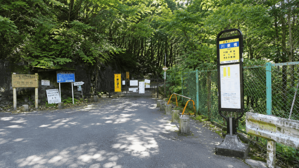
This is the route I suggest to guests visiting Mt. Kawanori for the first time, and the reason is simple: it puts the mountain’s best feature early, while you are fresh. From Okutama Station you take the bus to Kawanoribashi, walk the Kawanori forestry road to Hosokurabashi, and enter the gorge trail there. About 45 minutes of road, then about 45 minutes of stream-side trail brings you to Hyakuhiro Falls. From the falls it is roughly two hours of climbing to the summit, and then the long descent to Hatonosu Station.
The trade-off is other people. This side carries most of the traffic, and the falls and summit can feel busy on a weekend. That is a reason to start early, not a reason to avoid the route.
Hatonosu Route: Quieter, but Less Straightforward
Starting at Hatonosu Station removes the bus from your day entirely. You climb through forest past Oone-no-Yamanokami and Funai-do to the summit, and you can either return the same way or continue down to Kawanoribashi if the buses line up. The quiet is real: on this side I have gone long stretches without seeing another person, which is unusual for a mountain this accessible.
Quiet does not mean simple. The junctions here are less obvious than on the gorge side, and the climb is unbroken, so you get fewer natural pauses. If you are relying on following other hikers, this is the wrong side to choose.
Do not walk the route in reverse. Starting at Hatonosu and finishing at Kawanoribashi means descending the traverse above Hyakuhiro Falls, which the Okutama Tourism Association describes as one of the most slide-prone sections in the area. A 2026 ranger patrol of this mountain made the same point: the reverse direction is not recommended, and the descent is where most accidents on this mountain happen. Walk it in the standard direction, or walk an out-and-back from Hatonosu and skip the traverse.
How Difficult Is the Mt. Kawanori Hike?
Difficulty here comes from four things stacked on top of each other, not from the elevation number. The summit is 1,363 m, which sounds modest, but the day adds up: roughly 12 km of distance, around 900–1,050 m of cumulative climbing depending on how it is measured, a narrow gorge section with wet rock and wooden bridges, and a descent of about 6 km on tired legs.
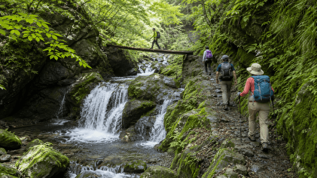
The narrow parts deserve specific mention. Above the falls, the trail runs as a traverse across a steep slope, and the tourism association flags the upper falls area as a place where slips are common. Ropes have been installed in spots. This is not a section to walk while looking at your phone, and it is not a section to rush because you are behind schedule.
Turnaround options are also limited. Once you are above the gorge, the quickest way out is usually forward, which means the decision about whether to continue has to be made earlier than it feels necessary. On this mountain, the honest test is not “can I get up” but “can I still descend carefully after five hours”.
How Long Does the Mt. Kawanori Hike Take?
Published times for this route differ, and the difference is not an error. Some sources publish walking time, others publish total activity time including rests, and the route variants are not identical. Plan with the longer figure and treat the shorter ones as information rather than a target.
| Source | Distance | Published time | What the number measures |
|---|---|---|---|
| Okutama Tourism Association | About 11.9 km | 7 h 30 | Estimated activity time for the Kawanoribashi–Hatonosu route |
| Yama to Kogen Chizu Web | 12.5 km | 5 h 40 | Walking time only; route graded intermediate; maximum elevation difference 1,053 m |
| YAMAP model course | 12.3 km | 7 h 25 | Total course time as listed on the model route |
For a traveller’s day, the useful planning number is 7–8 hours on the mountain plus the bus at the start and the train at the end. Add time for lunch at the summit, photographs at the falls, and the queue that can form on a busy weekend. Mt. Kawanori also has a way of feeling longer than the numbers suggest: the gorge section is slow, the climb after the falls is steady, and the descent keeps going after you think it should be finished.
How to Get to Mt. Kawanori from Tokyo
The whole route works on public transport, but it involves two systems and a bus that does not run often. From central Tokyo, take the JR Chuo Line to Ome and change to the Ome Line for Okutama. From Shinjuku that is about two hours and roughly ¥1,230 one way. On weekends and holidays there are sometimes direct holiday services, but the standard plan is a change at Ome.
At Okutama Station, the bus leaves from stop 1, outside the station. The ride to Kawanoribashi takes about 15 minutes and costs around ¥310. Here is the detail that catches people out: the destination on the front of the bus changes by day. On weekdays the service is bound for the limestone cave (route Oku 20). At weekends and on holidays it is bound for Higashi-Nippara (route Oku 21). Both pass Kawanoribashi, so you are fine either way, but if you are looking for a bus with the destination you read about online, you may convince yourself you are at the wrong stop.
Buses are infrequent, and the first one of the morning fills up on fine weekends. Missing a bus can cost you 30–60 minutes, which on a 7–8 hour hike is the difference between finishing in daylight and finishing in the dark. Aim to be at Okutama Station early rather than at the trailhead at the time you planned to start.
From Okutama Station to Kawanoribashi
Go to stop 1, check the destination board, and get off at Kawanoribashi. The stop is the end of the public road for most practical purposes: beyond it, the Kawanori forestry road is closed to general vehicles and the gate is normally shut. Walk around the gate and follow the road.
Do not rely on a timetable you found in a blog post. Nishi Tokyo Bus publishes a hiking timetable for the Okutama and Mitake area, revised in April 2026, and that is the version to check the night before. IC cards work on these buses, but carry some cash as a backup.
Returning to Tokyo from Hatonosu Station
One of the satisfactions of this route is that you do not have to go back to Kawanoribashi. The trail delivers you to JR Hatonosu Station, two stops from Okutama on the Ome Line, and from there it is roughly two hours back to central Tokyo with a change at Ome.
Hatonosu is a small, quiet station with no shop worth planning around. Check the departure times when you arrive at the summit rather than when you reach the platform, and give yourself a margin: the last part of the descent is slower than the map suggests, and the trains thin out in the evening.
Mt. Kawanori Trail Guide: Kawanoribashi to the Summit
The route below is described in walking order, because the sequence matters more than the distance. The first section is a road. The second is a gorge. The third is a climb. None of them feel like the others.
Kawanoribashi to Hosokurabashi
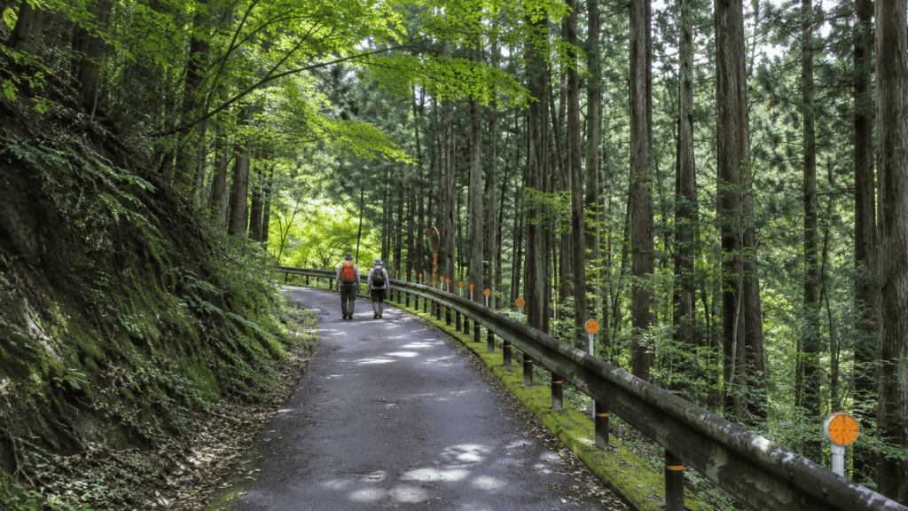
From the bus stop, the Kawanori forestry road runs gently uphill along the valley for about 45 minutes to Hosokurabashi. It is wide, mostly shaded, and easy to walk. Logging work has been scheduled in this area from June 2026 to late August 2029, and the road is open but work vehicles may cause short waits. The road reopened on 2 July 2026 after earlier closures, so any older account of this section being shut is out of date.
Hosokurabashi is where the road stops being a road. Cross the bridge and the gorge trail begins immediately, with wooden steps and a signposted turn into the trees.
Kai’s tip: The forestry road is so easy that people treat it as a warm-up and arrive at Hosokurabashi already moving at road speed. I do the opposite. I stop at the bridge, adjust my layers, check my boots and decide on the pace for the gorge, because the moment you leave the road the surface changes completely and the next 45 minutes are slower than the first 45. Treat Hosokurabashi as the start of the hike, not the end of the approach.
Hyakuhiro Falls: The Highlight of the Hike
From Hosokurabashi the trail follows the stream, crossing on wooden bridges and working over roots and rock, with small cascades below the path. After about 45 minutes the gorge opens and Hyakuhiro Falls appears on the left: a direct drop of about 40 m over dark, hard rock. In summer the air around it is noticeably cooler than on the road above, and in early summer the whole valley is green.
The falls are also the point where the day becomes more serious. The tourism association describes the trail above the falls as one of Okutama’s most slide-prone sections, and ropes have been fixed in places where the path crosses steep ground. There is no viewing platform with a railing. You are standing on the same wet rock as the water.
Kai’s tip: The falls are the one place on this hike where almost everyone reaches for a camera at the same moment, and that is exactly when people slip. I decide where my feet are going before I lift the camera, and I keep a hand free on the wet rock near the base. It is also the section where I stop being polite about footwear: trail shoes with grip or proper hiking boots, not running shoes with worn soles.
From Hyakuhiro Falls to the Summit
Above the falls the trail switches back up the slope, then pulls away from the stream and climbs onto a small ridge. This is the part that surprises people who assumed the falls were the main event. It is roughly two hours of steady climbing, with the grade changing often enough that you cannot settle into one rhythm.
Navigation needs attention here. Several paths cross this slope, including a less-used direct line to the summit, and the guidebook for this route specifically warns that the trails in this area intersect and need checking as you go. Follow the signs rather than the most worn-looking option. You pass the Yokogaya area, where a water source is marked on maps, and eventually reach a saddle junction on the ridge; from there a wide path leads to the summit.
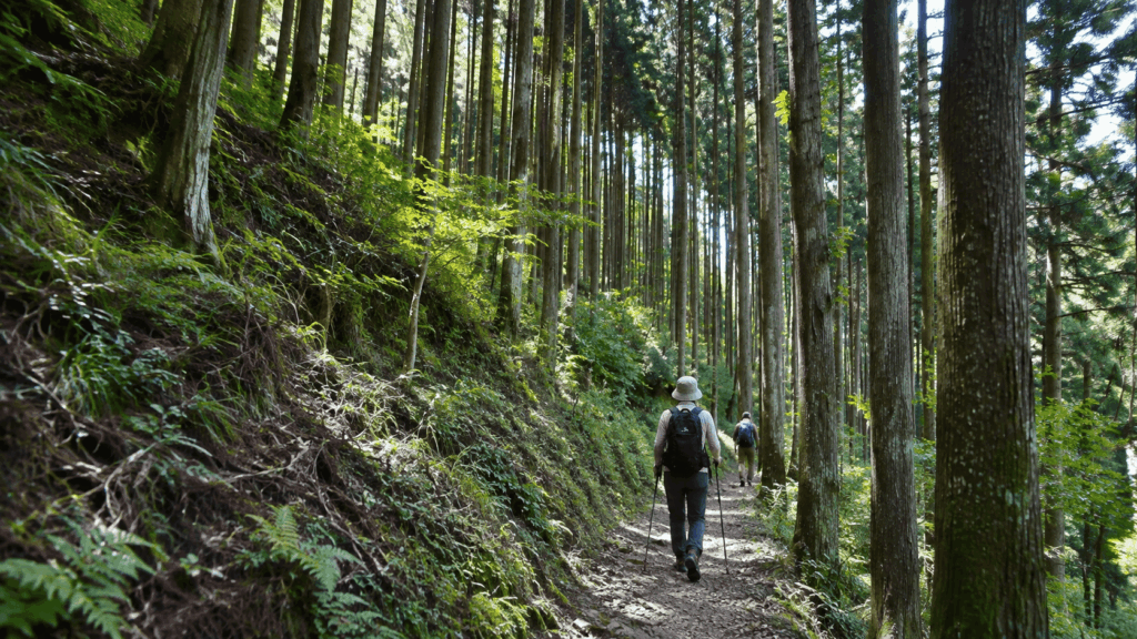
If you are only interested in the waterfall and not the summit, the gorge route can be walked as far as the falls and back, but you would still be starting from Kawanoribashi and committing to the bus. It is a legitimate half-day, not a shortcut.
The Summit and the Long Descent to Hatonosu
The summit of Mt. Kawanori is broad and open, with space to sit and eat, which is not always true on Tokyo-area mountains. On a clear day the view runs west to Mt. Kumotori and the ridge lines beyond, and south towards Mt. Fuji. On a cloudy day it is a clearing in the trees with a trig point.
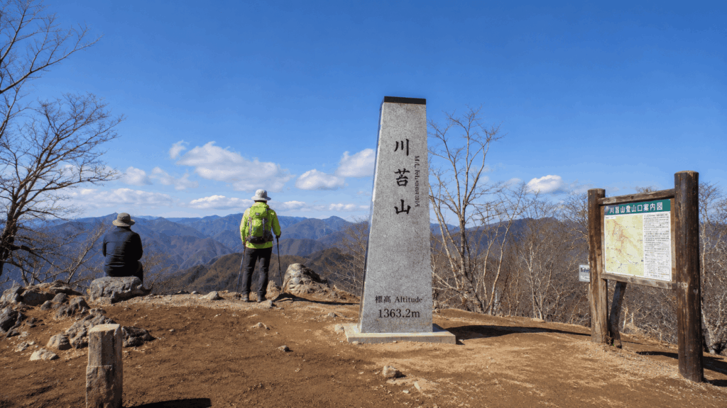
Weekend crowds collect here at lunchtime. If the top is full, the saddle junction just below it is a better place to eat: same mountain, fewer people, and you are not blocking a path while you unpack a bento.
| Section | Approximate time | What it demands |
|---|---|---|
| Kawanoribashi to Hosokurabashi | About 45 minutes | Almost none; gentle road walking |
| Hosokurabashi to Hyakuhiro Falls | About 45 minutes | Concentration; wet rock, bridges, roots |
| Falls to summit | About 2 hours | Steady climbing; navigation at junctions |
| Summit to Hatonosu Station | About 2.5–3 hours | Long descent; knees, footing, fading light |
These are planning estimates for a traveller’s pace with short breaks, not a measured profile. Treat the final row as the one to protect.
Why the Hatonosu Descent Can Feel Harder Than Expected
The descent from the summit to Hatonosu Station is around 6 km, and most of it runs through plantation cedar forest. It is not technically difficult, but it is long, rocky in places, and repetitive, and it comes at the end of the day when your legs have already done the climbing. From the summit you drop to Funai-do, then to Oone-no-Yamanokami, a small shrine where a ridge path and a forest road cross, and then down through the edge of a village to the station.
A ranger patrol of this mountain in April 2026 recorded a rockfall and collapse mid-way between Funai-do and Oone-no-Yamanokami, and a fallen tree shortly before Oone-no-Yamanokami. Conditions change, so treat those as examples of what this section does rather than a permanent description. The same patrol noted that this mountain has more rescues and accidents than any other in Okutama, and that the descent is where most of them happen.
Kai’s tip: The summit is not the finish, and the people who get into trouble here are usually the ones who stop eating and drinking once they reach the top. I take a proper break at the summit, then set a deliberately slower pace for the first 20 minutes of the descent, before my legs stiffen up. If I am guiding, I say the same thing out loud at the top: we are only halfway.
Mt. Kawanori Safety Tips and Current Trail Conditions
This is the section to read twice. Mt. Kawanori is a maintained, popular trail, but it is maintained in sections, by different bodies, and the information online is a mix of current notices and reports from years ago.
Check Trail Closures Before You Go
The Okutama Visitor Center publishes a trail and road status list, and it is the document to check the day before you travel. As of November 2026, the Kawanori forestry road is listed as open from 2 July 2026, with logging work scheduled from June 2026 to late August 2029 and possible waits for work vehicles.
What that list does not do is confirm the trail above Hosokurabashi. The gorge trail and the climb to the summit are not listed separately as open or closed. That does not mean they are shut, and it does not mean they are fine. It means the official page, read on its own, does not answer the question. Ring the visitor center and ask directly: whether the trail from Hosokurabashi to the falls is passable today, whether the section above the falls is passable, and whether logging work is causing delays on the forestry road.
Also read the dates on each line of the status list, not just the headings. Some closures in this area have been in place since 2019, including the Otanba forest road and its trailheads, while others were updated this year. A page that mixes six-year-old closures with this season’s notices will mislead you if you skim.
What to Pack for the Hike
- Hiking boots or trail shoes with real grip; the rock near the falls is wet year-round
- An offline hiking map or a GPS hiking app with the route downloaded, plus a paper map as backup
- Rain jacket and trousers, even on a clear forecast
- 1.5–2 litres of water, depending on season and how much you sweat
- Lunch and trail snacks; there is nothing to buy once you leave Okutama
- Headlamp, in case the descent runs late
- Warm layer for the summit and for stops
- Fully charged phone and a portable battery
- Basic first-aid supplies, including something for blisters
- Cash for the bus
Do not use a driving or city map app as your hiking navigation. On this mountain the useful information is the junction layout, not the road network.
Bears: this is Asiatic black bear country. A 2026 ranger patrol found that the signs on the route to the summit had been heavily clawed and damaged, which tells you how regularly bears use this slope. Bear bells or talking out loud on the descents and in the noisy gorge sections are sensible. Check the Tokyo Metropolitan Government’s bear sighting map before you go; parts of Okutama have had closures and incidents in 2025 and 2026, and the situation changes week to week.
Best Time to Hike Mt. Kawanori
Late spring and autumn are the most comfortable seasons, but each has a different reason and a different catch.
Late spring and early summer: fresh green in the gorge, water running well, mild temperatures. This is when the walk between Hosokurabashi and the falls is at its best. Weekends get busy even before the summer holidays start; on one trip I was on a full bus in June, well before peak season.
Summer: hot and humid on the climb, but the gorge and the falls stay noticeably cool. Start early, carry more water than feels necessary, and expect the exposed sections above the falls to be the hottest part of the day.
Autumn: the best light and the busiest trails. Colour peaks vary by year, and the summit and upper ridge turn before the gorge does.
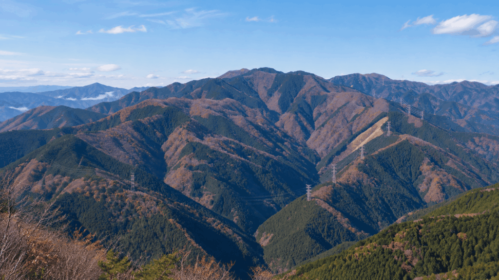
Winter: possible, but a different hike. Ice on the wooden steps and the rock near the falls, short daylight, and colder stops. Only go if you have traction devices and winter experience, and start earlier than you would in summer.
Rain matters more here than on a ridge hike. After rain the gorge rock and the wooden bridges are slippery, and the stream is louder, which makes it harder to hear people coming the other way. A wet forecast is a reason to change the plan, not just the jacket.
Practical Tips Before Your Mt. Kawanori Hike
Toilets, Water, Food and Start Time
The Okutama Tourism Association states that there are no toilets on this course and asks hikers to go before entering the mountain. The Yama to Kogen Chizu guide lists a toilet at Hosokurabashi, and there is a facility there, but I would not build a plan around it being open. Use the station area in Okutama before you board the bus.
There is no shop, vending machine or hut anywhere on the route. Water is marked at Yokogaya on maps, but treat stream water as untreated and do not plan to drink it. Carry what you need from Okutama, and eat lunch at the summit rather than hoping to buy something later.
The tourism association’s general advice for Okutama is to be at the trailhead by 9 a.m. For this route that is worth taking seriously: 7–8 hours of walking from a 9 a.m. start already puts your finish in the late afternoon, and the gorge gets dark before the open ground does. File a hiking plan before you go; the boxes are at JR Ome Line stations and police boxes, not at the trailhead.
Most people plan this hike around the climb and only discover on the way down that the day was decided there. The pace that matters is the one you can still hold in the afternoon, not the one you set on the forestry road. If you are ahead of schedule at the summit, spend the time on a proper break rather than banking it for a faster descent.
Self-Guided vs Guided: Do You Need a Mt. Kawanori Tour?
If you have hiked for six hours or more before, can read a map or follow a GPS track, and are comfortable making the call on weather and turnaround time, this route is entirely doable on your own. The trail is signposted, the junctions are findable with attention, and the transport, while infrequent, is straightforward once you know about the weekday and weekend bus difference.
A guide is useful for a narrower set of problems: you have the fitness but not the confidence in Japanese trail signage, you do not want to manage the bus and the route on the same day, or you are travelling alone and would rather not make every safety decision by yourself. What a guide does not do is make the mountain easier. The distance, the climb and the descent are the same.
| Factor | Self-guided | Guided |
|---|---|---|
| Navigation | You manage the map, junctions and turnaround decisions | Route finding is handled; you still walk the same ground |
| Planning effort | You check trail status, bus times and daylight yourself | Meeting point, bus transfer and route are arranged |
| Flexibility | Total; you can change the plan mid-hike | Fixed itinerary and pace for the group |
| Language support | Signs and notices are mostly in Japanese | English-speaking guide on the listed departures |
| Cost | Train, bus and your own gear | Tour price plus your travel to Okutama Station |
| Safety decision support | Entirely on you | A second opinion on conditions and pace; not a guarantee of safety |
| Best suited to | Experienced, self-reliant hikers | Fit hikers who want the logistics and language handled |
The guided version of this route, run by TOKYO HIKING and sold through booking platforms, meets at JR Okutama Station and finishes at JR Hatonosu Station. It is listed as an 8-hour activity in a group of up to six, with an English-speaking guide, the bus fare included, and free cancellation up to 24 hours before. It also states its conditions plainly: participants should have previously hiked for more than six hours or have comparable fitness, and it is not suitable for children under six, pregnant travellers, wheelchair users or visually impaired travellers. Bring at least a litre of water and cash for the bus. Prices and availability change by date, so check the current listing.
If your honest assessment is that six hours on rough ground is beyond you right now, a guide does not fix that. Choose a shorter mountain instead, and come back to Mt. Kawanori when the distance is realistic.
If you are comparing guided hikes rather than deciding on this one mountain, look at what each tour includes for transport and gear before comparing prices; the differences are usually larger than the headline cost.
For hikers who have the fitness for Mt. Kawanori but would rather not handle Japanese trail navigation and bus logistics alone, the TOKYO HIKING guided route is the option worth comparing. It covers the same mountain, waterfall and long descent described above, rather than offering a shortened alternative.
Why I’d book this one
- English-speaking guidance on the full route: The tour follows the Kawanoribashi-to-Hatonosu route, taking in Hyakuhiro Falls and the summit while a guide handles route finding.
- A small-group format: The listed group size is limited to six participants, making it a focused full-day hiking experience rather than a large sightseeing excursion.
- Flexible booking terms: The listing offers free cancellation up to 24 hours ahead and a reserve-now-pay-later option, subject to the conditions shown for your selected date.
Compare the guided hike before deciding: See current prices, available dates, meeting details and participation requirements for the Mt. Kawanori guided hiking tour. Check the transport inclusions and fitness conditions carefully; booking a guide does not remove the mountain’s physical demands or the need to confirm current trail conditions.
Mt. Kawanori Hike: Common Questions
Is Mt. Kawanori suitable for beginners?
Not for complete beginners. The route is about 12 km with roughly 900–1,050 m of climbing, and the gorge section above Hosokurabashi is narrow, wet and exposed in places. The descent to Hatonosu Station adds around 6 km at the end of the day. If you have done a few full-day hikes and are steady on uneven ground, you will be fine. If your only experience is paved trails or short walks, start with a shorter mountain and build up.
How long does the Mt. Kawanori hike take?
Allow 7–8 hours on the mountain, including breaks. Published figures differ because they measure different things: the Okutama Tourism Association lists about 11.9 km and 7 hours 30 minutes of activity time, while the Yama to Kogen Chizu guide lists 12.5 km and 5 hours 40 minutes of walking time. Plan with the longer figure, then add the bus from Okutama and the train home from Hatonosu.
Can you hike Mt. Kawanori without a guide?
Yes, if you can navigate and make your own weather and turnaround decisions. The trail is signposted and busy enough on the Kawanoribashi side that you will rarely be alone. The parts that require attention are the junctions on the climb above the falls, where several paths cross, and the descent, which is long and repetitive. Download an offline map before you leave; mobile signal in the valley is not something to rely on.
Can you see Hyakuhiro Falls on the Mt. Kawanori hike?
On the standard route from Kawanoribashi, yes. The falls come about 90 minutes from the bus stop, roughly 45 minutes along the forestry road to Hosokurabashi and another 45 minutes on the gorge trail. If you start from Hatonosu Station, the usual route to the summit does not pass the falls; reaching them would mean a significant detour. This is the main practical reason to choose the Kawanoribashi side for a first visit.
Is the Mt. Kawanori trail open right now?
The Kawanori forestry road has been listed as open since 2 July 2026, with logging work scheduled through late August 2029 and possible waits for work vehicles. The trail above Hosokurabashi is not listed separately as open or closed on the official status page, so the page alone does not confirm it. Call the Okutama Visitor Center before you travel and ask about the section from Hosokurabashi to the falls, and from the falls to the summit.
What is the best season to hike Mt. Kawanori?
Late spring and autumn are the most comfortable. Late spring brings fresh green and good water in the gorge; autumn brings colour and the biggest crowds. Summer is hot on the climb but cool near the falls, so start early and carry more water. Winter is a different hike, with ice on the wooden steps and short daylight, and should only be attempted with traction devices and winter experience.
Final Verdict: Is Mt. Kawanori Right for You?
Choose the Kawanoribashi route if you are a reasonably experienced hiker on your first visit and you want the falls. Start at Okutama Station, take the bus to Kawanoribashi, walk the forestry road to Hosokurabashi, climb through the gorge past Hyakuhiro Falls, and descend to Hatonosu Station. Leave early, carry a headlamp you probably will not use, and treat the descent as the part that decides your day.
Choose the Hatonosu out-and-back if you have done this mountain before, or you want quiet more than you want the waterfall. You skip the bus entirely, you can turn around at any point without ruining the transport plan, and you will likely see very few people. You will also miss the best scenery on the mountain, and the junctions require more attention than the gorge side.
Skip Mt. Kawanori if your group includes young children, someone who has never walked on rough ground, or anyone who will find 7–8 hours discouraging. There is no shortcut to the summit and no lift, and the route commits you to a long exit. A shorter Okutama walk will give you the forest without the commitment.
If you are travelling on a tight schedule, this is possible as a day trip from Tokyo, but only with an early start. You need to be on a morning train, on one of the first buses, and off the mountain before the light goes. If your available day is short or your trip is in November, when it gets dark around 16:30, pick a shorter hike and keep Mt. Kawanori for a trip with more room.
If navigation or language is the part that worries you, and you otherwise have the fitness, the guided version of this route is a reasonable way to do it. It meets at Okutama Station, includes the bus transfer, and finishes at Hatonosu, with an English-speaking guide and a group of no more than six. It does not reduce the distance or the climb, and it asks for prior experience of six hours or more on foot.
If you are returning to Okutama and have already done the falls, the Hatonosu side is the more interesting repeat. The mountain is quieter from that direction, and the walk down through Oone-no-Yamanokami and the village edge is a different day from the gorge.
Trail, transport and access information in this guide was checked in November 2026. Conditions on this mountain change with the season and with logging work, so confirm the current status with the Okutama Visitor Center before you set out.

Hi, I’m Kai. I’m a Tokyo-based travel writer, tourism industry insider, and the author of a published guidebook for international visitors to Japan. With over 10 years of professional experience at a leading Japanese tourism company, my mission is to help you skip the tourist traps and navigate Japan’s best destinations like a local. I believe the perfect day trip is like a traditional kaiseki meal: a beautiful balance of precise planning and unforgettable seasonal discovery. When I’m not out conducting field research, you’ll usually find me drafting new itineraries with one of my favorite fountain pens!