
The Magome to Tsumago trail is the most-walked section of the Nakasendo, and the headline numbers are modest: roughly 8–9 km, about 2.5–3 hours of walking, and a high point of around 790 m at Magome Pass. For most first-time visitors, the better direction is Magome to Tsumago. You get the climb out of the way early — a short, steep push of about 2.2 km up to the pass — and then spend the rest of the walk descending gradually into Tsumago.
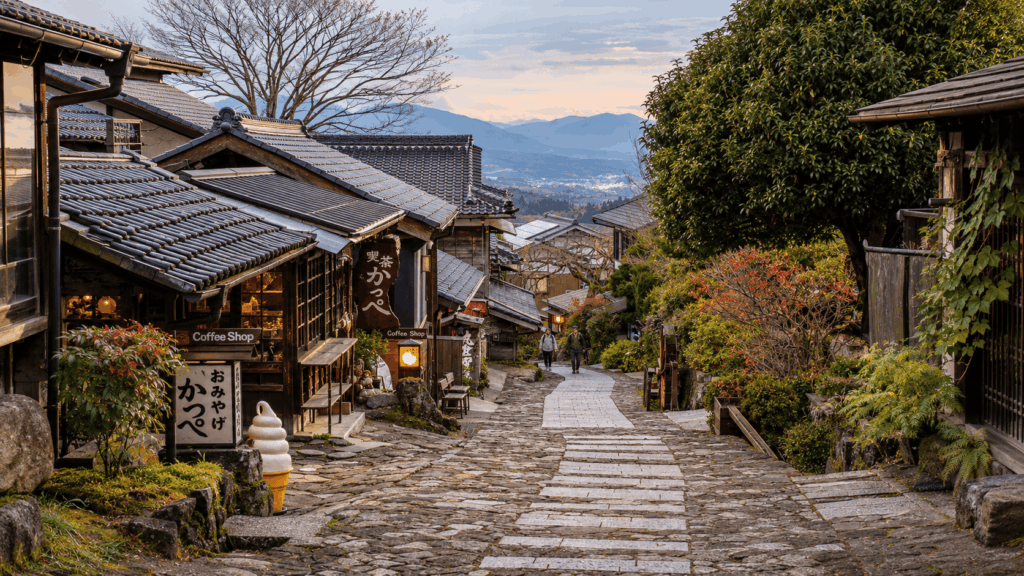
What that summary hides is worth knowing before you set out. The stone-paved slope inside Magome-juku is genuinely steep, parts of the forest path are narrow and uneven, and summer humidity does not stop at the treeline. The other thing it hides is logistics: the walk itself needs no booking or permit, but the return bus does need a plan. Decide which departure you are aiming for before you start walking, not after you arrive in Tsumago.
Want to walk from Magome to Tsumago without planning every rural train and bus connection? A private guided Nakasendo hike from Nagoya follows this recommended direction, with an English-speaking guide accompanying you on public transport and helping with the connections. If you prefer that support over arranging the journey yourself, check available dates, current prices, and what’s included in the private guided Nakasendo hike.
Magome to Tsumago Trail at a Glance
This is a half-day walk between two preserved post towns, not a mountain hike. There is no scrambling, no exposure, and no route-finding challenge — the trail is well signposted in both directions. What it does ask for is a few hours of steady effort on uneven ground, and enough time budgeted to actually enjoy the towns at either end.
| Quick facts | Details |
|---|---|
| Distance | Roughly 8–9 km, depending on which official measurement you follow |
| Walking time | About 2.5–3 hours on the move; budget 4–5 hours with rests, photos and time in the towns |
| Recommended direction | Magome to Tsumago for most first-time walkers |
| Difficulty | Easy to moderate for reasonably fit walkers — non-technical, but not flat |
| Highest point | Magome Pass, around 790 m, on the Gifu–Nagano prefectural border |
| Start | Magome-juku, in Gifu Prefecture |
| Finish | Tsumago-juku, in Nagano Prefecture |
| Return | Local bus back to Magome, or a bus and train connection from nearby Nagiso Station |
Official sources quote both 8 km and 9 km, largely because they measure from different points. Rather than pick one, treat 8–9 km as the honest range: it is short enough to walk in an afternoon, long enough that you will feel it the next morning if you are not used to hills.
Who this hike suits — and who it doesn’t
It tends to suit:
- Travelers who can walk for three hours with some uphill at a conversational pace.
- Anyone who wants both a historic townscape and a proper stretch of forest in one day.
- People with a full day to spend, including the bus at each end.
- Walkers who are happy to carry water and snacks rather than rely on shops along the way.
It tends to be a poor fit for:
- Travelers with limited time who mainly want to see the two towns — the towns are worth visiting without the walk between them.
- Anyone with significant knee trouble on descents, or who finds uneven stone painful.
- Families with very small children, or travelers using a stroller or wheelchair. The Magome tourist association explicitly asks visitors not to bring strollers or wheelchairs onto the trail, and suggests carrying children aged three and under.
- Anyone visiting in winter without checking conditions, daylight and footwear first.
The word “easy” causes more trouble than any other part of this hike. It means “no technical skill required”, not “flat, smooth and short” — if you are looking for genuinely easy hikes near Tokyo or elsewhere, this trail is a step up in sustained effort. The first twenty minutes from Magome are the steepest of the day, and the last few kilometres into Tsumago are a long, continuous descent — two very different kinds of effort. If the logistics are the part you would rather not handle, there is a guided day trip from Nagoya that includes the transport; note that it walks the route in the opposite direction, from Tsumago to Magome.
If you have not yet decided which Nakasendo section to walk at all, that comparison belongs in the broader Nakasendo guide rather than here — just as comparing it to our Kumano Kodo Nakahechi route guide is a separate conversation entirely. This page assumes Magome and Tsumago are already your target.
Magome to Tsumago vs Tsumago to Magome: Which Direction Is Easier?
For most people, Magome to Tsumago is the easier direction, and the reason is topographic rather than a matter of opinion. Magome sits at roughly 600 m, Tsumago at roughly 420 m, and Magome Pass between them at about 790 m. Walking from Magome, almost all of the climbing is concentrated in the first 2.2 km to the pass. After that, the route loses height steadily over the remaining distance into Tsumago.
Tsumago’s own official walking guidance describes it the same way: the slope between Magome-juku and the pass is short and steep, while the slope between Tsumago-juku and the pass is long and gradual. Walking in reverse, that long gradual slope becomes a long gradual climb, spread across more of your day.
| Factor | Magome to Tsumago | Tsumago to Magome |
|---|---|---|
| Initial climb | Short and steep: about 2.2 km from the post town to the pass | Longer and more gradual, starting almost immediately |
| Overall uphill character | One concentrated climb, then largely done | Uphill spread over a larger share of the walk |
| Downhill character | Long, continuous descent of roughly 365 m | Less total descent, but the final drop into Magome is steep and on stone |
| Knee considerations | Easier on the lungs, harder on the knees if long descents bother you | Harder on the lungs, gentler overall on the knees until the last stretch |
| Where the hike ends | Tsumago-juku: quieter, fewer services, infrequent buses | Magome-juku: more shops and food, frequent buses to Nakatsugawa |
| Best for | Most first-timers; walkers who prefer to get the climb over with | Hot-weather days, walkers who want fewer people, anyone staying in Magome |
| Logistics | You must catch one of a small number of buses back from Tsumago | Return buses from Magome to Nakatsugawa run frequently through the day |
The exceptions worth taking seriously
Heat. In midsummer, the argument flips for some walkers. The climb from the Tsumago side runs through heavier shade for much of its length, while the descent towards Tsumago leaves you exposed in places. On a hot, humid day, a shaded climb can be less punishing than an exposed descent. Neither direction is comfortable in August; the difference is where you spend your worst hour.
Knees. The common advice that Magome to Tsumago is easier assumes your lungs are the limiting factor. If your problem is a long downhill, the total descent is what matters, and this direction has more of it. Reverse the route and you trade descent for ascent — which is easier on the joints and harder on the heart — with one steep, stone-paved drop at the very end.
Crowds. Most independent walkers start in Magome, so walking from Tsumago means meeting fewer people and passing them rather than being passed. If quiet matters more to you than an easier gradient, that is a legitimate reason to reverse.
Where you sleep and where you go next. This decides more hikes than fitness does. If you are staying in Magome and continuing to Nagoya, ending in Tsumago leaves you dependent on one of a handful of buses. If you are staying in Tsumago and heading to Nagano or Matsumoto, walking into Tsumago is the cleaner finish.
A workable rule: choose Magome to Tsumago unless you have a specific reason not to. “I hate downhill” and “I am walking in August” are specific reasons. “Everyone says it’s easy” is not.
How Difficult Is the Magome to Tsumago Hike?
The honest rating is easy to moderate, and the modifier matters more than the first word. Nothing on this trail requires technique: there is no rock scrambling, no exposure, no river crossing and no route-finding. The trail is marked, and the junctions are obvious. What makes it feel harder than the distance suggests is the surface and the sustained gradient, not the terrain type.
Three things catch people out.
The stone-paved slope inside Magome-juku. Before you have left the town, the road tilts up sharply between the wooden buildings. It is short, but it is the steepest sustained section of the day, and it arrives when you are still adjusting your pack and your pace. Starting here rather than twenty minutes later changes how the rest of the walk feels.
The narrow forest sections. Beyond the pass, the path narrows between cedar trunks, with roots, loose stones and short flights of worn steps. Nothing is dangerous, but you cannot stride freely; you look at your feet more than at the view. On a wet day, the old stone paving — preserved in several stretches — becomes genuinely slick. Tsumago’s official guidance warns about exactly this after rain.
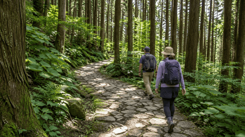
Humidity. The forest provides shade, not air conditioning. Between July and early September, the still air under the cedars can feel hotter than the open sections, and sweat does not evaporate quickly.
Time estimates vary because people count differently. Three hours of walking is realistic at a steady pace with brief stops. Add a proper break at the pass, a detour to the waterfalls, photographs, and time in Tsumago, and most people are out for four to five hours.
What to wear. Grippy trainers or trail shoes are enough in dry weather; the Magome tourist association asks visitors to avoid sandals and heels outright. Trail runners are close to ideal. If it has rained heavily in the previous day or two, treat the stone sections as you would a wet bathroom floor. A light rain shell is worth carrying year-round — there is nowhere to shelter on the pass itself.
Kai’s tip: The part I warn people about is not the distance, it is the surface. Between the cedar trunks the path narrows into short, tilted sections of stone and packed earth, and that is where I have seen confident walkers lose their footing — not on the climb. Wear something with an actual tread pattern, and slow down on the worn paving rather than trying to keep your city pace. In summer I finish this walk soaked through even in full shade, so plan on a change of shirt rather than hoping the forest will cool you down.
As a practical test: if you can walk for three hours on hilly ground and hold a conversation, you can complete this route. If a thirty-minute uphill leaves you stopping to catch your breath, take the bus to the pass and walk down, or ride between the towns and enjoy them on foot instead.
Magome to Tsumago Walking Route, Step by Step
The route divides neatly into four parts: the climb out of Magome, the pass, the long forest traverse with its rest stops and detour, and the approach into Tsumago. Knowing which part you are in tells you how to spend your energy — and where to stop even if you feel fine. Use the toilets in Magome before you set out; facilities between the towns are limited, and the pass is not the place to discover you skipped this.
Start in Magome-juku and Tackle the First Climb
Begin at the lower end of Magome-juku, near the tourist information center and the main parking areas. This is the moment to sort out anything practical: leave a bag for forwarding if you have arranged it, buy water, and rent or buy a bear bell if you want one. The Magome association is direct about supplies — places to buy food and drink on the trail are limited, so carry what you need rather than assuming you can top up.
The post town itself is the first obstacle. Photographs of Magome show a wide, gentle lane of wooden inns and waterwheels; the reality is a street that tilts up hard, with a stone-paved section that is steep enough to make you stop and reconsider your packing. It is short, but it is the sharpest gradient of the day. Take it slowly, and look back — the view over the Kiso valley opens up behind you as you climb, which is the best excuse in Japan to pause.
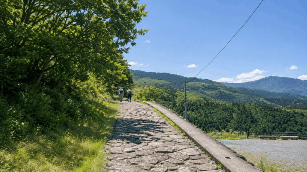
Above the houses, the route passes through terraced fields and small plots before entering cedar forest. From the top of the town to the pass is roughly 2.2 km of climbing. It is steady rather than brutal, but it is continuous, and it comes before you have warmed up.
Reach Magome Pass and Take a Break
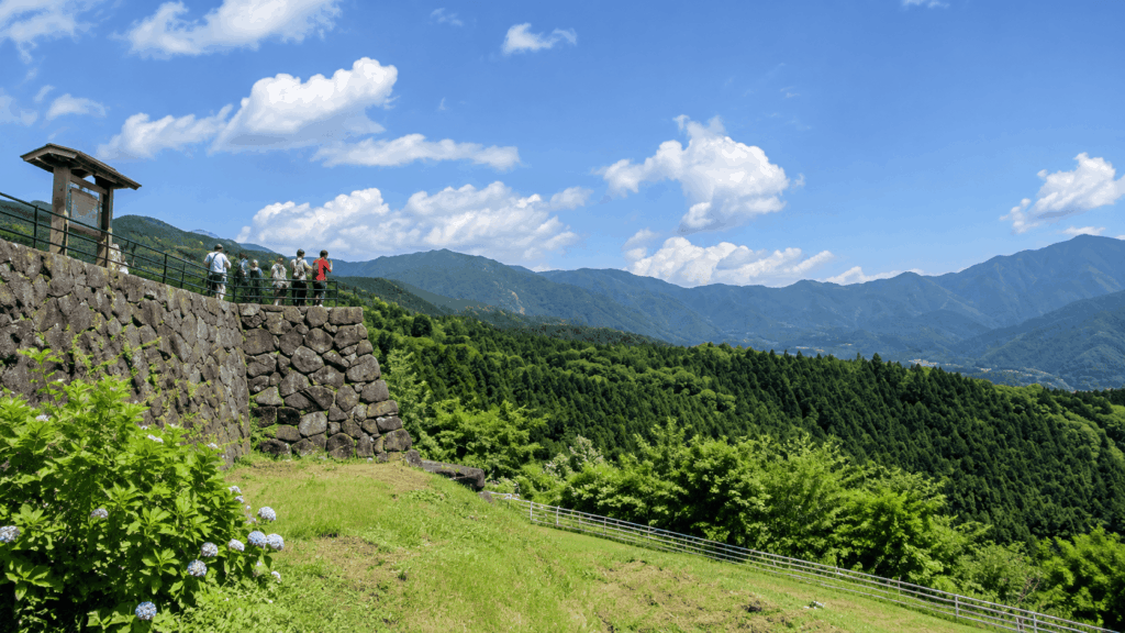
Magome Pass sits at about 790 m, on the prefectural border, marked by a stone monument and a haiku by Masaoka Shiki. It is not a viewpoint in the postcard sense: trees close in on both sides and the clearing is small. What it offers is a psychological line. The climbing is essentially finished, and the remaining distance is mostly descent.
At my own pace, walking from the streets of Magome, I usually reach the pass in around fifty minutes. Treat that as one person’s experience rather than a schedule — walkers with day packs, children or camera bags routinely take longer, and there is no prize for arriving early.
Toge no Chaya, the teahouse at the pass, is the natural place to stop: gohei-mochi with sesame or walnut, and coffee. It usually opens around 10:30 and closes around 16:00, and it closes on irregular days. That combination matters for planning. If you start early, you will reach the pass before it opens; if you are relying on it for lunch, you may find it shut. Carry water and something to eat regardless, and treat the teahouse as a bonus rather than a supply point.
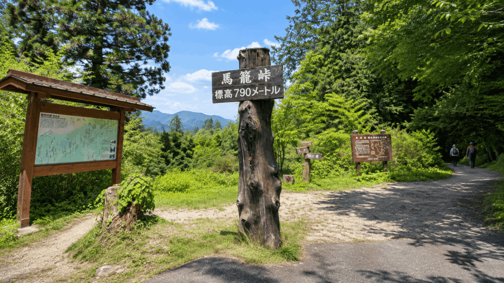
One correction to a common assumption: the pass is not the end of all uphill. There are short rises after it, and the path undulates through the forest. The overall trend is down, but do not budget your water on the belief that the hard part is over.
Walk Through the Forest and Historic Rest Stops
Beyond the pass, the character of the walk changes. The path runs through cedar forest, narrows between trunks, and repeatedly crosses stretches of preserved stone paving. This is the most atmospheric part of the route and also the part where you need to watch your feet.
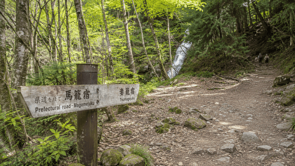
Ichikokutochi Tateba Chaya is roughly midway between the two towns: an Edo-period building kept as a free rest house, where you can sit, look at the interior, and understand what a travellers’ stop on this road actually was. Do not confuse it with Toge no Chaya at the pass — they are different buildings in different places, and only one of them sells you lunch.
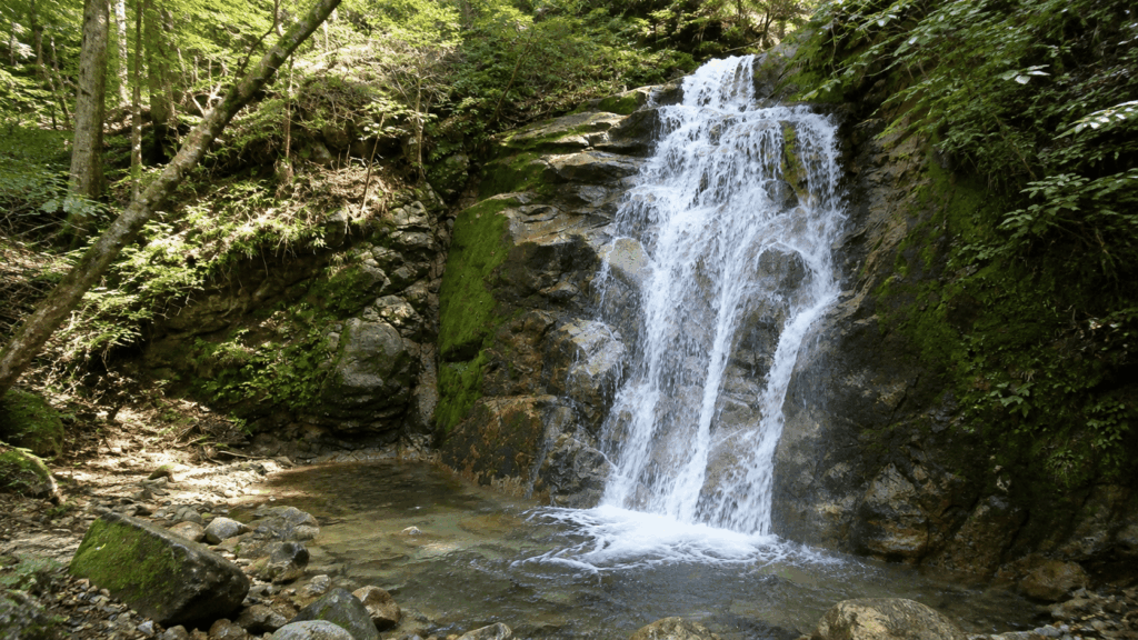
The detour to Odaki and Medaki Falls — the two waterfalls associated with the Musashi legend — adds time and a short descent and re-ascent. The access path has been subject to construction work, with closures reported into early 2027, so check locally before counting on it. If it is open, it is worth twenty minutes; if it is closed, the main trail is unaffected.
Further on, the route passes Otsumago, a small hamlet of traditional houses that most day-trippers walk straight through. It is quieter than either post town and, for many people, the most memorable settlement on the route.
On busy days you will meet other walkers coming the other way, often in groups. The path is too narrow to pass comfortably without one person stepping aside. It costs nothing to be the one who yields, and on this trail it is the norm rather than an exception.
Finish in Tsumago-juku
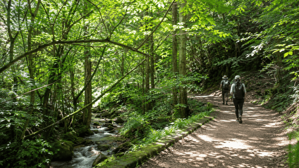
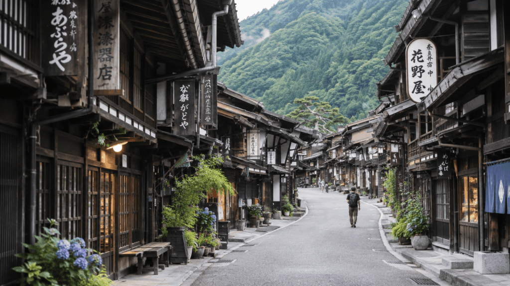
The last stretch descends through more stone paving and past the remains of a barrier checkpoint before the wooden buildings of Tsumago come into view. Tsumago has been deliberately preserved — no overhead wires, no cars in the main street — and arriving on foot, slightly tired, is the best way to see it.
Two practical points about arrival. First, most shops and museums in Tsumago keep daytime hours and close in the late afternoon; if you arrive at 16:30 expecting to browse, you will find shutters. Second, if you forwarded a bag, collection runs from 13:00 to 17:00 at the Tsumago information center. Walk fast and you may reach town before your luggage does.
Gohei-mochi is the local thing to eat here — grilled rice on a stick, brushed with a sweet-savoury sauce. After eight kilometres it tastes considerably better than it has any right to.
Before you sit down, check the time of your bus. That single habit prevents the most common bad ending to this walk. If you are still choosing between the two post towns rather than walking between them, a direct comparison of their atmospheres is a better starting point than trail logistics. If you enjoy this mix of forest trails and traditional architecture, and are heading to Kyoto next, the Kurama to Kibune hike offers a very similar half-day experience.
How to Get to Magome and Return After the Hike
There are three realistic ways to do this walk, and the right one depends less on budget than on how much of the day you want to spend arranging things.
| Travel style | Starting point | Return plan | Best for | Main drawback |
|---|---|---|---|---|
| Rental car | Drive to Magome and park near the lower entrance | Walk to Tsumago, then take the local bus back to your car | Flexible travelers, families, anyone combining the Kiso Valley with other stops | You must match your finish time to a bus departure, or wait |
| Train and local bus | JR Nakatsugawa Station, then the Magome-bound bus | Bus from Tsumago to Nagiso Station, then train | Travelers continuing to Nagoya, Matsumoto or Nagano | Two timetables to coordinate, with infrequent services |
| Guided day tour | Nagoya Station, with transport included | Returned to Nagoya by coach | Anyone who would rather not manage local buses, or wants historical context | Fixed itinerary, higher cost, and the route usually runs Tsumago to Magome |
Getting to Magome by Train and Bus
From Nagoya, take a limited express on the Chuo Main Line to JR Nakatsugawa Station — roughly 50 minutes to an hour depending on the service. Outside the station, the Magome-bound Kitaena Bus leaves from the bus rotary, normally from stand 3. The ride takes around 25–30 minutes and costs ¥800 one way, paid when you get off. Seats cannot be reserved, and the Japan Rail Pass does not cover it.
Morning departures begin shortly before 8:00 and continue through the day, so an early start is achievable without a taxi. Have coins or a small note ready; paying on exit while a queue forms behind you is not the moment to be hunting for change.
From Matsumoto or Nagano, the approach is different: travel to JR Nagiso Station on the Chuo Main Line and take the local bus up to Tsumago, then decide whether to walk the route in reverse. Do not assume the Nagoya-side connections apply from the north.
Parking in Magome and Returning by Bus
Parking in Magome is easier than its reputation suggests, with one important catch about timing. Most lots are free, including the large areas near the lower entrance; a small number of spaces are paid. The lots are labelled by letter and number, with the A series near the lower entrance and the B and C series closer to the upper entrance.
The catch: vehicles are barred from the post town street between 10:00 and 16:00 every day. Arrive late and you will be parking at the edge and walking in with your bag, which is fine — but it changes the shape of your morning. Arriving before 10:00 lets you drive closer, park, and start walking without hauling luggage up the slope.
If you leave the car in Magome, the return leg is straightforward but infrequent. The Nagiso community bus runs from Tsumago back over the pass to Magome, and the standard departures in the current timetable are these:
| Departs Tsumago | Arrives Magome |
|---|---|
| 10:17 | 10:45 |
| 12:47 | 13:15 |
| 14:22 | 14:50 |
| 16:42 | 17:10 |
The fare is ¥1,000 for the Tsumago–Magome section. An additional early departure has operated in some seasons — during Golden Week and for a few weeks in late July and August — but it is seasonal rather than standard, so do not plan around it without checking. Timetables are revised periodically; confirm the current version on the Nagiso town website for your dates rather than relying on any published list, including this one.
Kai’s tip: When I take people through this section, we park near the lower entrance in Magome, walk over the pass, and pick the car up by bus from Tsumago. The mistake is treating the last departure as the target. On wet days in particular, the bus fills with hikers who all finished at the same time, and standing at the stop watching a full bus pull away is a poor way to end a good walk. Aim for the second-to-last departure, and if you finish early, spend the extra hour in Tsumago instead of at the bus stop.
Continuing from Tsumago to Nagiso Station
If you are travelling by train rather than collecting a car, the onward leg is short: the local bus from Tsumago to JR Nagiso Station takes about ten minutes and costs ¥300. From Nagiso, Chuo Main Line trains run towards Nakatsugawa and Nagoya in one direction, and towards Kiso-Fukushima and Matsumoto in the other.
Walking to Nagiso instead of taking the bus is possible, but it adds roughly an hour on roads after you have already walked the trail. Most people regret it. The bus is the sensible choice, and the connection is short enough that a missed train usually means a wait rather than a problem.
Best Time to Hike and What to Wear
The official guidance sets a hard minimum: the Magome association asks walkers to start no later than 15:00 in summer and 14:00 in winter, because there is no lighting on the trail. Those are cut-offs for safety, not recommendations. In practice, aim to be walking by mid-morning — you will have the pass to yourself more often, and you will not be descending in fading light.
| Season | What to expect | What matters most |
|---|---|---|
| Spring (March–May) | Mild temperatures, fresh green, occasional rain | Layers and a rain shell; weekends and holiday periods are busy |
| Summer (June–early September) | Hot and very humid, with the rainy season in June and early July | Water, salt, insect protection, an early start |
| Autumn (October–November) | The most comfortable walking weather, with autumn colour later in the season | Book accommodation early; expect company on the trail |
| Winter (December–March) | Cold, early sunset, possible snow and ice on the pass | Footwear with grip, daylight planning, a check on conditions before setting out |
Kai’s tip: The assumption I hear most often is that the forest will be cool in summer because it is shaded. It is shaded, and I still finish this walk drenched in July and August — the air under the cedars is still and humid, and there is almost no breeze on the climb. Start earlier than you think you need to, carry more water than the distance suggests, and bring a spare shirt rather than a second layer.
| Packing checklist | Why it earns its place |
|---|---|
| Grippy trainers or trail shoes | Worn stone paving is the main hazard, wet or dry |
| 1–1.5 litres of water | Few reliable places to buy between the towns |
| Snacks or a packed lunch | The pass teahouse closes irregularly |
| Light rain shell or compact umbrella | No shelter on the pass; rain makes stone slippery |
| Sunscreen and a hat | Exposed sections exist, particularly near Tsumago |
| Insect repellent or a bug net | The association recommends it in summer |
| Bear bell | Available to rent or buy at the information centers; a precaution, not a drama |
| Small daypack | Keeps your hands free on the narrow sections |
| Offline map or downloaded route | Signposting is good, but phone signal is patchy in the forest |
Luggage Forwarding and Shorter Hiking Options
You do not have to carry a suitcase over a mountain pass. Between Magome, Otsumago and Tsumago there is a seasonal luggage forwarding service run through the tourist information centers.
For the 2026 season, the service operates from 20 March to 30 November. Bags are accepted between 8:30 and 11:30 at the Magome Tourist Information Center, Magome-juku BASE, the Tsumago Tourist Information Center, or participating inns in Otsumago, and collected between 13:00 and 17:00 at the same locations. The rate is ¥1,000 per item. Outside those hours a temporary service is available at a higher rate — currently ¥4,500 for up to three pieces, with ¥1,000 for each additional bag.
Two details that catch people out. First, the collection window starts at 13:00, so a fast walker can reach Tsumago before the bag does. Second, the regular service ends on 30 November; if you are walking in winter, you are relying on the temporary arrangement and should confirm it in advance.
If the full route is more than you want, Tsumago’s official guidance describes a shorter version: take a bus or taxi up to the pass, then walk down only. The descent from the pass to Tsumago takes around 1.5 hours and still passes the old paving, the waterfalls and Ichikokutochi Tateba Chaya. You lose the climb and the satisfaction of the full traverse, but you keep most of the scenery. Note that this requires arranging transport to the pass, which is not always straightforward.
If you are staying overnight in the area, forwarding your bag to your accommodation changes the day entirely — you can walk with a daypack and arrive to find your luggage waiting. That is worth planning at the same time as your room, not afterwards.
Self-Guided vs Guided Nakasendo Hike: Which Is Better?
The trail needs no guide, no ticket and no reservation. That is the starting point for any honest comparison. A guided tour buys you three things: transport you do not have to coordinate, historical explanation you would otherwise walk past, and a fixed schedule that removes decisions. It also removes flexibility, adds cost, and — in the most widely booked version of this tour — walks the route in the opposite direction to the one recommended above.
| Factor | Self-guided | Guided tour |
|---|---|---|
| Transport planning | You arrange the buses and the return leg | Round-trip coach from Nagoya included |
| Hiking direction | You choose, so Magome to Tsumago is possible | Usually fixed; the main Nagoya tour runs Tsumago to Magome |
| Flexibility | Total — start when you like, stop where you like | Set pace and itinerary with the group |
| Historical explanation | Signboards and your own reading | Live guide, typically in English, Spanish or French |
| Cost | Train and bus fares only | Substantially more, though it covers transport |
| Return journey | Your responsibility, and the tightest part of the day | Handled for you |
| Best for | Confident independent travelers with a day to spare | Travelers short on time, or uneasy about rural bus connections |
The most-booked option from Nagoya is a small-group day trip that runs about eight hours in total, including roughly three hours of hiking on the 8 km section. It starts and ends at Nagoya Station, with the meeting point by the Silver Clock near the Shinkansen gates, and includes a guided walk through Tsumago before the hike and free time in Magome afterwards. Groups are capped at around 14 people, guides are offered in English, Spanish or French, and cancellation is free up to 24 hours before departure.
Three things to know before booking. It walks from Tsumago to Magome, not the other way round — so you get the longer climb and finish in the busier town, which is the reverse of what this guide recommends for most first-timers. Lunch is not included; the operator asks guests to buy a bento before departure because food options on the route are limited. And the waterfall access path has been under construction, with the operator noting possible closures into early 2027.
There is also a non-hiking version of the same day trip, which is a reasonable choice for families with small children or travelers with mobility concerns: you tour Tsumago, rejoin the group in Magome, and skip the trail entirely.
If keeping the Magome-to-Tsumago direction matters to you but you still want a guide, private operators run that version. Their itineraries are not identical — some add extra walking at the Tsumago end — so compare the transport, the total distance and the cancellation terms rather than assuming they are interchangeable with the group tour.
For travelers who want the recommended Magome-to-Tsumago direction but would rather leave the rural transport connections and historical explanations to a local guide, the private Nakasendo hike from Nagoya is a particularly relevant option. Unlike the main coach-based group tour, it uses express trains and local buses with a guide accompanying you throughout the journey.
Why I’d book this one
- The walking direction matches this guide: The itinerary starts the hike in Magome and finishes in Tsumago, so you get the shorter, steeper climb first rather than the longer ascent from Tsumago.
- Less transport guesswork: Recent travelers mention guides helping with train and bus connections while explaining the history of the Nakasendo and its preserved post towns. Public-transport tickets are listed among the tour inclusions.
- A more personal pace: Traveler feedback highlights knowledgeable guides and opportunities to stop along the way. The private format also makes it worth checking how the itinerary can accommodate your group’s walking pace and interests.
See live availability, current prices, itinerary inclusions, and recent traveler reviews for the private Magome-to-Tsumago guided hike. Check the total walking distance and cancellation terms for your selected date before deciding whether the extra support is worth the cost.
For most readers of this page, self-guided is the better value: the route is well marked, the towns are the attraction as much as the path, and the only genuinely difficult part is the return bus, which is a solvable problem with a timetable. Choose the guided tour if coordinating two rural bus services in a foreign language is the thing that would stop you going at all.
Frequently Asked Questions About the Magome to Tsumago Trail
How long does it take to hike from Magome to Tsumago?
Allow about 2.5–3 hours of actual walking, and four to five hours in total if you stop at the pass, take the waterfall detour, and spend time in both post towns. The distance is usually quoted as 8–9 km, depending on which official measurement you follow. Most people are slower than they expect on the stone sections, so a late start plus a long lunch is the usual reason for finishing in a hurry.
Is it easier to walk from Magome to Tsumago or the other way around?
Magome to Tsumago is easier for most first-time walkers, because almost all the climbing is packed into the first 2.2 km up to Magome Pass, after which the route loses height gradually into Tsumago. Walking from Tsumago spreads the uphill over more of the day. The exceptions are real, though: if long descents are what hurt your knees, the reverse involves less total descent, and on hot summer days the climb from the Tsumago side is more heavily shaded.
Can you hike Magome to Tsumago in regular sneakers?
In dry weather, yes, provided they have a proper tread pattern. The Magome tourist association asks visitors to avoid sandals and heels, and that is sensible advice rather than box-ticking: the risk on this trail is not the gradient but the worn stone paving, which becomes slick after rain. Trail shoes or trail runners are the best compromise. If it has rained heavily in the previous day or two, treat the paved sections with real care or consider the shorter downhill-only route.
How do you get back to Magome after hiking to Tsumago?
Take the Nagiso community bus from Tsumago to Magome. In the current timetable the standard departures are 10:17, 12:47, 14:22 and 16:42, taking about 28 minutes and costing ¥1,000. There are only a handful of services, and an extra early departure operates only in certain seasons, so check the Nagiso town website for your travel dates and decide which bus you are targeting before you start walking. If you are continuing by train instead, the bus from Tsumago to Nagiso Station takes about ten minutes and costs ¥300.
Is the Magome to Tsumago trail worth walking in the rain?
Light rain is manageable and the forest is atmospheric in mist, but the stone paving and packed earth become slippery, and there is no shelter at the pass. Conditions matter more than the forecast headline: steady rain after a dry week is different from heavy rain on already-saturated ground. Carry a rain shell, slow down on the paving, and be prepared to switch to the bus-and-short-walk version if the weather turns. Walking the route in a downpour to keep a schedule is not a good trade.
Are there places to eat or refill water along the way?
Very few, and this is the most common practical mistake. The teahouse at Magome Pass usually opens around 10:30 and closes around 16:00 on an irregular schedule, and Ichikokutochi Tateba Chaya is a free rest house rather than a shop. Buy water and food in Magome before you leave, carry more than the distance seems to justify, and treat anything you find open on the trail as a bonus rather than a plan.
Final Verdict: Which Version of This Hike Fits You?
There is no single correct way to walk this section, but there is a correct way for your knees, your schedule and your season. Here is how the decision usually breaks down.
Choose Magome to Tsumago if…
- This is your first visit and you want the version most people describe: a short, sharp climb, then a long, gentle descent into one of Japan’s best-preserved post towns.
- You are reasonably fit but not a regular hiker, and you would rather spend your effort early than ration it all day.
- You are driving and plan to leave the car in Magome, then return by bus from Tsumago.
- You want to finish in the quieter of the two towns and are not in a hurry to leave.
Choose Tsumago to Magome if…
- You are walking in July or August and would rather climb in shade than descend in sun.
- Long descents are the thing your knees object to, and you accept a longer climb in exchange for less total downhill.
- You dislike walking in a stream of people and would rather meet them coming the other way.
- You are staying in Tsumago or arriving from Nagiso, and Magome is your exit towards Nakatsugawa and Nagoya.
Skip the full walk if…
- You are travelling with very young children, or anyone using a stroller or wheelchair — the trail is explicitly not suited to them.
- You have half a day and want to see both towns properly. Take the bus between them and spend the time on the streets instead.
- You are visiting in winter without checking snow, ice and daylight. The pass at 790 m can be a different world from the towns.
- You want the scenery without the climb: the downhill-only route from the pass to Tsumago takes about 1.5 hours and keeps most of the highlights.
Take the guided tour if…
- Coordinating two rural bus services in Japanese is the reason you were considering skipping the walk altogether. That is a legitimate reason, and the Nagoya day trip solves it.
- You want the history explained rather than read off signboards, and you value a guide’s context over your own pace.
- You are short on time and would rather have the day structured for you.
Be clear about the trade-off, though: the most widely booked tour from Nagoya walks from Tsumago to Magome, which is the reverse of the direction recommended here. You will still see both towns and walk the same trail, but you will climb the longer side and finish in Magome. If the Magome-to-Tsumago direction matters to you — and for most first-timers it should — either walk it yourself or look specifically for a private tour that runs that way.
What I would tell a friend planning this for the first time is simple: start in Magome, leave early enough that you are not watching the clock at the pass, carry water you think is excessive, and know which bus you are catching before you take your first step. Do those four things and the walk delivers exactly what it promises — a few hours of forest, two extraordinary towns, and the particular satisfaction of arriving somewhere on foot.

Hi, I’m Kai. I’m a Tokyo-based travel writer, tourism industry insider, and the author of a published guidebook for international visitors to Japan. With over 10 years of professional experience at a leading Japanese tourism company, my mission is to help you skip the tourist traps and navigate Japan’s best destinations like a local. I believe the perfect day trip is like a traditional kaiseki meal: a beautiful balance of precise planning and unforgettable seasonal discovery. When I’m not out conducting field research, you’ll usually find me drafting new itineraries with one of my favorite fountain pens!