
You do not need to walk the entire Nakahechi Route to understand why people come here. That one fact changes how most travelers should plan their trip.
The Nakahechi is the main artery of the Kumano Kodo, the pilgrimage network that leads to the three grand shrines of Kumano. The traditional walking start is Takijiri-oji, and from there it is roughly 38 km to Kumano Hongu Taisha — four to five days for most walkers. But the route is a series of sections, not a single commitment. You can join it for 30 minutes, for half a day, or for a week.
For a first visit, the most practical introduction is the walk from Hosshinmon-oji to Kumano Hongu Taisha: about 7.5 km, 2 to 3 hours on the official estimate, and almost entirely downhill in net terms. It is well signposted, it passes through forest and working mountain villages, and it ends at one of the most important shrines in Japan. It is also not a flat path, and the buses that serve both ends run only a handful of times a day.
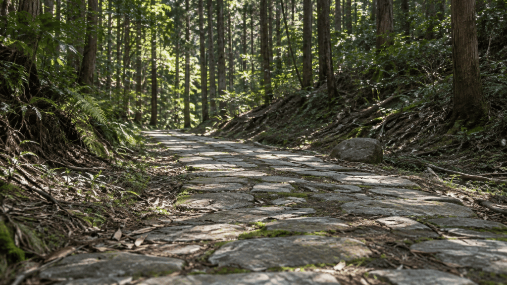
Having walked this section with international visitors in 2025, the thing I now warn people about first is not navigation. It is their shoes.
Quick answer: Base yourself in the Hongu area, take the bus to Hosshinmon-oji, and walk back to Kumano Hongu Taisha. Download the official map before you go, allow more time than the walking estimate suggests, and check the bus timetable before you start walking rather than after.
- Best first hike: Hosshinmon-oji to Kumano Hongu Taisha (about 7.5 km, 2–3 hours)
- Shortest taste of the trail: Gyuba-doji-guchi to Chikatsuyu-oji (1.3 km, about 30 minutes)
- Best full day: Takijiri-oji to Chikatsuyu-oji (about 13.3 km, 6–8 hours, around 1,010 m of climbing)
- Not for you if: you want a paved, level promenade, or you are unwilling to plan around a sparse rural bus schedule
Considering a guided walk? Want the pilgrimage stories as well as the scenery? An English-guided private walk covers the same Hosshinmon-oji to Kumano Hongu Taisha section, adding cultural context along the way. Check guided walk availability and meeting details before deciding whether to go independently.
Kumano Kodo Nakahechi Route: What You Need to Know
The Kumano Kodo is a network of pilgrimage routes across the Kii Peninsula, and the Nakahechi — the “middle route” — is the one most visitors walk. It ran inland from the coast toward Kumano Hongu Taisha, and it has been in continuous use for more than a thousand years. It is a UNESCO World Heritage site as part of the “Sacred Sites and Pilgrimage Routes in the Kii Mountain Range.”
One clarification matters before anything else. The Kumano Sanzan — Kumano Hongu Taisha, Kumano Hayatama Taisha and Kumano Nachi Taisha — are not clustered at the end of one short walk. The Nakahechi brings you to Hongu first. Reaching the other two shrines involves either a boat down the Kumano River or a separate trip east toward Shingu and Nachi. Travelers who assume all three are a single afternoon are the ones who end up rushing.
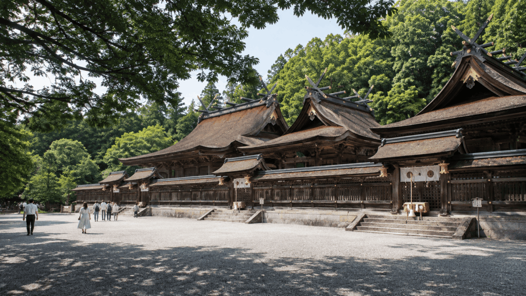
The second clarification is about distance. Takijiri-oji to Kumano Hongu Taisha is the core walking section, and it is usually described as about 38 km. That is a multi-day undertaking. The Nakahechi also has shorter highlight sections that use the same trail, the same waymarkers and the same scenery, and they require no multi-day logistics at all.
Practically, the places you will see named on maps are the oji — small shrines that marked stages of the pilgrimage. Takijiri-oji is the trailhead. Takahara is a village on a ridge with wide views. Chikatsuyu-oji sits in a valley with inns and a bus stop. Tsugizakura-oji marks the start of the climb toward the Hongu basin. Hosshinmon-oji is the last of them before the shrine, and its name means the “gate of awakening of the aspiration to enlightenment” — the outermost entrance to Kumano Hongu Taisha’s sacred precincts.
Kumano Kodo Nakahechi Route Map: Where the Trail Actually Goes
Do not rely on a general tourist map of Wakayama. The route is maintained and documented by the Tanabe City Kumano Tourism Bureau, which publishes an overview map and separate PDF maps for each section. Download the map for the section you plan to walk, save it to your phone, and print a copy if you are the kind of person who likes paper.
The official Nakahechi maps are available from the bureau here: Tanabe City Kumano Tourism Bureau — Kumano Kodo maps.
Here is the sequence as it runs from west to east. Treat this as an orientation aid, not as a navigation tool — the actual distances, bends and junctions are on the official map.
- Takijiri-oji — trailhead on the Tonda River, with the Kumano Kodo Kan Pilgrimage Center beside it
- Takahara — ridge-top village, reached by a steep climb
- Gyuba-doji-guchi — trailhead beside the Kumano Kodo Nakahechi Michi-no-Eki road station
- Chikatsuyu-oji — valley village with accommodation and buses
- Tsugizakura-oji — start of the long climb over to the Hongu side
- Hosshinmon-oji — the outer gate of the Hongu shrine’s precincts
- Kumano Hongu Taisha — the shrine itself, with Oyunohara a short walk away
Two limitations are worth stating plainly. An official map shows you the route; it does not tell you that a section is closed after a landslide, or that the last bus left twenty minutes ago. Trail condition notices and timetables are separate checks, and both are covered further down. Second, a phone map is only as good as its battery. On a half-day walk this is a minor concern. On a full-day section in the mountains it is not.
Which Nakahechi Section Should You Hike?
Most route guides list sections by distance. That is the least useful way to choose. Three questions decide it: how much time you actually have, how much climbing your legs will accept, and how you get back to your accommodation at the end. The table below puts all three in one place.
| Route section | Distance | Walking time | Terrain and difficulty | Best for | Bus at the finish |
|---|---|---|---|---|---|
| Gyuba-doji-guchi → Chikatsuyu-oji | 1.3 km | About 30 min | Short climb to Hashiori-toge, then a cobblestone descent. Official rating 1. | A quick taste of the trail and the Gyuba-doji statue | Yes — Chikatsuyu-oji and Gyuba-doji-guchi stops |
| Hosshinmon-oji → Kumano Hongu Taisha | About 7.5 km | 2–3 hrs | Forest trail and village road, net descent of about 460 m but with genuine climbs. Official rating 2. | First-time hikers and anyone with half a day | Yes — Hongu Taisha-mae |
| Takijiri-oji → Takahara | About 4 km | 2–3 hrs | Steep, sustained climb through forest. Short, but not easy. | A demanding leg with ridge-top views | No — nearest bus stop is Kurisugawa, about 30 minutes on foot |
| Takijiri-oji → Chikatsuyu-oji | About 13.3 km | 6–8 hrs | Around 1,010 m of ascent, uneven surfaces, some village pavement. A full mountain day. | Walkers who want one serious day on the trail | Yes — Chikatsuyu-oji |
| Chikatsuyu-oji → Kumano Hongu Taisha | About 24.5 km | 9–12 hrs | Long and varied, with pavement through Nonaka then mountain trail. Around 1,100 m of ascent. | Experienced hikers with an early start | Yes — but confirm the last service |
How to read this table. Walking times are the bureau’s estimates and do not include breaks, photographs, shrine visits or the time it takes to find the trailhead. Difficulty ratings are not a single measurement — they combine distance, time, elevation gain and loss, terrain, bus access and how isolated the section is. A “2” is not a guarantee of comfort on a wet day.
The most common planning error I see is choosing by distance alone. Takijiri-oji to Takahara is only about 4 km, but it climbs steadily from the river, and people who expected a stroll arrive at the village far more tired than they planned. Meanwhile the 7.5 km Hosshinmon-oji walk feels easier than its length suggests, because the net direction is downhill. If you have one day and average fitness, take the longer, gentler section. If you want to be tested, take the shorter, steeper one.
For a longer trip, the sections combine into a natural sequence: Takijiri-oji to Takahara, Takahara to Chikatsuyu, Chikatsuyu to the Hongu area. The bureau’s suggested walks page sets out these combinations with distances and accommodation options, and it is a better starting point than assembling stages yourself.
The Best Nakahechi Walk for Beginners: Hosshinmon-oji to Kumano Hongu Taisha
This is the section I recommend to anyone walking the Kumano Kodo for the first time, and it is the section I have guided. The official figures are about 7.5 km, 2 to 3 hours, roughly 190 m of total ascent and 460 m of descent. Some bureau pages round the distance to about 7 km, so do not be alarmed by the discrepancy — it comes from where the measurement starts and stops.
The walk begins at Hosshinmon-oji, a small shrine at the edge of a village, and follows a road through the village to Mizunomi-oji, the site of an old schoolhouse. Look for the folk-art wood carvings along this stretch. At Mizunomi-oji the trail enters the forest and stays there until it emerges at the western end of the Fushiogami settlement, where the terraced fields and tea plantations open up.
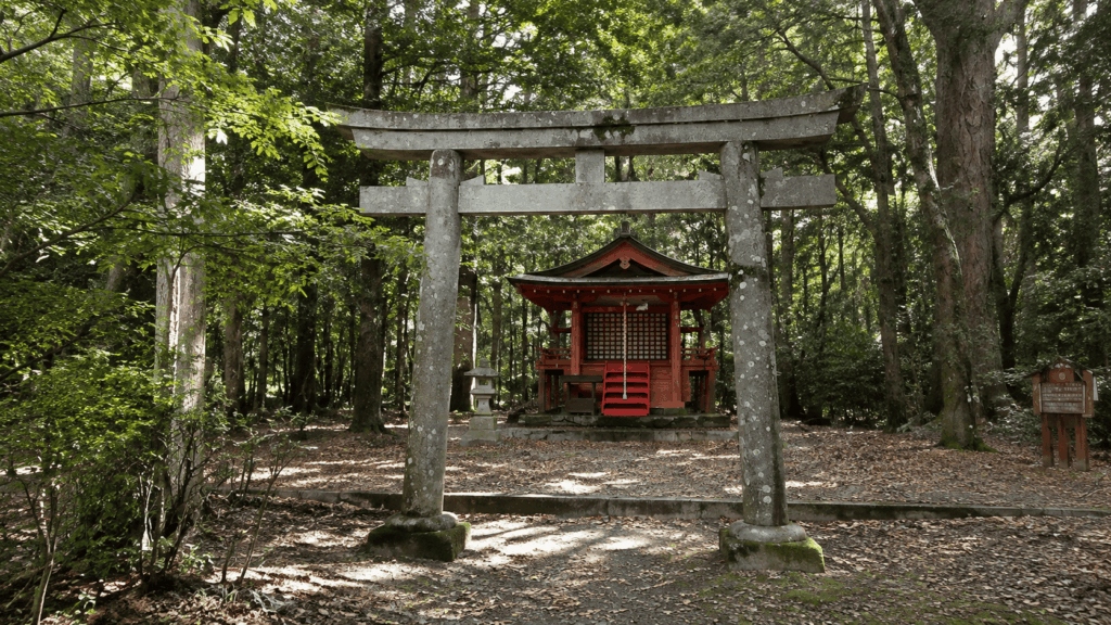
Fushiogami-oji is the emotional hinge of the walk. This is where pilgrims are said to have fallen to their knees after catching their first glimpse of the grand shrine in the valley below. There is a covered rest area here where local people sometimes serve handmade snacks and coffee made with hot-spring water; the days they operate change, so treat it as a welcome surprise rather than a plan.
From there the route descends through forest past Sangen-jaya. Halfway between Sangen-jaya and Kumano Hongu Taisha there is a short side trail to a lookout point, and it is worth the detour. The final approach mixes forest path with paved road through settled streets before you reach the shrine.
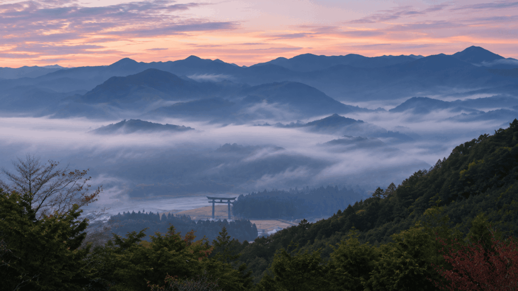
What to budget. The official 2 to 3 hours is walking time. Add time at Fushiogami-oji, the viewpoint, and the shrine itself, plus the walk to Oyunohara — the original site of the shrine, about 10 minutes away, marked by a torii gate 33.9 m tall. A half day is the realistic unit. Travelers who book a tight bus connection at the far end are the ones who end up hurrying through the part they came for.

Two practical warnings. First, there is no accommodation at Hosshinmon-oji. If you miss the last bus back toward Hongu, Yunomine Onsen, Kawayu Onsen or Tanabe, you are not staying where you planned. Second, the Kumano Hongu Heritage Center opposite the shrine is open 9:00–17:00 with free admission, and it is the most useful place in the area for context on what you have just walked through — but it closes, so do not leave it until the end of the day.
The walk is genuinely suitable for beginners. It is not a flat path, and after rain the stone underfoot changes character. That is the subject of a later section, and it matters more than any map.
Is the Nakahechi Trail Easy to Follow? Signs, Maps and Navigation
The Nakahechi is one of the better-marked mountain routes in Japan. Waymarkers are placed at junctions and at intervals along the trail, and the bureau’s section maps are detailed enough to follow. This is why self-guided walking is realistic here rather than reckless — the infrastructure exists, and it is maintained.
That is not the same as saying you can set out empty-handed. Three things still need doing before you start:
- Save the official PDF for your section offline. Signal in the valleys is unreliable, and a map that needs to load is not a map.
- Check the current trail status. The bureau publishes detours and closures, and the city publishes its own notices. A route that is fine in spring can be rerouted after heavy rain.
- Tell someone your plan. Your accommodation, or the reservation system you booked through, is the usual channel.
Kai’s tip: Some of the visitors I walked with in 2025 had printed very detailed maps before leaving home because they were worried about getting lost. In practice, the markers at the junctions did most of the work, and they did not need to walk with their eyes on paper. Knowing that the signs are there removes a lot of the anxiety before you even arrive — but it is not a reason to skip the map, because the one junction where you do need it is the one where you will really need it.
There are two useful places to ask a human being if something is unclear: the Kumano Kodo Kan Pilgrimage Center beside Takijiri-oji, which has introductory displays and a water tap for refilling bottles, and the Kumano Hongu Heritage Center opposite the shrine at the Hongu end. Both are staffed, both are free, and both are better than guessing at a junction.
What the Trail Is Really Like Underfoot: Stone, Steps and Rain
The Nakahechi is not one surface. Within a single section you will walk on forest soil and roots, on moss-covered stone paving, on steep stone staircases, on cobblestone descents, and on ordinary asphalt through villages. The character of the walk changes every twenty minutes, which is part of its appeal and the reason generic advice fails.
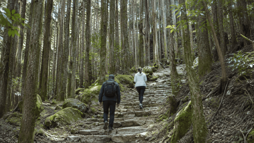
The stone is the part that surprises people. Much of the historic paving is dark, uneven and shaded by cedar, and it holds moisture long after the rain stops. On a dry day it is merely uneven. After rain it is genuinely slippery, particularly on descents, where the steps are shallow and worn smooth in the middle.
What I have found guiding here is that footwear is the single decision that most affects how much someone enjoys the day. Light city sneakers with a smooth sole are the wrong tool on wet stone. A shoe or boot with a proper tread pattern, and ideally some ankle support, changes the descent from cautious to comfortable. A waterproof layer matters too, not because it always rains, but because mountain weather here changes faster than the forecast suggests.
Trekking poles are optional. On the Hosshinmon-oji section I would call them nice to have. On the long descents of the Chikatsuyu to Hongu section, or on the steep climb out of Takijiri-oji, they earn their weight.
Two cautions against over-generalizing. Not every stone surface is dangerous — much of the paving is stable and easy. And not every wet day is a problem — plenty of people walk in light rain without incident. The judgment call is about combining factors: rain, plus a steep descent, plus worn stone, plus tired legs at the end of a long day. When those line up, shortening the plan is the sensible move rather than a failure.
How to Get to the Nakahechi Trailheads and Use the Local Buses
Almost everyone reaches the Nakahechi by train to Kii-Tanabe Station and then bus. Ryujin Bus operates the Kumano Hongu Line through the Nakahechi villages, and the same corridor is served by other local operators on different stretches. Coming from the east, around Shingu, Meiko Bus covers the Kii-Katsuura and Shingu side.
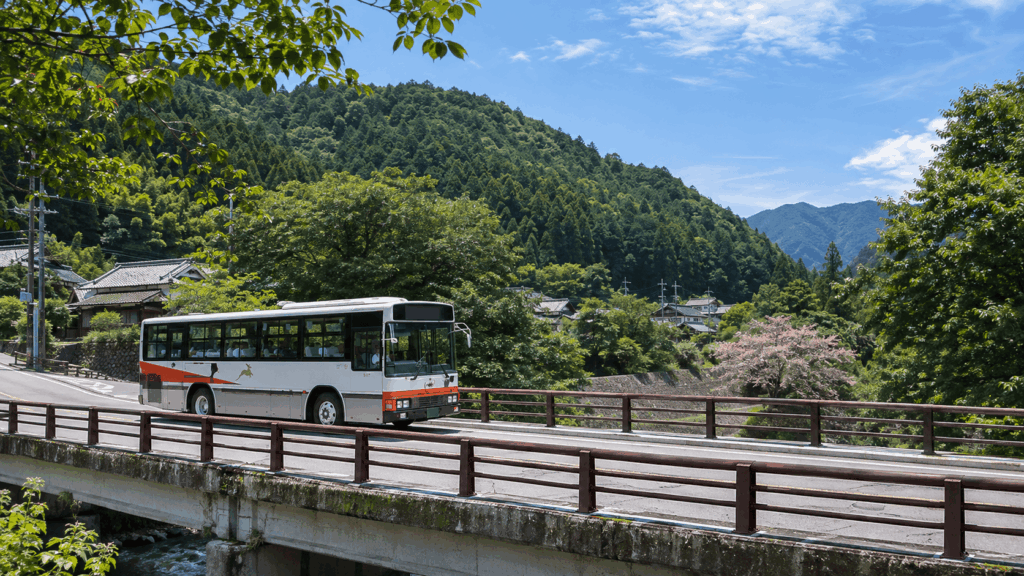
For the beginner walk, the useful detail is this: you can reach Hosshinmon-oji directly from Kii-Tanabe by bus, but it takes over two hours. In the 2026 timetable, an early departure from Kii-Tanabe reaches Hosshinmon-oji around 8:40. Most people instead stay in the Hongu area and take the short bus up from Hongu Taisha-mae, which takes about 15 minutes.
That short bus is the constraint nobody warns you about. In the 2026 timetable there are only a limited number of departures from Hongu Taisha-mae toward Hosshinmon-oji each day, and some early services operate seasonally rather than year-round. Check the current operator timetable for the exact times on your travel date. The fare is a few hundred yen, around ¥470 at the time of writing.
Kai’s tip: I have done this the easy way and the hard way. The easy way is to leave the car in the Hongu basin, take the bus up to Hosshinmon-oji, and walk back down to the shrine — the bus becomes your start line and your legs become the return journey. The hard way is to walk first and then discover that the return bus you assumed existed does not run when you need it. Plan backwards from the timetable, not forwards from your enthusiasm.
Two more notes for international visitors. Ryujin Bus began accepting contactless card payments on the Kumano Hongu Line from September 2026, which removes the small-notes problem on that route, but this is a rural bus network and you should not assume every operator or every route works the same way. And buses fill up in peak spring and autumn; the bureau specifically warns about this. Being at the stop early is worth more than being right on time.
Current timetables and fare tables are published by the operator: Ryujin Bus — Hongu Taisha-mae bus stop.
Food, Rest Stops and the Gyuba-doji Statue
Food is the part of Nakahechi planning that catches people out, because the map shows villages and villages imply lunch. They do not.
The bureau is unusually direct about this. Between Chikatsuyu-oji and Kumano Hongu Taisha there are no restaurants at all, and walkers are advised to carry a packed lunch. On the Takijiri-oji to Chikatsuyu-oji day, the only places to eat are Kiri-no-Sato Takahara Lodge, the Kumano Kodo Nakahechi Michi-no-Eki road station, and a few places in Chikatsuyu village — and even there, most walkers bring lunch and eat it on the trail. Common lunch stops include the creek beside Jagata Jizo and the Mikoshi-toge area.
The road station at Chikatsuyu is the most useful single stop on the route. Its address is 2474-1 Nakahechi-cho Nearu, Tanabe, and the current official listing gives the shop as 9:00–17:00 and the café as 9:00–14:30, closed on Thursdays from December to February and over New Year. Note the seasonality of that Thursday closure — it is not a year-round day off, which several guides get wrong.
Kai’s tip: When I stopped at that road station, the food service was winding down far earlier in the afternoon than I had assumed it would. The official listing now puts the café at 9:00–14:30, and I would not plan a late lunch around it either way. Carry something to eat, and treat a hot meal as a bonus rather than the plan.
A few minutes from the road station, up a short climb to Hashiori-toge, is the Gyuba-doji statue — the image most associated with this stretch of trail. It depicts the retired emperor Kazan on a journey to Kumano, seated across a horse and a cow. It is 55.2 cm tall. When I finally saw it, it was much smaller than I had pictured from photographs, and I suspect most visitors have the same reaction. That is not a criticism. It is a small, strange, centuries-old object in a mountain pass, and its scale is part of why it stays with you.
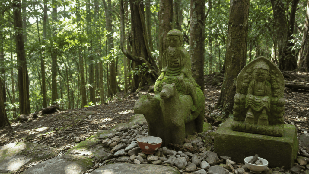
Be careful with geography here, because it is a common source of confusion. The Gyuba-doji statue is on the Hashiori-toge pass near Chikatsuyu, reached on the 1.3 km Gyuba-doji-guchi to Chikatsuyu-oji walk. It is not on the Hosshinmon-oji to Kumano Hongu Taisha route. Those are two different sections on two different parts of the Nakahechi, and combining them into one three-hour outing does not work.
How Many Days Do You Need for the Nakahechi Route?
The honest answer depends entirely on which Nakahechi you mean, and this is where most itineraries go wrong. There are four realistic formats:
- Half a day: Hosshinmon-oji to Kumano Hongu Taisha, plus the shrine and Oyunohara. This is the version that fits a normal Japan trip.
- One full day: Takijiri-oji to Chikatsuyu-oji, about 13.3 km with roughly 1,010 m of ascent. This is a real mountain day, not a sightseeing walk.
- Two to three days: Takijiri-oji to Takahara, Takahara to Chikatsuyu, then Chikatsuyu toward the Hongu basin. This is the classic short pilgrimage and the version most first-time multi-day walkers choose.
- Four to five days: the full core route from Takijiri-oji to Kumano Hongu Taisha, about 38 km, staying in mountain villages along the way.
Accommodation is what actually determines the shape of a multi-day trip, not fitness. The villages are small, the inns are small, and the number of beds in Chikatsuyu or Nonaka is not large. Book early, and book the whole chain at once rather than one night at a time, because a gap in the middle forces a replan. The Hongu area — Yunomine Onsen, Kawayu Onsen, Wataze Onsen — has more capacity and makes a good base for the half-day walk.
If you are carrying a suitcase rather than a pack, the daily luggage shuttle run through KUMANO TRAVEL moves your bag between participating accommodation. It requires booking at least 20 days in advance, and it only serves eligible lodgings and routes, so confirm your specific inn is covered before you count on it.
One thing I would push back on: walking the entire route is not the only way to have the experience people describe. Travelers who try to compress too much into too few days consistently report the same thing — they arrived at Kumano Hongu Taisha with no time left to be there. The shrine is the destination of a thousand years of walking. Give it an hour.
Self-Guided or Guided? Do You Need a Tour?
No, you do not need a guide to walk the Nakahechi. The route is marked, the maps are public, the buses are scheduled, and thousands of people walk it independently every year. Anyone who tells you a guide is necessary for safety is overselling.
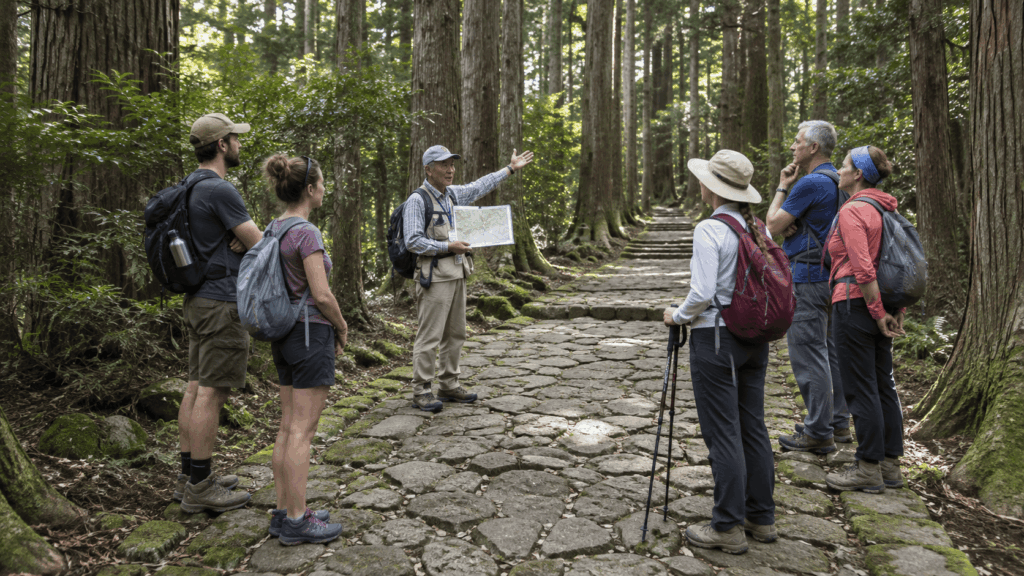
What a guide adds is interpretation. The oji along this route are small, weathered structures that look like nothing in particular unless someone explains what they were for. The distinction between the shrines, the meaning of the gate at Hosshinmon-oji, the reason pilgrims knelt at Fushiogami-oji — this is exactly the kind of context that a map cannot give you and that most travelers piece together afterwards from a museum display.
| Option | Best for | What you get | What you still arrange | Watch out for |
|---|---|---|---|---|
| Self-guided Hosshinmon-oji walk | Independent travelers, budget-conscious walkers, anyone who wants to set their own pace | Freedom to stop, photograph, picnic and change plan mid-walk | Bus to the trailhead, map, food, water, footwear | Missing the sparse return bus; no one to ask about the history |
| English-guided Hosshinmon-oji walk | Travelers who want the Kumano faith explained as they walk | English commentary on the oji and the pilgrimage tradition, plus logistics handled | Getting to the meeting point; personal gear | Group pace; transport to the start may not be included; weather risk is unchanged |
| Multi-day self-guided trip with accommodation planning | Walkers doing two or more days who want the logistics solved | Inn bookings, luggage movement, a route that fits the beds that exist | Daily walking decisions, food, weather calls | Booking windows are long; changes late in the process are hard |
If you are leaning toward the guided version, the established option on this exact section is a private English-language walk from Hosshinmon-oji to Kumano Hongu Taisha, run with local guides. It takes about 3.5 hours, is limited to small groups, meets at the Kumano Hongu Heritage Center, and includes a short bus transfer to the trailhead. It covers Mizunomi-oji, Fushiogami-oji, Sangen-jaya and Haraido-oji with commentary on the Kumano faith. Prices, availability and cancellation terms change, so check the current listing before you commit.
A guided walk does not remove the physical realities described above. You will still be on the same wet stone, in the same weather, at the same pace as the group. What you are paying for is understanding, not safety.
If you want to understand the spiritual meaning behind the shrines rather than simply follow a well-marked trail, this private guided walk is worth considering.
Why I’d book this one
- The route matches the recommended beginner hike. It follows the Hosshinmon-oji to Kumano Hongu Taisha section highlighted in this guide, rather than taking you to an unrelated part of the pilgrimage network.
- English-language interpretation adds context. Recent travelers mention knowledgeable guiding and clear English explanations, especially useful for understanding the oji shrines and Kumano faith.
- The private format makes the experience more personal. Recent feedback highlights the guide’s flexibility and attention to individual interests, although the trail conditions and physical demands remain the same.
See current availability, start times, cancellation terms, and recent traveler reviews for the guided Kumano Kodo walk. Check the meeting details and what is included before choosing this over the self-guided option.
Before You Hike: Nakahechi Planning Checklist
Everything in this guide condenses into a short list. Run through it the night before, not at the bus stop.
- Walking section chosen, with a realistic finish time
- Official section map downloaded and saved offline
- Current trail conditions and closures checked
- Bus times confirmed in both directions, including the last service
- Shoes with real tread; rain layer packed
- Water and lunch carried, especially on any section beyond Chikatsuyu
- Weather forecast checked, with a shorter alternative in mind
- Enough daylight allowed for the walk plus the shrine
- Accommodation confirmed, and luggage arrangements confirmed if using a shuttle
- Someone told where you are going and when you expect to finish
If you are walking the half-day section, the two items that matter most are the bus times and your shoes. Everything else can be improvised. Those two cannot.
Frequently Asked Questions
Is the Kumano Kodo Nakahechi Route suitable for complete beginners?
Parts of it are, and parts of it are not. The Hosshinmon-oji to Kumano Hongu Taisha section is the realistic entry point: about 7.5 km, 2 to 3 hours of walking, and a net descent rather than a climb. It is still a mountain trail with uneven stone and some uphill, so it is not a flat promenade. Anyone who can comfortably walk for three hours will manage it. The longer sections, particularly Chikatsuyu-oji to Kumano Hongu Taisha at around 24.5 km, are for experienced walkers.
How many days do you need for the Nakahechi Route?
It depends which version you mean. The half-day highlight walk from Hosshinmon-oji takes an afternoon. A single serious day, such as Takijiri-oji to Chikatsuyu-oji at about 13.3 km, uses a full day. The classic multi-day route from Takijiri-oji to Kumano Hongu Taisha covers roughly 38 km and takes most walkers four to five days, or two to three days if they only walk the first half toward Chikatsuyu. Accommodation availability, not fitness, usually decides the shape of a multi-day trip.
Can you walk the Nakahechi without a guide?
Yes. The trail is marked at junctions, the Tanabe City Kumano Tourism Bureau publishes detailed section maps for free, and the buses connect the trailheads and villages. Self-guided walking is the norm here, not an advanced option. A guide is worth paying for if you want the history of the oji and the Kumano faith explained as you walk — not because the route is dangerous or hard to find.
Do you need hiking boots for the Nakahechi trail?
You need footwear with real grip, which is not the same as a heavy boot. The historic stone paving is worn and holds moisture, and the descents are where people notice it. Light city sneakers with smooth soles are a poor choice after rain. A trail shoe or a light boot with a proper tread pattern is enough for the half-day section. Trekking poles help on the long descents and on the steep climb out of Takijiri-oji, but they are optional.
Where does the Nakahechi Route start, and how do you get there?
The traditional walking start is Takijiri-oji, reached by bus from Kii-Tanabe Station. For the beginner section, the start is Hosshinmon-oji, which you can reach directly from Kii-Tanabe in a little over two hours, or far more conveniently by a 15-minute bus from Hongu Taisha-mae if you are staying in the Hongu area. That short bus runs only a handful of times a day, and some early services are seasonal, so check the current timetable before you build a plan around it.
Is there food and water along the Nakahechi trail?
Less than the map suggests. There are no restaurants at all between Chikatsuyu-oji and Kumano Hongu Taisha, and the bureau advises walkers to carry a packed lunch. On the Takijiri-oji to Chikatsuyu-oji day, options are limited to Kiri-no-Sato Takahara Lodge, the Kumano Kodo Nakahechi Michi-no-Eki road station, and a few places in Chikatsuyu village. The road station’s café currently closes in the early afternoon and shuts on Thursdays in winter, so do not plan a late lunch around it.
What should you do if it rains on the Nakahechi trail?
Light rain is walkable and plenty of people do it. The issue is the combination of wet stone, a steep descent and tired legs, which is when the historic paving becomes genuinely slippery. Shorten the plan rather than cancel it: the Hosshinmon-oji walk can be cut short by leaving the trail at Fushiogami, and the shrine and heritage centre at the Hongu end remain visitable in any weather. Check the bureau’s trail status page and ask your accommodation before setting out, because conditions change fast in these mountains.
Final Verdict: Which Nakahechi Walk Is Right for You?
Choose the Hosshinmon-oji to Kumano Hongu Taisha walk if you have half a day, you are travelling with someone who is not a hiker, or you want the pilgrimage experience without committing your whole trip to it. It delivers forest, mountain villages, a viewpoint, the oji, and the shrine itself — the full emotional arc in about three hours of walking.
Choose Takijiri-oji to Takahara if you want to be out of breath and rewarded for it. Four kilometres sounds trivial until you realise it climbs steadily from the river. This is the section for someone who wants a short, hard leg and a ridge-top village at the end, and it pairs naturally with a night in Takahara.
Choose Takijiri-oji to Chikatsuyu-oji if you want one proper mountain day rather than a sampler. At about 13.3 km and roughly 1,010 m of ascent, it is the honest version of “walking the Kumano Kodo” for people with limited time. Start early, carry lunch, and do not book anything tightly for the evening.
Choose a two- to five-day route if the walking itself is the point of the trip. This is where the Nakahechi becomes a pilgrimage rather than a hike: mountain inns, early starts, and arriving at Hongu having earned it. Book the accommodation chain before anything else, and start the luggage shuttle conversation at least 20 days out.
For first-time visitors to Japan, the half-day section is the right call. It fits around Kyoto, Osaka or Kii-Katsuura without demanding a reorganisation of the itinerary, and it does not require you to solve rural accommodation logistics on your first trip.
For families, the Gyuba-doji-guchi to Chikatsuyu-oji walk is the friendliest option: 1.3 km, about 30 minutes, a short climb to a pass with a small statue, then a cobblestone descent into a village. It is a taste rather than a pilgrimage, but it is achievable and it has a story at the midpoint.
For travellers on a tight schedule, do not attempt to combine the Gyuba-doji statue with the Hosshinmon-oji walk. They are on different parts of the route, and the driving and bus connections between them will eat the day you were trying to save.
For repeat visitors, skip the sampler and take Chikatsuyu-oji to Kumano Hongu Taisha, or add the Akagi-goe and Dainichi-goe routes around the Hongu basin. You already know what the shrine looks like. What you have not done is the long approach.
Skip the trail entirely if you need step-free access. The stone staircases, roots and uneven paving make the walking sections unsuitable for wheelchairs and difficult with a stroller. Kumano Hongu Taisha, Oyunohara and the heritage centre are all reachable without walking the trail, and they are worth the trip on their own.
If you take one thing from this guide, take the sequencing: choose the section by the bus at the end, not by the distance on the map. Everything else — the shoes, the lunch, the map — follows from that.

Hi, I’m Kai. I’m a Tokyo-based travel writer, tourism industry insider, and the author of a published guidebook for international visitors to Japan. With over 10 years of professional experience at a leading Japanese tourism company, my mission is to help you skip the tourist traps and navigate Japan’s best destinations like a local. I believe the perfect day trip is like a traditional kaiseki meal: a beautiful balance of precise planning and unforgettable seasonal discovery. When I’m not out conducting field research, you’ll usually find me drafting new itineraries with one of my favorite fountain pens!