
Okinawa is an archipelago, but every trail in this guide is on Okinawa Main Island — the island most travelers reach through Naha Airport. The outer islands, including Iriomote and Ishigaki, work on a different set of logistics and permits, and they are covered separately near the end.
Okinawa is worth exploring on foot, but the trails here do not offer the same experience twice. Choose ASMUI Spiritual Hikes for a managed nature walk through limestone formations, Mount Katsuu for a short, steep climb above Nago Bay, or Ta-taki Falls for a river trek that soaks you to the knees. If you are based in Naha, the drive north is the part most itineraries underestimate.
One thing to settle before anything else: Hiji Falls, the waterfall walk most older guides still list first, has been closed since severe rain damage in November 2024, with no reopening date announced as of November 2026. It is not included among the five hikes below.
If Ta-taki Falls is your priority and you are staying in Naha without a rental car, a guided river trek can simplify both transport and equipment planning. Check available dates, hotel pickup details and included gear for the guided Ta-taki waterfall trek.
Best Hikes in Okinawa at a Glance
These five cover the range of what walking in Okinawa actually means: a paid interpretive park, a low mountain with sea views, a proper forest climb, a river route, and a subtropical forest trail. None of them is a long alpine trek — the highest point on the island is 503 m — but low elevation here does not mean low effort.
- Easiest footing, highest cost: ASMUI Spiritual Hikes — around ¥2,500 per adult, with shuttle, audio guide and lounge included.
- Best reward for the least walking: Mount Katsuu — roughly 30–40 minutes up, but over rock almost the entire way.
- Most adventurous: Ta-taki Falls — knee-deep wading, rope sections, and rental gear you should not skip.
| Hike | Best for | Walking time | Terrain and difficulty | Access | Key caveat |
|---|---|---|---|---|---|
| ASMUI Spiritual Hikes | An easy, organized nature walk | 30–60 min on the course; 90–150 min at the site | Limestone paths, stairs and some steep, exposed sections. Easy to moderate. | Car; bus plus village bus is possible but slow | Paid entry; not a free mountain trail |
| Mount Katsuu | Coastal views | About 30–40 min one way (visitor reports; no official figure) | Rocky, steep and slippery when wet. Moderate. | Car | Short does not mean easy |
| Mount Ishikawa | A conventional mountain hike | A: 1–1.5 h / B: 2.5–3 h / C: 3–4.5 h | Forest trail with fixed ropes and signage. A is easiest; B and C demand more. | Car | Sign-in required; closed Mondays; descend by 16:00 |
| Ta-taki Falls | River trekking and a waterfall | About 40 min one way, wading | Riverbed walking, knee-deep water, rope-assisted rock sections. Moderate to adventurous. | Car or guided tour | Felt-soled shoes and a life jacket strongly advised; closes in bad weather |
| Mount Yonaha (to the ninth station) | Yanbaru forest | 3–4 h round trip | Wide former logging road, slippery in places, two confusing junctions. Easy to moderate. | Car | Not a summit hike; protected area above the ninth station |
The walking times above are walking times only. They exclude the drive, the sign-in desk, and the time you will actually spend standing at a viewpoint. Terrain ratings are our editorial assessment based on each operator’s or agency’s published trail description, not an official grading system — treat them as a way to compare the five, not as a promise.
If the waterfall is the reason you are reading this, the decision that matters is not which trail to pick but whether to walk it independently or with a guide. That comparison sits further down, after the route details.
The 5 Best Hikes on Okinawa Main Island
Two of these are managed facilities with staffed reception desks, two are community forest trails with no entrance fee, and one is a river. Read the terrain description before the scenery description — the mismatch between the two is where most disappointing days come from.
1. ASMUI Spiritual Hikes — Best for an Easy Nature Walk
ASMUI Spiritual Hikes (formerly Daisekirinzan) sits inside Yanbaru National Park in Kunigami Village, in the far north of the island. The site is built around large limestone rock formations and subtropical forest, with a short shuttle transfer from the reception area up to the trailhead.
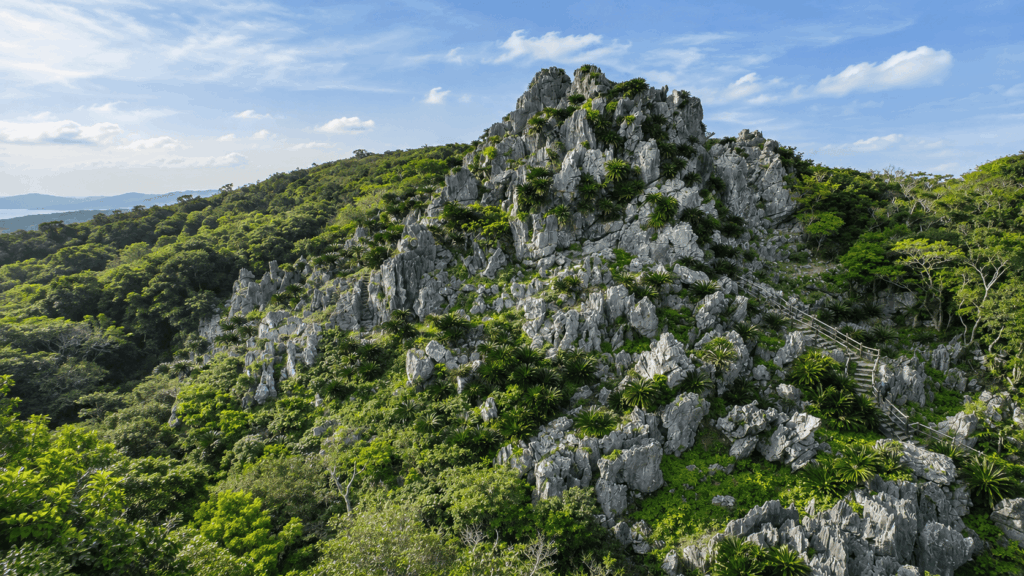
According to the operator’s current English information, admission is ¥2,500 for adults (15 and over) and ¥1,000 for children aged 6–14, and it includes the shuttle bus, an audio guide and use of the lounge. Hours are 9:30–17:30 with last admission at 16:00, open year-round, with free parking. The published visit length is 90 to 150 minutes, broken down roughly as 30 minutes for reception and transfer, 60 minutes for the Regular Course or 30 minutes for the Short Course, about 20 minutes in the Spirit Lounge, and 30 minutes to return.
That breakdown is worth reading twice, because it explains a common confusion: the 90–150 minutes is time at the facility, not time on your feet. The actual walking is closer to an hour on the Regular Course. If you are fitting ASMUI into a day that also includes Cape Hedo or the Yanbaru forest roads, budget the full facility time, not the walking time.
The terrain is not a flat boardwalk. The route passes over and between limestone formations, with stairs, uneven surfaces and sections on higher ground. Travelers with knee or balance concerns should ask at reception about the Short Course and which parts of the site are manageable without climbing. The audio guide is included for a reason — the formations make far more sense with the explanation attached to them than they do as scenery alone.
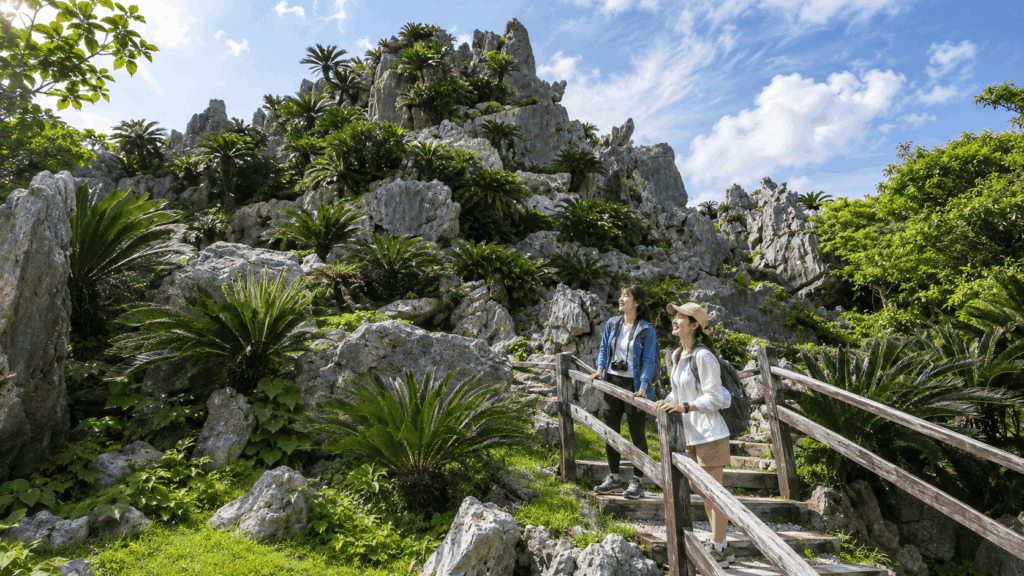
Best for: first-time visitors to Yanbaru, families with children old enough to walk an hour, anyone who wants nature without route-finding, and travelers who value interpretation over distance.
Skip it if: you want a free mountain trail, you resent paying for access to natural scenery, or your group measures a good hike by elevation gain.
Where to go: the ASMUI Gateway reception building in Ginama, Kunigami Village. The shuttle runs every 20 minutes from 9:40 to 16:00, so arriving after 15:00 leaves you very little margin.
If you prefer to explore ASMUI independently, compare current admission prices and date-specific ticket conditions on Klook before your visit.
2. Mount Katsuu — Best for Coastal Views
Mount Katsuu (Katsuu-dake) rises about 452 m above Nago City, and the summit opens onto Nago Bay and the Motobu peninsula. There is a free car park at the trailhead on the Katsuyama side, and no entry fee or reservation.
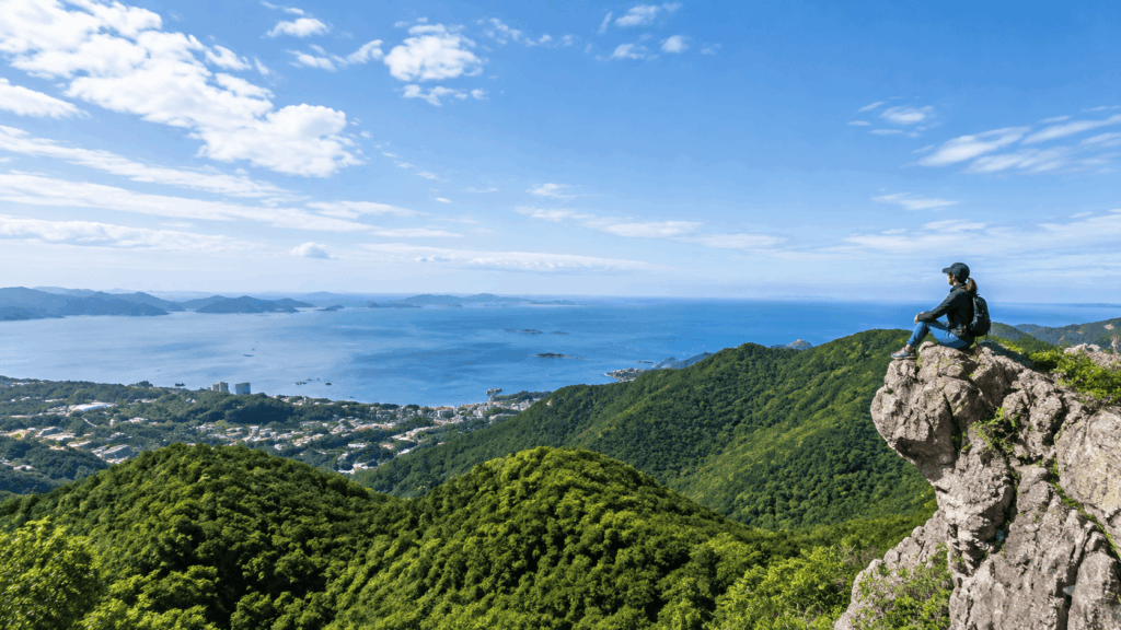
This is the hike most people picture when they want “”a short climb with a sea view,”” and the payoff is real. However, as detailed in our guide to the Mount Katsuu hike, what the photographs do not show is the surface. The upper trail is rock — not gravel, not soil, but uneven limestone that requires hands in places. Visitor reports put the ascent at roughly 30–40 minutes, though no single official figure is published, and the trail is easy to follow even where it is steep.
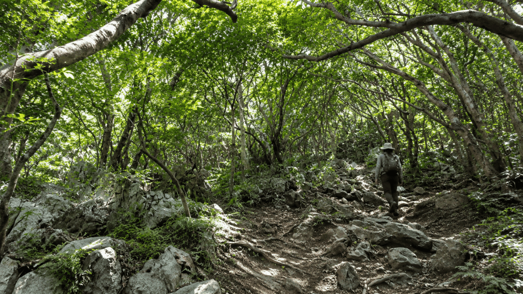
Best for: travelers with limited time who still want a summit, confident walkers, and anyone staying in Nago or Onna who wants a half-day outing without a long drive.
Skip it if: you are imagining a paved observation deck, you are walking in smooth-soled shoes or sandals, or recent rain has left the rock wet. The mistake that shows up again and again in trip planning is treating a short trail as an easy one — here, the distance is short and the effort is not.
Where to go: the free car park at the Katsuu-dake trailhead, Katsuyama, Nago. Trekking shoes are strongly recommended rather than optional.
3. Mount Ishikawa — Best for a Proper Mountain Hike
Mount Ishikawa (Ishikawa-dake) is a 204 m peak straddling Uruma City, Onna Village and Kin Town, and it is the closest thing on this list to a conventional Japanese mountain hike. The trailhead is at the Okinawa Prefectural Ishikawa Youth House, and every hiker signs in at the office before starting.
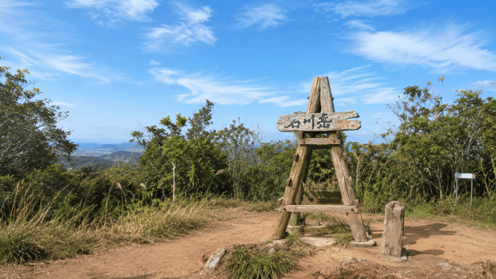
There are three courses, all of which climb to the summit and descend:
- A Course: about 1 km, roughly 1–1.5 hours
- B Course: about 2 km, roughly 2.5–3 hours
- C Course: about 3 km, roughly 3–4.5 hours
Reception for general hikers runs 8:30–14:00, and everyone is expected to be down by 16:00. Groups of 20 or more need to book by the previous day. The facility is closed on Mondays, or the following day when Monday falls on a public holiday — a detail that catches out visitors who plan a Monday hike because it is the day they happen to be driving through Uruma.
The courses are maintained with signage and fixed ropes at the steeper sections, which makes them navigable but does not make them gentle. A Course is the shortest and the usual starting point for children and first-time hikers; B and C add distance, roots and steeper ground. The summit looks out over the Pacific, the East China Sea and the mountains to the north, and the forest section holds heat and humidity even early in the day.
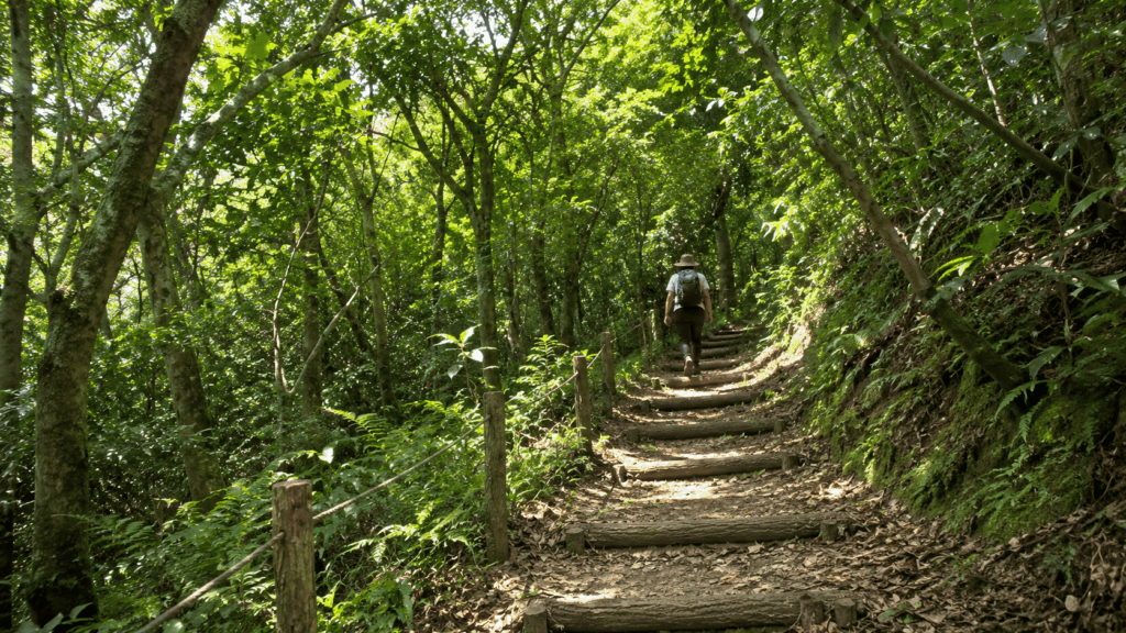
Best for: travelers who want a real climb with a summit, hikers who have done Japanese low mountains before, and anyone staying in the central part of the island who wants to avoid the long drive north.
Skip it if: you cannot reach the desk before 14:00, your visit falls on a Monday, or your group is not comfortable using ropes on rock. If a typhoon has passed through recently, check the facility’s current notices before driving out — short closures after storms are not unusual.
Where to go: the Ishikawa Youth House office, Uruma City, not the summit trailhead sign further up the road. Sign in first, then drive or walk to your course entrance.
4. Ta-taki Falls — Best for Adventurous River Trekking
Ta-taki Falls is the one on this list that is not really a hike. The route to the falls follows the Hennan River in Ogimi Village, and you walk in the river — knee-deep in places — for about 40 minutes each way, covering roughly 1.3 km. There are rock sections where you use a rope to climb up or down. If you are looking for a shaded forest path with a waterfall at the end, this is not it.
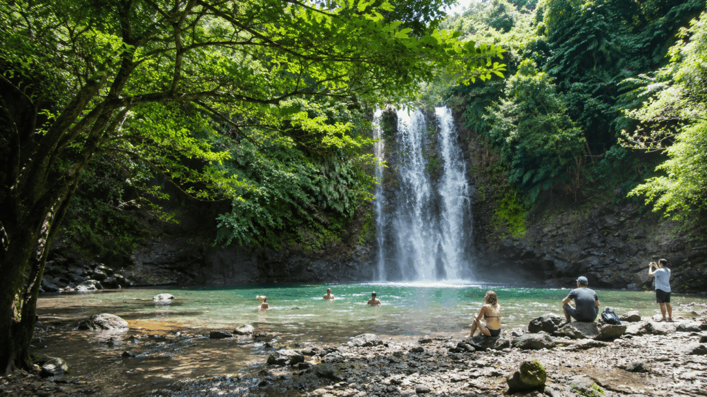
According to the site’s official information, there is no entrance fee. You pay for the village-run car park instead: 8:00–17:30 with last entry at 16:00, ¥500 for up to two hours for a standard car and ¥50 for each additional 30 minutes. The car park has 74 spaces, toilets, changing rooms, coin showers for ¥100 and lockers for ¥100. Large buses cannot enter.
The operator is unusually direct about gear. Felt-soled shoes, a life jacket and a helmet are recommended, and all of them can be rented at the car park. Sandals, island slippers and slides are described as dangerous, and even sport sandals and foam clogs are called unsuitable — rubber soles slide on mossy rock, small stones get inside, and the site notes that injuries from slipping and from hitting toes on rocks have actually occurred. A rash guard is suggested in summer; a wetsuit in the cooler months.
The other thing the official guidance stresses is that conditions change fast. The river can rise quickly, and the car park closes without notice when a thunderstorm or heavy-rain advisory is issued, when a typhoon is approaching, or when the river is already dangerous. Swimming and parking status is updated on the official site every morning at 8:00 and revised through the day.
Best for: travelers who want an adventurous half-day, groups with a car and a change of clothes, and anyone comfortable getting wet and using their hands on rock.
Skip it if: you cannot bring or rent proper footwear, you are unsure whether every member of your group can handle the rope sections, or the forecast is unstable. The fact that some tours accept children from age 3 says something about the operators’ scope, not about whether the route suits your particular child — ask the operator what the actual walked section involves.
Where to go: the Ogimi Village Ta-taki car park in Tsubumi, Ogimi. Search for the car park by name rather than the waterfall itself — the official site warns that navigation apps have sent visitors to the wrong location when they search the falls.
One scheduling note worth having before you commit: the official FAQ states that weekends and public holidays between 11:00 and 15:00 from July to October are often extremely busy, to the point where entry may involve a long wait or a request to come back another time. Early morning is not just cooler; it is the difference between walking and queueing.
5. Mount Yonaha — Best for Yanbaru Forest Hiking
Mount Yonaha (Yonaha-dake) is the highest point on Okinawa Main Island at 503 m, and this is where expectations need adjusting. You do not hike to the summit. The maintained route runs from the trail entrance to the ninth-station marker and back — about 3 km round trip, 3 to 4 hours — and everything above the ninth station is a protected area.
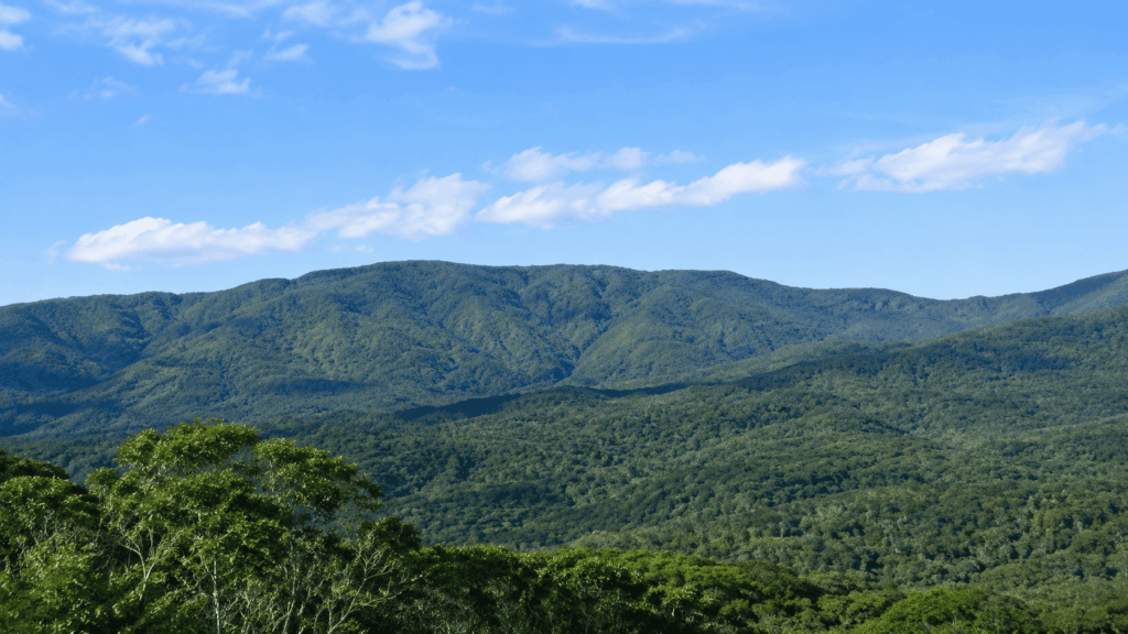
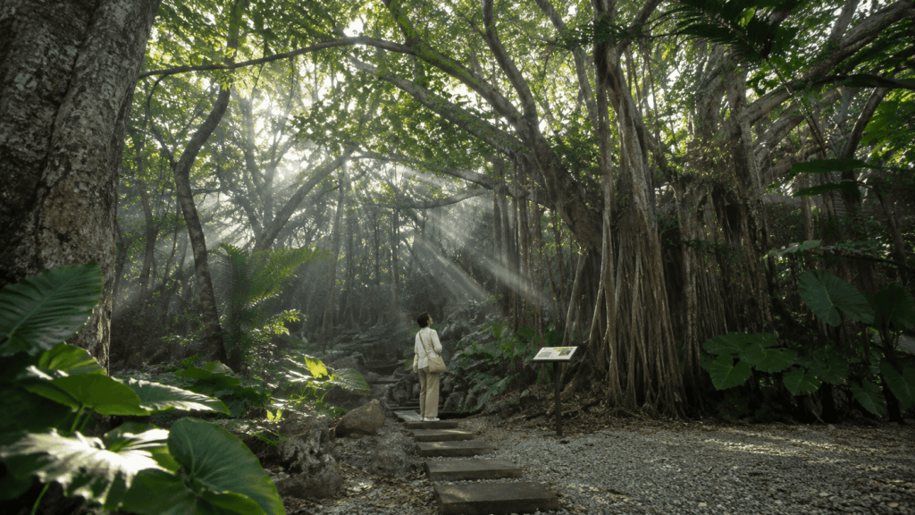
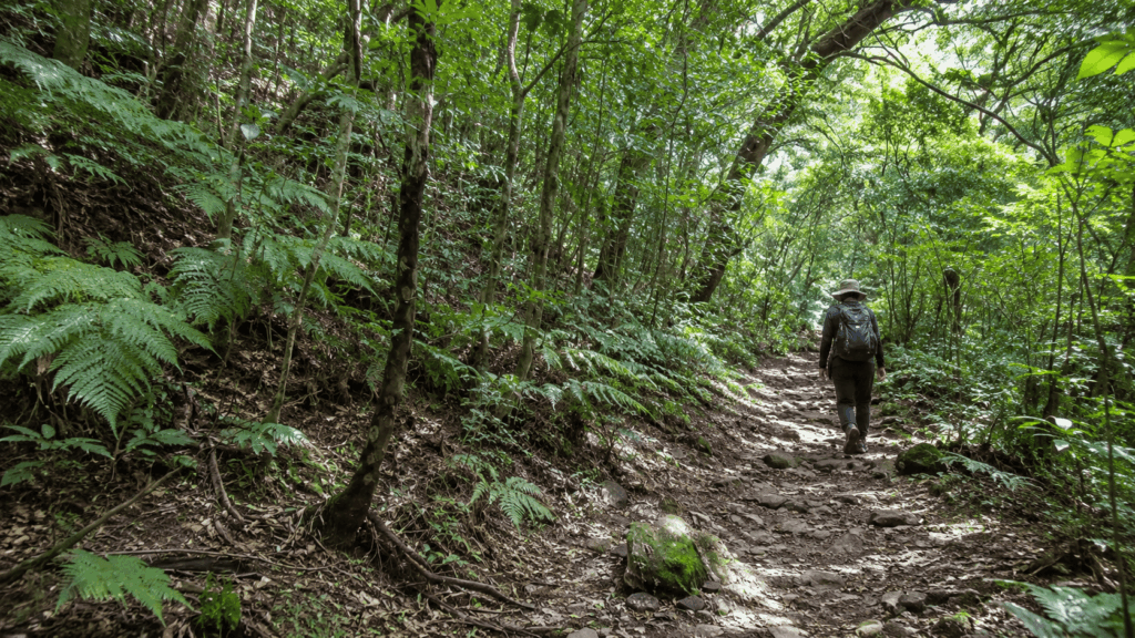
The trail is a former logging road about 2 m wide, which makes it easy to follow and gentler underfoot than Mount Katsuu. It is still a wet subtropical forest: the official description notes slippery sections, two places where a side trail can send you the wrong way, and habu vipers in dense vegetation off the path. What you get for the effort is not a panorama but the forest itself — tree lizards, giant taro, and the ferns and birds that make Yanbaru one of the most biodiverse corners of Japan.
Best for: travelers who care more about ecology than views, repeat visitors who have already done the coastal hikes, and anyone who wants a long, quiet walk in primary subtropical forest.
Skip it if: you want a summit and a view, you have half a day and want a big payoff, or you are uncomfortable on trails with unclear junctions. The village recommends a guide for this area, and for good reason — the forest looks the same in every direction once the light changes.
Where to go: the Mount Yonaha trail entrance in Kunigami Village, within Yanbaru National Park. Do not plan to continue past the ninth-station marker; the protected zone above it is not a route.
Which Okinawa Hike Should You Choose?
Four variables decide this faster than any ranking: how much walking you actually want, where you are sleeping, whether you have a car, and what you want to look at. Everything else is detail.
| Your priority | Best choice | Why | When to skip it |
|---|---|---|---|
| An easy walk with interpretation | ASMUI Spiritual Hikes | Managed paths, audio guide, shuttle, facilities | You want free, unmanaged nature |
| Sea views with minimal distance | Mount Katsuu | Summit views over Nago Bay in under an hour of climbing | Rock is wet, or anyone in the group has bad knees |
| A traditional mountain hike | Mount Ishikawa | Three graded courses, ropes and signage, real summit | You arrive after 14:00, or it is a Monday |
| A waterfall with adrenaline | Ta-taki Falls | River wading, rope sections, waterfall pool | No proper footwear, or unstable weather |
| Deep subtropical forest | Mount Yonaha | Yanbaru ecology, long quiet trail, no crowds | You want a view or a summit |
| No rental car | Guided Ta-taki tour, or ASMUI by bus | Transport is included or arranged; both remove the driving problem | You only have one day and want two stops |
Kai’s tip: The planning error I see most often is choosing three hikes instead of one. ASMUI alone takes two to two and a half hours on site before you count the drive, and Ta-taki is a half-day once you add changing, walking and the car park. If you have a single day in the north, pick one substantial stop and let the drive be part of the day rather than something to beat.
Two reminders that matter more than the table. First, “”easy”” and “”short”” are not synonyms — Mount Katsuu is the shortest climb here and among the most demanding underfoot. Second, the same hike has different value depending on where you sleep: a Nago or Onna base turns the northern trails into a normal morning, while a Naha base turns them into a full-day excursion.
Can You Go Hiking in Okinawa Without a Car?
It is possible, but the honest answer is that northern Okinawa is built around driving. The trails themselves are free and open; the problem is getting to the trailhead and back before dark.
If you are staying in Naha: ASMUI is roughly 2 to 2.5 hours by car from the Naha area. Public transport exists in the sense that the operator documents it — route 67 from Nago Bus Terminal toward Hentona, then a village reservation-only bus — but the connections are infrequent and the timing is unforgiving. Doing this by bus in one day is a logistical exercise, not a relaxed outing.
If you are staying in Nago or Onna: Ta-taki is about 25 minutes by car from Nago Bus Terminal, and Mount Katsuu is on Nago’s doorstep. This is the base that makes the northern hikes practical.
If you are staying in the central area: Mount Ishikawa in Uruma is the most accessible of the five without a long drive, though you still need to reach the youth house and sign in before 14:00. Confirm current bus routes and walking distances to the office before relying on them.
Kai’s tip: When people say a hike takes an hour, they usually mean the walking. From Naha, a 40-minute river walk at Ta-taki is realistically a five-to-seven-hour day once you include the drive each way, the car park, changing, and the time at the falls. The trail is the short part. If your itinerary has one free day, decide whether you want to spend most of it in the car — because that is the actual trade.
If you have no car and no appetite for bus connections, the practical answer is a tour with transport included rather than a DIY attempt. The trade-off is cost and a fixed schedule.
Trails to Avoid or Check Before Visiting
Okinawa’s most-photographed waterfall walk is currently unavailable, and several other routes have conditions attached. Checking this before you leave the hotel is the single highest-value five minutes of planning in this article.
- Hiji Falls — closed. The walkway, car park and campsite have been closed since severe rain damage in November 2024, and local reporting a year later described the area as still unrepaired with no reopening date. Guides and blog posts written before that date still describe it as open. Do not build a day around it.
- Mount Yonaha — partial. The ninth station is the end of the permitted route. The area above it is protected, and this is not a formality to work around.
- Mount Ishikawa — conditional. The youth house is closed on Mondays, reception closes at 14:00, and the facility suspends hiking after typhoons and during other closures. Check the current notice before driving out.
- Ta-taki Falls — weather-dependent. The car park closes when a thunderstorm or heavy-rain advisory is issued, or when the river is high. Status is posted each morning at 8:00.
What goes wrong most often is not poor fitness or bad luck with the weather. It is arriving at a place that a two-year-old blog post described as open. Facility pages and municipal notices are updated; search results are not.
Best Time to Hike in Okinawa and Essential Safety Tips
Okinawa can be walked year-round, but the seasons change what the same trail demands. November to March is cooler and drier, with comfortable walking temperatures and colder water at Ta-taki. May and June bring the rainy season. July to September is hot, humid and the core of typhoon season, when a perfectly clear morning can turn into a closed car park by afternoon.
Heat is the risk travelers underestimate most. Humidity makes a one-hour climb feel considerably longer, and shade in the forest does not mean cool. Carry more water than you think you need, start early, and treat midday as the part of the day to avoid rather than the part to plan around.
Surface conditions matter as much as weather. Limestone and rock trails here — Mount Katsuu especially — become genuinely slick after rain, and reef shoes or fashion sneakers offer almost no grip. At Ta-taki, the specific hazards are the riverbed, the rope sections and rapid rises in water level, all of which the operator documents directly.
Also worth knowing: habu vipers are present in dense vegetation, particularly off-trail in Yanbaru, so stay on the path and do not push into overgrowth for a photo. Insects are active in the wet months, mobile signal is weak in parts of the northern forest, and daylight is your real deadline — several of these routes have no lighting and no staff after hours.
Kai’s tip: The habit that saves the most wasted mornings is checking two things before leaving the hotel: the operator’s status page and the radar. Ta-taki posts its swimming and parking status at 8:00 each day, and the pattern in summer is often clear morning, stormy afternoon. Walking at 9:00 and driving back by 14:00 solves more problems than any piece of gear.
What this article will not tell you is that any season is “”safe.”” A dry, cool day on Mount Ishikawa and a typhoon-eve afternoon at Ta-taki are not comparable experiences, and no single rule covers both.
What About Hiking on Iriomote and Ishigaki Islands?
Searches for hiking in Okinawa often surface Iriomote and Ishigaki, and the scenery in those results is genuinely more dramatic. What the results rarely make clear is that these are not day trips from the main island. They require a flight to Ishigaki and, for Iriomote, a ferry — a separate trip with its own booking and its own rules.
Iriomote Island has the deepest jungle experience in the prefecture, and since March 2025 it has also had the most formal entry system. Five designated areas, including the Hinai River route to Pinaisara Falls, require prior approval from the Taketomi town mayor, applied for up to six months in advance, with a handling fee of ¥500 per person. For Pinaisara, a registered guide must accompany the group, and daily numbers are capped at 200. Other designated areas have different conditions, so the permit is not a single blanket permission.
Ishigaki Island has its own mountain, Mount Omoto, which is the highest peak in Okinawa Prefecture. Trail access, current conditions and realistic timings should be confirmed locally before planning around it — we have not verified them to the standard we would want for a route recommendation, and we would rather say so than guess.
The practical distinction: on the main island you can decide the night before and drive out. On the outer islands you are booking transport, permits and often a guide, which changes the planning horizon from days to weeks.
Should You Hike Independently or Book a Guided Tour?
For four of the five hikes here, independent is the sensible default. ASMUI, Mount Katsuu, Mount Ishikawa and Mount Yonaha are marked, signposted routes where a guide adds interpretation but not access. Ta-taki is the exception, and not because the route is secret — because the route is wet, the gear matters, and conditions change during the day.
| Decision factor | Independent visit | Guided tour |
|---|---|---|
| Transport | You drive; about 25 min from Nago to the Ta-taki car park | Some tours include transport; others meet at the car park |
| Safety equipment | Rent felt shoes, life jacket and helmet on site, or bring your own | Gear is typically included in the tour price |
| Route knowledge | Route is unmarked in places; you follow the river and previous footprints | A local guide reads the water and chooses the line |
| Language support | Official signage and rental staff; English support varies | Depends on the operator — confirm the guide’s language before booking |
| Weather decisions | Entirely yours; the car park closes when conditions deteriorate | The operator makes the call and may cancel |
| Approximate cost | ¥500–1,000 parking plus optional rentals | Published rates have started around ¥7,800 for one person, with lower per-person prices for groups; transport-inclusive day tours run considerably higher |
| Flexibility | Total — start when you like, leave when you like | Fixed start times and a schedule set by the operator |
| Who should choose it | Confident walkers with their own footwear, a car and a stable forecast | First-time river trekkers, travelers without gear, groups with children, and anyone without a car |
A tour does not remove risk, and no operator can promise a safe river. What a guide changes is the decision-making: whether the water is too high, which line to take at the rope section, and when to turn around. If you are weighing the cost, compare it against what you would otherwise spend on gear rental, a rental car day and the risk of arriving to find the car park closed.
If you are booking, check what the price actually covers — gear, insurance, photos, transport, lunch — and read the cancellation terms before you pay. Some listings apply strict charges from the day before, which matters in typhoon season when plans genuinely do change.
For travelers who want the Ta-taki river experience but would rather not organize a rental car, equipment and route decisions independently, this guided option is worth comparing with a DIY visit.
Why I’d book this one
- Transport handled: The listing includes round-trip hotel transfers from Naha, removing the need to arrange a rental car for the trip north.
- Equipment included: A guide, life jacket, marine shoes and gloves are listed as part of the experience, reducing the gear you need to organize independently.
- Traveler feedback: A recent traveler highlighted the pickup arrangements and the guide’s cultural explanations, although the review sample is still small.
See live availability, pickup details, cancellation terms and recent traveler reviews for the guided Ta-taki waterfall trek. Check the exact itinerary and inclusions for your date before deciding whether the extra cost is worthwhile.
Frequently Asked Questions
Are there easy hikes in Okinawa?
Yes, but “”easy”” needs a definition. ASMUI Spiritual Hikes is the most manageable option for most travelers: managed paths, an audio guide, a shuttle and staff on site, with a 30-minute Short Course for anyone who wants to keep it brief. It is still a limestone landscape with stairs and steeper sections, and it costs ¥2,500 for adults. If you want free and flat, Okinawa does not really offer that combination in the north — the gentlest free option, Mount Yonaha’s lower trail, is 3 to 4 hours round trip.
Can you hike in Okinawa without a car?
Partly. Mount Ishikawa in Uruma is the most realistic without a car, since it sits in the central part of the island, though you still need to reach the youth house and sign in before 14:00. The northern trails are a different problem: ASMUI can be reached by route 67 from Nago Bus Terminal plus a village reservation bus, but connections are infrequent, and Ta-taki has no practical public transport option. For most travelers without a car, a tour with transport included is the workable answer rather than a bus itinerary.
What is the best waterfall hike in Okinawa?
Ta-taki Falls in Ogimi Village is the waterfall experience currently available on the main island, but call it what it is: a river trek, not a forest walk. You wade knee-deep for about 40 minutes each way, use ropes at rock sections, and should wear felt-soled shoes rather than sandals. Hiji Falls, which most older guides recommend, has been closed since rain damage in November 2024 and has no announced reopening date. Plan for Ta-taki and check its status on the morning of your visit.
Do you need a guide to hike in Okinawa?
On the main island, no — ASMUI, Mount Katsuu, Mount Ishikawa and Mount Yonaha are all walkable independently, with the last two requiring sign-in or awareness of the protected zone. The calculus changes at Ta-taki, where a guide is worth considering if you lack gear, have not walked a river before, or are travelling with children. On Iriomote, it is not optional: the Pinaisara route requires a registered guide and prior approval, with a daily cap of 200 people.
Is it safe to hike in Okinawa in summer?
It can be, with the right timing. The real hazards in summer are heat and humidity rather than technical terrain, so start early and carry more water than feels necessary. Afternoon storms are common, and at Ta-taki a thunderstorm advisory closes the car park. Check the forecast and the operator’s status page before setting out, and treat midday as the time to be driving or resting rather than climbing. No season here is uniformly safe or uniformly difficult.
Is Hiji Falls open again?
No. As of November 2026, the walkway, car park and campsite remain closed following severe rain damage in November 2024, with no reopening date announced. Many blog posts and tour listings still describe it as an active hike because they predate the closure. If Hiji Falls was the reason for your trip north, Ta-taki Falls is the closest alternative experience, and it is a very different one.
Final Verdict: Which Okinawa Hike Is Right for You?
If this is your first trip to Okinawa: choose Mount Katsuu. It gives you the image most people come for — a summit above the East China Sea — in under an hour of climbing, with no booking, no fee and no reception desk. Wear proper shoes and go in the morning.
If you are travelling with family or a mixed-ability group: choose ASMUI Spiritual Hikes. The shuttle, the audio guide, the Short Course and the lounge make it the only option here where a low-energy member of the group can sit out comfortably while others keep walking. Budget the full 90 to 150 minutes rather than the walking time.
If you want the waterfall: choose Ta-taki Falls, but decide first whether you are walking it independently or booking a guide. Independent works if you have a car, proper footwear and a stable forecast. If any of those is missing, the guided version solves all three, and the published rates start around ¥7,800 for a solo traveller and drop per person in groups.
If you have one free day and are based in Naha: do not attempt two northern hikes. Pick Ta-taki or ASMUI, accept that the drive is most of the day, and leave Mount Katsuu for a Nago or Onna morning if your route passes through.
If you have no rental car: Mount Ishikawa is your best independent option, and a transport-included Ta-taki tour is your best waterfall option. Attempting ASMUI by bus is possible on paper and frustrating in practice.
If you have hiked Okinawa before and want something quieter: choose Mount Yonaha. It is the least spectacular on paper and the most memorable in the forest, provided you accept that the ninth station is the end of the route and that a guide is recommended by the village for good reason.
If you are chasing the deepest jungle in Japan: this article is the wrong starting point. Iriomote is a separate trip with permits, a registered guide and a daily cap, and it should be planned weeks out rather than the night before.
The common thread across all five is that none of them rewards improvisation. The closures, the reception hours, the Monday closure at Ishikawa, the car park that fills on a July weekend — these are the details that decide whether a hiking day works. The trails themselves are short. The planning is the hike.

Hi, I’m Kai. I’m a Tokyo-based travel writer, tourism industry insider, and the author of a published guidebook for international visitors to Japan. With over 10 years of professional experience at a leading Japanese tourism company, my mission is to help you skip the tourist traps and navigate Japan’s best destinations like a local. I believe the perfect day trip is like a traditional kaiseki meal: a beautiful balance of precise planning and unforgettable seasonal discovery. When I’m not out conducting field research, you’ll usually find me drafting new itineraries with one of my favorite fountain pens!