
Tokyo is ringed by mountains, and a handful of them make realistic day hikes for people who do not hike at home. If you have one free day and want the simplest possible introduction, choose Mt. Takao’s Trail 1 and take the cable car partway up. The trail is paved, signposted in English, and reached by a direct train from Shinjuku.
But easy does not mean flat. Trail 1 still includes a fork where you either climb a 108-step stone staircase or take a gentler slope beside it, and a long run of steps above Yakuoin Temple. The cable car also stops well below the summit, so the last stretch is on foot whatever you do.
The five routes below are the ones that stay within reach of a beginner: two on Mt. Takao, one on Mt. Mitake, one in Kamakura, and one short summit in Saitama. Here is the short version before the detail:
- Best first hike: Mt. Takao, Trail 1 — paved, signposted, easy to shorten with the cable car
- Best forest trail: Mt. Takao, Trail 6 — stream, stepping stones, real dirt underfoot
- Best stream scenery: Mt. Mitake, Rock Garden — the most immersive of the five, and the longest day
- Best hiking plus sightseeing: Kamakura, Kuzuharaoka–Daibutsu Trail — a ridge walk between temples
- Best short summit: Mt. Hiwada — about an hour up from the station, with a rocky option
This guide is not for everyone. If you need ground that is completely level, struggle with stairs, or want a paved promenade rather than a mountain path, none of these five will suit you, and a riverside walk, a garden, or a coastal route like the Jogasaki Coast trail would be a better use of your day. Every route here involves climbing.
If you would rather have the temple explanations, lunch and a hot spring arranged for you, there is also a small-group guided version of the Mt. Takao day; it is graded moderate rather than easy, so read the walking requirements before you decide.
Prefer a planned Mt. Takao day? If you’re comfortable with moderate walking and want an English-speaking guide, local lunch and a hot spring included in your day, the small-group tour is worth comparing with a DIY visit.
See the Mt. Takao guided tour itinerary, walking requirements, and available dates.
Which Easy Hike Near Tokyo Should You Choose?
Start with what you actually want from the day. The five routes differ less in physical difficulty than in what kind of day they produce: a temple-lined mountain, a stream in the forest, a ridge between shrines, or a short climb to a view.
Easy Hikes Near Tokyo at a Glance
| Hike / route | Best for | Walking time | Terrain | Closest station | Main drawback |
|---|---|---|---|---|---|
| Mt. Takao — Trail 1 | First-time hikers; mixed fitness levels | 100 min up / 80 min down from the base | Paved concrete and wide; 108-step staircase or gentler slope; many stairs above Yakuoin | Takaosanguchi (Keio Line) | Busy; the pavement feels more like a road than a trail |
| Mt. Takao — Trail 6 | Repeat visitors and nature lovers | 100 min up / 80 min down from the base | Dirt and rock, stream crossings, narrow sections, wooden stairs near the top | Takaosanguchi (Keio Line) | Muddy after rain; uphill-only during autumn crowd restrictions |
| Mt. Mitake — Rock Garden loop | Forest and stream scenery | 2 h 30 min loop from the visitor centre | Forest path with roots, rocks and steps; steep ground near Nanayo Falls | Mitakesan (cable car), via JR Mitake and a bus | Longest journey; not a flat walk despite the cable car |
| Kamakura — Kuzuharaoka–Daibutsu Trail | Hiking combined with temples | About 1.5 h of walking (official course time); allow 2.5–3 h with temple and shrine visits | Unpaved ridge path, exposed roots, uneven slopes and steps; slippery after rain | Kita-Kamakura (JR), finishing at Hase | No summit; temple stops easily double your planned time |
| Mt. Hiwada — Onnazaka route | A short climb to a summit | About 1 h up from the station; 2–2.5 h round trip | Gentle slope on Onnazaka; rock scramble if you take Otokozaka | Koma (Seibu Railway) | Few facilities; the more interesting route is the harder one |
Read the walking-time column carefully. The Mt. Takao figures are for the full trail from the base station; if you ride the cable car, the climb from the upper station to the summit takes roughly 50 minutes instead. None of these times include train travel, cable-car queues, lunch, or time spent at temples.
Best Hikes by Travel Style
First-time visitors. Trail 1 with the cable car. You get the temple, the summit view and a proper mountain atmosphere without committing to a full climb, and you can turn back at Yakuoin Temple if the stairs above it look like too much.
Nature lovers. Trail 6 if you want the water and the forest on the same mountain, or Mt. Mitake if you are willing to spend an extra hour each way travelling for a quieter, wetter, greener valley.
Hiking and temples together. Kamakura. It is a ridge path rather than a summit, and the walking is broken up by shrines, which suits people who find a straight climb tedious.
Short summit adventure. Mt. Hiwada. Under an hour of climbing from the station, a real (if low) summit, and a rocky route for anyone who wants to use their hands.
Groups with mixed fitness. Trail 1, because the cable car, the temple and the summit each work as a natural stopping point for whoever is slowest that day.
When I take first-time visitors to Mt. Takao, I usually start them on Trail 1 and use the cable car for the middle section. That is a decision about reducing fatigue and keeping the day predictable, not a claim that Trail 1 is the best trail on the mountain — it is simply the one with the fewest ways to go wrong.
What Does “Easy” Actually Mean?
“Easy” in hiking descriptions usually hides four separate questions. Ask all four before you commit:
- Easy to reach: can you get there by train without a car, and how much of the day does the journey eat?
- Easy underfoot: is it paved, or dirt, roots and rock? Are there stairs, and how many?
- Easy to shorten: is there a cable car, a bus, or a mid-point where you can turn around without missing the point?
- Easy to plan: are there toilets, food, clear signs, and a straightforward way back before dark?
Mt. Takao scores well on three of the four and poorly on crowds. Mt. Mitake scores well on scenery and badly on the length of the day. Kamakura is manageable for many beginners but includes uneven ground, and it is easy to over-schedule. Mt. Hiwada is short but has the fewest facilities.
One detail worth knowing before you compare any of them: the Mt. Takao visitor centre states plainly that there is no hiking course on the mountain without stairs. Stairs are how the trails protect the ground from two and a half million pairs of feet a year. If a description tells you a Japanese mountain trail is easy, it is telling you the gradient is manageable — not that the steps have disappeared.
Mt. Takao Trail 1 — Best for First-Time Hikers
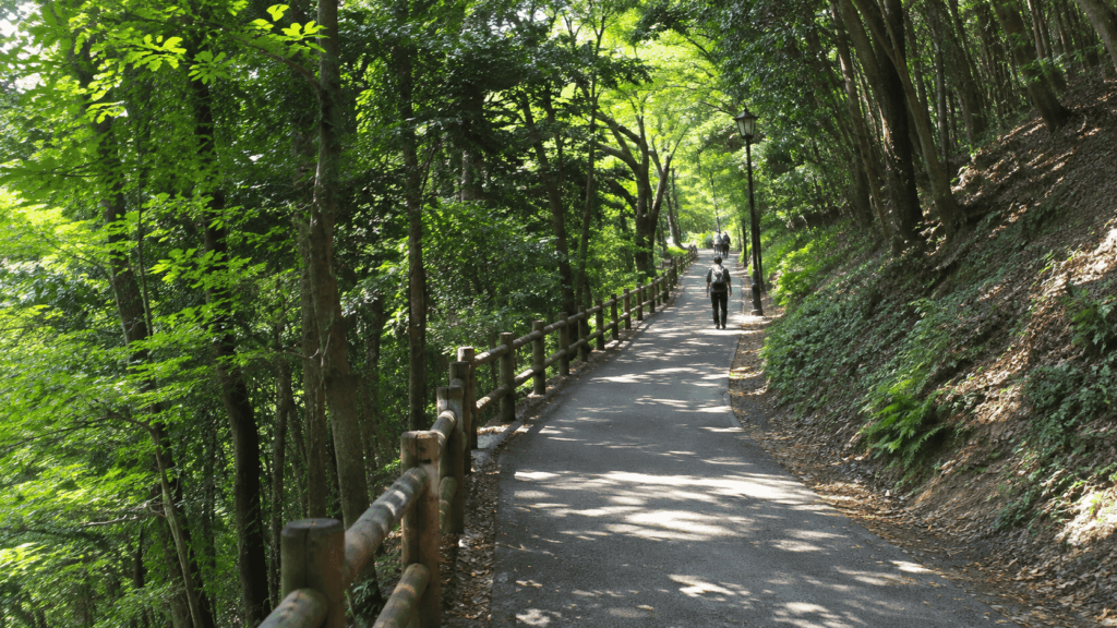
Trail 1 is the main route up Mt. Takao and the approach to Yakuoin Temple. It runs 3.8 km from the base to the 599 m summit, climbing in about 100 minutes and descending in about 80, and it is paved with concrete from bottom to top. It is the only one of the five routes here where the surface is never the obstacle; the difficulty is entirely in the gradient and the steps.
How to Get to the Trailhead
Take the Keio Line from Shinjuku to Takaosanguchi Station: about 50–57 minutes, around ¥430 with an IC card. Some trains run direct; others require a change at Kitano, where the connection is usually across the same platform.
Three station names on this mountain sound almost identical, and mixing them up is the most common transport mistake visitors make:
- Takao Station — JR Chuo Line, one stop away, not where you start
- Takaosanguchi Station — Keio Line, at the foot of the mountain, where the hike begins
- Takaosan Station — the cable car’s upper station, partway up the mountain
From Takaosanguchi, walk about five minutes to the cable car’s lower station, Kiyotaki. Trail 1 also starts near here if you intend to walk the whole way.
Is Trail 1 Actually Easy?
Easy for a mountain, yes. Easy in the sense of level, no. Three things surprise people who booked the day expecting a gentle stroll:
The staircase at the fork. Past Jōshin-mon gate, Trail 1 splits. The left branch, Otokozaka, is 108 stone steps straight up. The right branch, Onnazaka, is a gentler slope that takes slightly longer. The number 108 matches the Buddhist count of earthly desires, which is a nicer thought on the way down than on the way up. Take Onnazaka if you are unsure; almost everyone does on the descent.
The steps above Yakuoin Temple. The paved surface continues, but from the temple upward the route is largely stairs, and this is the section people underestimate. It is short, but it is steep and it comes after you have already been walking for an hour.
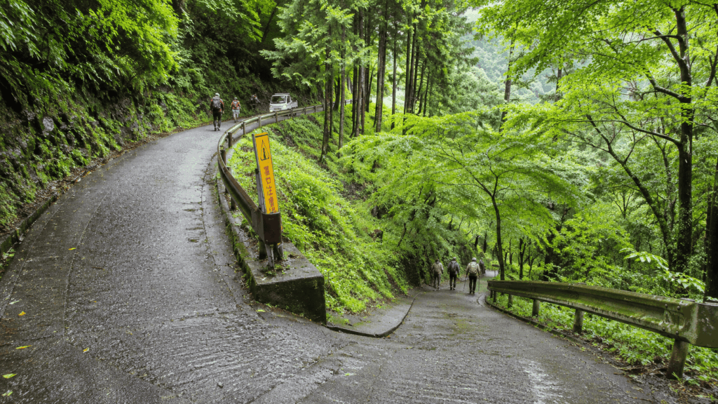
The weather. The visitor centre notes that the slope below the ropeway line gets slippery in rain, and parts of the route are wooden boardwalk rather than concrete.
A pair of comfortable trainers with tread is enough for Trail 1 in dry weather. Smooth-soled fashion sneakers are not, particularly on the descent.
Cable Car or Walk All the Way?
The cable car runs from Kiyotaki to Takaosan Station in about six minutes, costs around ¥490 one way or ¥980 return, and departs roughly every 15 minutes. It removes the steepest, least interesting part of the climb and leaves you with the temple and summit section.
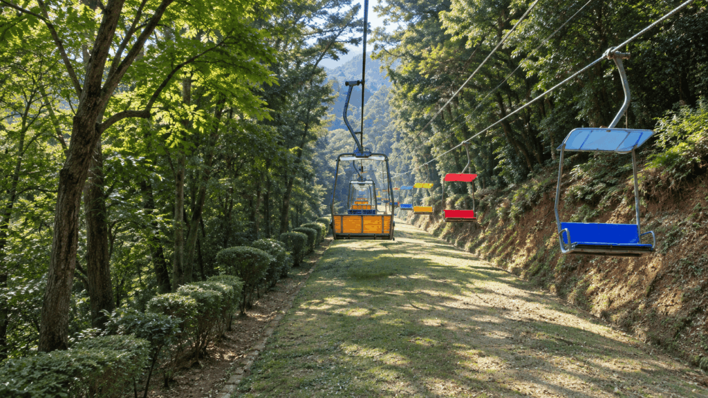
What it does not do is reach the summit. From Takaosan Station you still have around 50 minutes of walking on Trail 1, including the staircase fork and the steps above the temple. Budget the cable car as a shortcut through the middle of the mountain, not as a lift to the top.
Kai’s tip: The first cable car leaves at 8:00, so “start early” on Mt. Takao means being at Takaosanguchi around 7:50, not arriving at dawn. I plan around that first departure rather than around sunrise, because the queue for the cable car builds quickly on weekends and a full car can mean waiting for the next one. If you want the mountain before the crowds and you are not using the cable car, walking from the base at 7:30 is the better trade.
Mt. Takao Trail 6 — Best for a More Natural Hike
Trail 6 is the route to take if Trail 1 sounds like a road. It follows a stream past Biwa Waterfall, crosses it on stepping stones, and climbs through dirt and rock to the summit: 3.3 km, about 100 minutes up and 80 down, the same effort as Trail 1 but a completely different day.
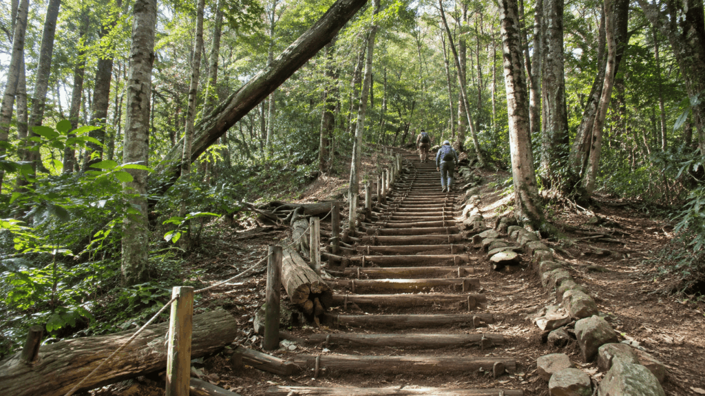
It is not, however, the beginner-friendly version of Trail 1. The visitor centre warns about the stepping-stone section and about narrow stretches where two people cannot easily pass. Near the top there is a long wooden staircase that is the single hardest few minutes on either trail.
Trail 1 vs Trail 6
| Trail 1 | Trail 6 | |
|---|---|---|
| Surface | Concrete pavement the whole way | Dirt, rock, roots and boardwalk |
| Stairs | 108-step option at the fork; many steps above Yakuoin | Uneven rock steps; long wooden staircase near the summit |
| Stream crossings | None | Stepping stones and narrow sections beside the water |
| Shoes | Trainers with tread are fine in dry weather | Grippy shoes or light hiking shoes; smooth soles are a bad idea |
| Cable car shortcut | Yes — removes the middle of the climb | No. The cable car drops you onto Trail 1, not Trail 6 |
| After rain | Slick below the ropeway line, but walkable | Muddy and genuinely slippery; the worst conditions of the two |
| Crowds | Heavy, especially near the temple | Lighter, but bottlenecks at the narrow sections |
| Best for | First visits, mixed fitness, uncertain weather | Repeat visitors, photographers, anyone who wants water and forest |
When to Avoid Trail 6
Three situations argue for Trail 1 instead:
- The day after rain. The stream section and the wooden stairs hold water. This is not a theoretical warning; it is the difference between a pleasant climb and a slow, careful one.
- Autumn crowd restrictions. As of November 2026, the section between Biwa Waterfall and the junction with Trail 5 is uphill only, all day, from 31 October to 6 December. The stretch from Kiyotaki up to the waterfall remains two-way, but you cannot descend the upper part of Trail 6 during this period, so plan to come down Trail 1. Check the Mt. Takao visitor centre for the current dates before you travel, as these restrictions change every year.
- Anyone in your group is unsure on uneven ground. Trail 6 rewards confidence; it punishes hesitation on wet rock.
Kai’s tip: The mistake I see is treating Trail 6 as the “nicer” version of Trail 1 without checking the ground first. After a wet day the stream path turns into a mud-and-root obstacle course, and the wooden staircase near the top is where people stop talking and start counting steps. I still choose Trail 6 when I want the water and the quiet, but I choose it on a dry day, and I always plan the descent on Trail 1.
Mt. Mitake Rock Garden — Best for Forest and Stream Scenery
If the photos you want are moss, boulders and moving water, Mt. Mitake is the strongest of the five. The Rock Garden loop follows about 1.5 km of stream through a field of huge stones, with a rest area and toilets partway round. The visitor centre rates it two stars out of three and gives 2 hours 30 minutes of walking from the visitor centre — not from the station.
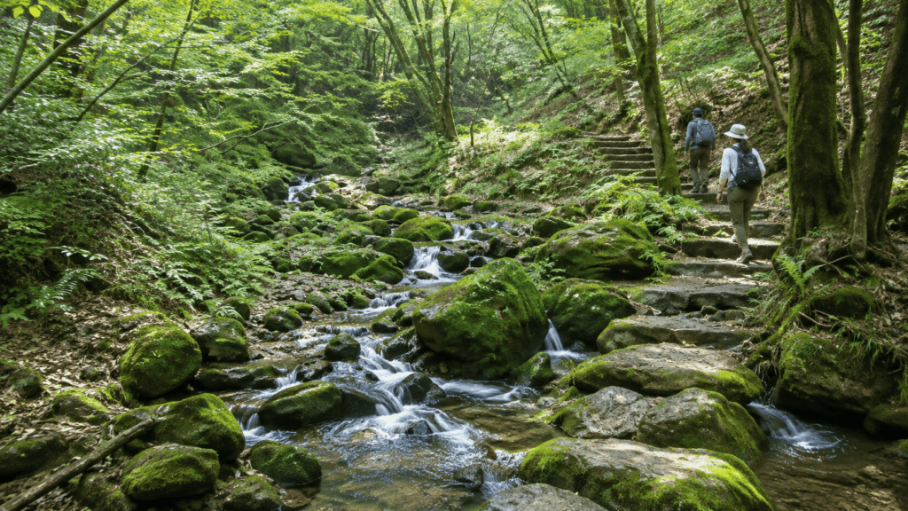
That distinction matters. Mt. Mitake is the longest day here, and the cable car does not put you at the start of the hike.
Getting to Mt. Mitake by Train and Cable Car
From Shinjuku, take the JR Chuo and Ome lines to JR Mitake Station — about 1 hour 20 to 30 minutes. From the station, a bus runs to the cable car base in roughly 10 minutes, and the cable car covers the steep section to Mitakesan Station in about six minutes. Fares were revised in October 2026 to around ¥700 one way, so check the current price rather than relying on older guides.
From Mitakesan Station it is a short walk to the visitor centre, where the Rock Garden loop begins. The cable car also undergoes periodic maintenance shutdowns, so confirm operating dates for your travel day.
Rock Garden vs a Short Shrine Walk
These are two different outings that get sold under one mountain name.
The Rock Garden loop is the stream walk: rocks, roots, wet ground, 2 hours 30 minutes of walking, with the option to add Nanayo Falls. The falls come with a steep slope and an iron staircase, and the visitor centre suggests that people with low fitness or small children skip them and reach the garden via Nagao-daira instead. (If you want a more demanding waterfall hike in the same region, see our guide to the Mt. Kawanori hike.)
The shrine walk is the paved route from the cable car station up to Musashi Mitake Shrine: about 35 minutes each way, with more than 300 stone steps near the top. It is a pilgrimage, not a hike, and it is the easier half-day if you are short on time or energy.
Do not treat them as the same difficulty. One is a forest trail with wet rock; the other is a steep paved approach with a lot of steps.
Who Should Skip the Rock Garden?
Skip it if anyone in your group has knee trouble, dislikes uneven ground, or expects a cable car to remove the climbing. Skip it too if you have a fixed afternoon plan in Tokyo — the journey, the loop and the return easily fill six to seven hours. Choose the shrine walk, or choose Mt. Takao, and enjoy the day instead of rushing it.
Kamakura Kuzuharaoka–Daibutsu Trail — Best for Hiking and Sightseeing
Kamakura’s trail is the odd one out: no summit, no mountain to speak of, and yet one of the most satisfying days on this list. It runs about 3 km along a forested ridge from Kita-Kamakura to the Great Buddha at Hase, linking Jochiji Temple, Kuzuharaoka Shrine, Zeniarai Benten and Sasuke Inari along the way. If you enjoy combining forest trails with temples, the Kurama to Kibune hike in Kyoto offers a very similar experience.
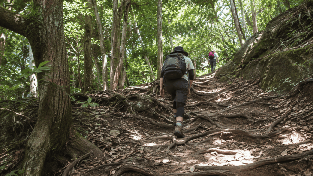
It is a real path, not a city walk. The surface is unpaved, and the official guidance warns that it becomes muddy and especially slippery after rain. Some stretches have exposed roots and steeper rises and descents, so take the natural trail seriously even if the overall distance is short.
Suggested Walking Direction
Walk it from Kita-Kamakura to Hase. That direction puts the climbing at the beginning while you are fresh, ends at the Great Buddha, and finishes a short walk from Hase Station on the Enoden line. Doing it in reverse works, but you finish at a smaller station with less choice of trains.
The order of stops is straightforward: Jochiji, then the ridge to Kuzuharaoka Shrine, down to Zeniarai Benten, a short detour to Sasuke Inari, then on to Kotoku-in and the Great Buddha.
How Much Time Do You Need?
Kamakura’s official tourism association lists about 1 hour 30 minutes for the roughly 3 km route. Allow 2 hours 30 minutes to 3 hours if you plan to visit the shrines and temples along the way; those stops, rather than the trail distance, are why the outing takes longer.
Plan on three hours if you want to wash coins at Zeniarai Benten and walk through the Great Buddha’s grounds, and four if you also want lunch. Travellers consistently underestimate this section and end up skipping the temples to catch a train, which defeats the purpose of choosing Kamakura over a mountain.
Mt. Hiwada via Onnazaka — Best for a Short Summit Hike
Mt. Hiwada is 305 m, in Saitama, and it is the shortest commitment on this list: about an hour of walking from Koma Station to the summit, and two to two and a half hours for the round trip with breaks. On a clear day the top looks out over the Kanto plain, and the summit has the unmistakable satisfaction of being an actual peak rather than a viewpoint.
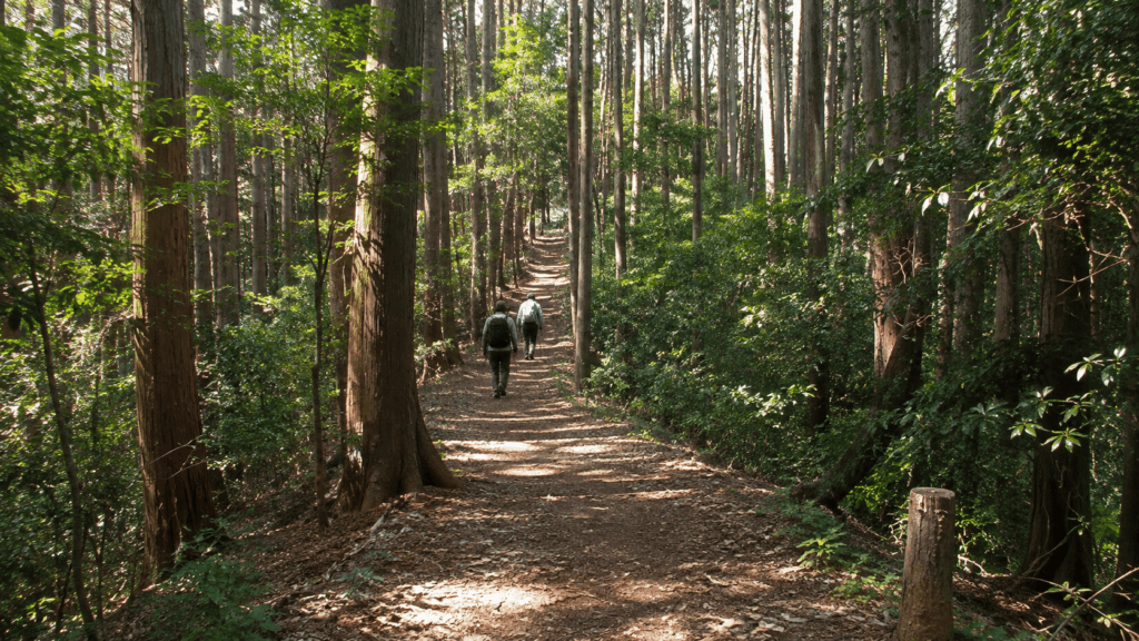
It is also the least equipped. No cable car, no temple complex, limited food, and a trailhead 25 minutes’ walk from the station.
Onnazaka vs Otokozaka
At the first torii, the path splits, and this is where people choose badly.
- Otokozaka reaches the second torii in about 15 minutes through a rocky section where you may need your hands. It is shorter and more interesting, and it is not the beginner route.
- Onnazaka takes about 20 minutes on a gentle slope. Hidaka City recommends it for beginners and, specifically, for the descent.
From the second torii it is roughly another 10 minutes to the summit. Note that the 20-minute figure applies to the Onnazaka section alone — it is not the length of the hike. Station to summit is about an hour, and the city also asks visitors not to climb the rock faces, where fatal accidents have occurred.
Is Mt. Hiwada Worth the Trip?
Yes, if what you want is a short climb to a summit without the crowds, the shops and the cable car. No, if you want facilities, food options, a temple, or a route you can shorten when you get tired — Mt. Takao does all of that better and is barely further from central Tokyo.
It is also the least forgiving of the five in bad weather: the rocky section is exposed, and there is nowhere sheltered to wait out a shower.
How to Get to These Hikes from Tokyo Without a Car
All five are reachable by train, but “reachable” covers a wide range. The table gives the realistic picture from Shinjuku, including the last mile, which is where most itineraries quietly fall apart. Both Mt. Takao trails use the same station and the same cable car.
Train Access Compared
| Hike | Train time from Shinjuku | Arrival station | Last-mile access | Extra time to add |
|---|---|---|---|---|
| Mt. Takao (Trail 1 or 6) | 50–57 min (Keio Line) | Takaosanguchi | 5 min walk to the cable car; trail starts nearby | Cable car queue, 10–30 min in busy periods |
| Mt. Mitake | 1 h 20–30 min (JR) | JR Mitake, then bus and cable car | Bus about 10 min, then cable car about 6 min, then walk to the visitor centre | Bus and cable car waits; 30–45 min in total |
| Kamakura | About 55 min (JR Shonan–Shinjuku Line) | Kita-Kamakura (finish at Hase) | Trailhead a few minutes from the station | Temple entry and stops; 1–1.5 h |
| Mt. Hiwada | 1 h 10–25 min (Seibu, 1–2 changes) | Koma | 25 min walk to the trailhead | Nothing else; there is no shuttle |
How to Budget Enough Time
Add up four separate numbers instead of guessing one:
- Train and local transport — including the bus and cable car at Mitake, and the walk from the station at Hiwada.
- Actual walking time — use the figures in the first table, and adjust for the section you are actually walking.
- Breaks and sightseeing — lunch, the temple, the shrine, the photographs. This is the number people leave out.
- The return journey — plus the walk back to the station, which is uphill at Hiwada.
A comfortable Mt. Takao day using the cable car is five to six hours door to door. Kamakura with temples is similar. Mitake is the longest at seven or more. If your total exceeds the daylight you have, cut a section rather than walking faster.
What to Wear and When to Go Hiking Near Tokyo
The right kit depends entirely on which route you picked, so treat packing as a decision rather than a checklist.
- Shoes with tread — non-negotiable on Trail 6, the Rock Garden and Kamakura after rain
- Water — there are vending machines on Mt. Takao, but not on the Mitake stream path or at Hiwada
- A light layer and a rain shell — the mountains here are low but wet
- An offline map on your phone, plus a charged battery
- Some cash, for buses, lockers and small shops
- A small light — the visitor centre notes that the mountain has no lighting
Can You Hike in Sneakers?
Conditionally:
- Trail 1: yes, in dry weather, if they have tread. Avoid smooth-soled fashion trainers.
- Trail 6: only if they grip. Wet roots and stepping stones punish flat soles.
- Rock Garden: grippy shoes preferred; the stone steps are often damp.
- Kamakura: trainers are fine in dry weather; the path gets slick after rain.
- Hiwada: fine on Onnazaka; Otokozaka involves using your hands on rock.
Best Seasons for Easy Hikes Near Tokyo
Spring and autumn are the most comfortable, and also the busiest. Autumn foliage on Mt. Takao draws crowds that change the character of Trail 1 entirely, and late November weekends are the peak.
Summer is hot and humid rather than dangerous, but the climb feels harder than the distance suggests, and hornets are active on forest trails from summer into autumn. Winter is quiet and clear, with the best chance of seeing Mt. Fuji from the summit, but daylight ends around 16:30 in December and the trails are unlit — start earlier than feels necessary.
Avoiding Crowds and Slippery Trails
Weekdays are dramatically quieter than weekends. After rain, switch to Trail 1 or Kamakura rather than cancelling: both handle wet ground far better than the stream path or the Hiwada rock section.
Kai’s tip: On Mt. Takao the crowd pattern is lopsided — most people climb in the morning and come down between early and mid-afternoon, so the descent is where you meet the queue, not the ascent. If I am on the mountain on a busy weekend, I aim to be heading down before noon rather than trying to beat everyone up. A weekday start before 9:00 is still the single easiest improvement you can make to the day.
Make Your Mt. Takao Hike a Full Day: Food, Views and Onsen
Mt. Takao’s real advantage over the other four is what happens around the walk. You can eat something specific, soak in a hot spring and be back in Shinjuku for dinner, which is hard to arrange anywhere else on this list.
Tengu-yaki and Tororo Soba
Tengu-yaki, a small bean-paste cake stamped with a tengu face, is sold at Takao Sumika — and Sumika sits directly in front of the cable car’s upper station, not at the summit. This is the single most common location mix-up on the mountain: people reach the top, look for the famous snack, and find only the summit restaurants.
Tororo soba, cold noodles with grated mountain yam, is the other local staple and is served in several places along Trail 1 and at the summit. The soba counter at Sumika generally operates from mid-morning to late afternoon, but hours shift with the season, so check on the day rather than planning around a fixed time.
Relaxing at Keio Takaosan Onsen
Keio Takaosan Onsen / Gokurakuyu is next to Takaosanguchi Station, which makes it the ideal last stop: soak, then walk to the platform. It is open from around 8:00 to 22:30, with last entry about 45 minutes before closing, and admission is roughly ¥1,100 on weekdays and ¥1,300 at weekends and peak periods.
One rule needs stating plainly, because it catches visitors out at the door: tattoos are not permitted, including small tattoos, fashion tattoos and sticker tattoos. If that affects you, plan around it before you buy a ticket — there are tattoo-friendly alternatives elsewhere in the region, and the guided tour mentioned below uses a different facility entirely.
Lockers and the Seasonal Beer Garden
Coin lockers at Takaosanguchi Station let you walk without a bag, which makes the onsen stop much easier at the end of the day. They fill on busy weekends, so arrive early if you are carrying luggage.
TAKAO BEER MOUNT, the beer garden near the cable car’s upper station, is seasonal rather than year-round — in 2026 it ran from late May to late November, opening at midday. It is a genuinely good finish to a warm-weather hike, but check the current season’s dates and booking rules, as group minimums apply and the schedule changes each year.
Should You Hike Independently or Join a Guided Tour?
For Mt. Takao in particular, doing it yourself is entirely realistic. The trail is signposted in English, the train is direct, and the cable car removes the navigation problem. A guide adds value in specific situations, not as a default.
The practical comparison for a Mt. Takao day:
- Independent: roughly ¥430 each way on the Keio Line plus about ¥980 return on the cable car, full control of pace, and the freedom to abandon the summit and eat lunch instead.
- Guided: around $120 for an eight-hour small-group day with an English-speaking guide, lunch, a temple visit and a hot spring, meeting at Takaosanguchi and finishing at Hachioji. Cable car or chairlift fare of about ¥500 is paid separately.
When DIY Is the Better Choice
Choose independent travel if you want to walk at your own speed, stop for photographs, or change plan mid-mountain. Trail 1 makes this easy: there are signs, toilets, food and a cable car at both ends, and the route back to Tokyo is a single train. If your main worry is navigation, a downloaded map solves it for free.
When a Guided Tour Is Worth Considering
A guide earns the money when you want the temple explained rather than just visited, when you would rather not assemble the day yourself, and when lunch and a hot spring are part of the point. The reviews for the Mt. Takao tour consistently praise the guides’ knowledge and their pacing, and several travellers mention that the guide adjusted speed for the slower members of the group.
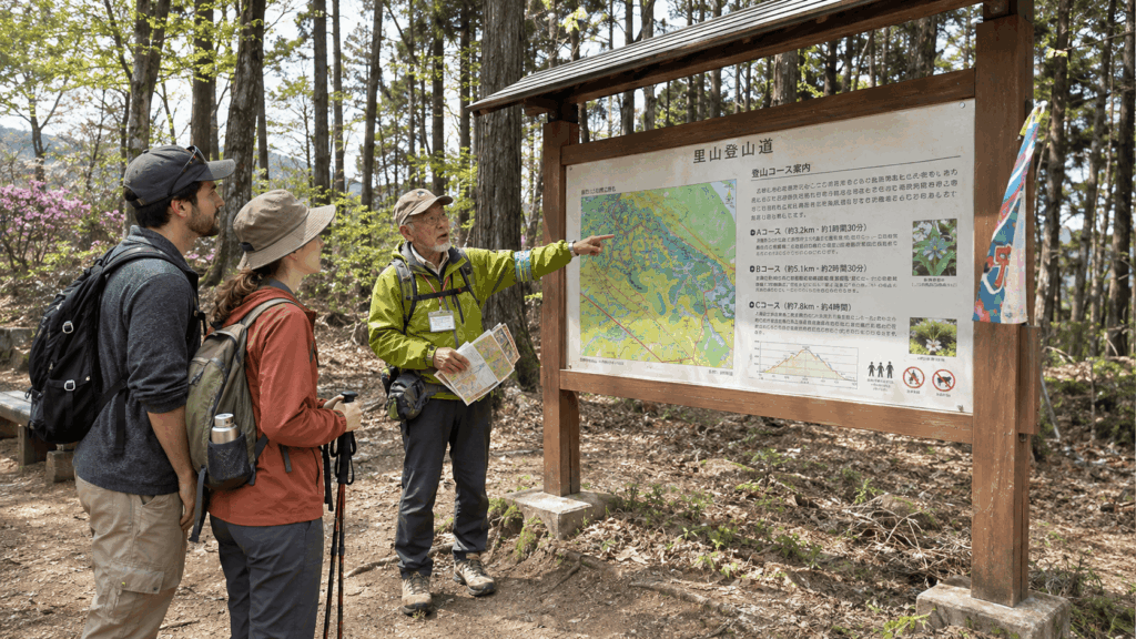
Two conditions matter more than the price. First, the operator grades the walking as moderate and does not recommend it for people with very low fitness — it is a fuller day on the mountain than the cable-car version described above. Second, travellers with tattoos are taken to a different hot spring about 35 minutes away, so the onsen stop will not be the station-side bath.
If neither of those applies and you simply want the day arranged, it is a reasonable purchase. If you are comfortable on Trail 1 and mainly want to see the mountain, keep the money and buy lunch at the summit instead.
If you want the temple stories, lunch arrangements and onsen experience handled together — and you’re comfortable with a moderate hike — this is the guided option worth a closer look.
Why I’d book this one
- More context than a self-guided walk: Recent travelers frequently highlight the guides’ local knowledge and explanations of Mt. Takao’s cultural sites.
- A more manageable group experience: Reviews also mention attentive pacing and adjustments for walkers who need more time, though the tour still requires moderate fitness.
- A full day without assembling every stop: The itinerary combines mountain sightseeing, local lunch and an onsen visit. You can review the current cancellation terms and what’s included before deciding.
See live availability, start times, and recent traveler reviews for the Mt. Takao guided tour.
Easy Hikes Near Tokyo: FAQ
What is the easiest hike near Tokyo?
Mt. Takao’s Trail 1, with the cable car for the middle section. It is paved from bottom to top, wide enough to walk two abreast, signposted in English, and reached by a direct train from Shinjuku. The cable car removes the steepest part of the climb, and the temple at the halfway point gives you a natural place to turn around if the day is going badly. Just do not read “easiest” as “flat”: you still face a 108-step staircase or a gentler slope beside it, and a long run of steps above Yakuoin Temple.
Can you hike near Tokyo in sneakers?
On Trail 1 in dry weather, yes — as long as they have tread. On Trail 6, the Mt. Mitake Rock Garden and the Kamakura ridge after rain, grip matters more than cushioning, and smooth-soled fashion trainers are a poor choice. On Mt. Hiwada’s Otokozaka route you may need to use your hands on rock, which is a different question from footwear entirely. If you are only packing one pair of shoes for the whole trip, choose the grippiest everyday pair you own and save the smooth ones for the city.
Can you visit Mt. Takao without a guide?
Yes, and most people do. The route is a single well-marked trail from a station 50 minutes from Shinjuku, the cable car is straightforward to use, and there is food and drink on the mountain. The two things that actually trip people up are not navigation: the confusingly similar station names (Takao, Takaosanguchi, Takaosan) and the fork between Otokozaka’s 108 steps and the gentler Onnazaka slope. A downloaded map and five minutes of reading solve both.
Which hike near Tokyo is best for beginners who love nature?
Mt. Takao’s Trail 6 if you want water and forest without a long journey, or the Mt. Mitake Rock Garden if you are willing to spend an extra hour each way for a quieter, wetter valley. Trail 6 is the better first choice: it is the same distance and climbing time as Trail 1, and you can descend by Trail 1 if the ground is wet. Mitake is more impressive but demands more of the day, and its stream path includes rock, roots and a steep optional detour to Nanayo Falls.
Can you see Mt. Fuji from Mt. Takao?
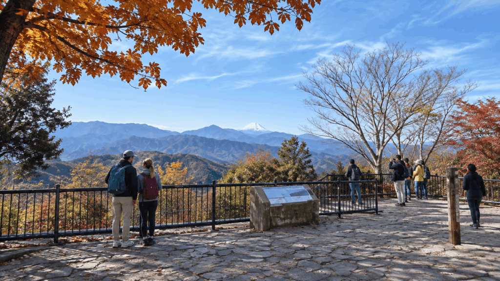
Sometimes. The summit has open views to the west, and on clear days — most likely in winter — Mt. Fuji is visible from the top and from a few points on the way up. It is weather, not scheduling, that decides this, so do not build the day around it. If seeing Fuji is a priority for your trip, treat Mt. Takao as a bonus rather than the plan, and check the forecast on the morning you go.
How long does a Mt. Takao hike take?
Using the cable car, allow five to six hours door to door from central Tokyo, including the train, the walk to the summit, lunch and the descent. Walking the whole of Trail 1 both ways adds roughly another hour and a half of walking. If you also stop at the onsen at Takaosanguchi Station, add an hour — which is the difference between a half-day outing and a full one.
Final Verdict: Which Hike Fits You?
Choose Mt. Takao’s Trail 1 if this is your first hike in Japan, you are travelling with someone whose fitness differs from yours, or you want the option to cut the day short. It has the most exits, the most facilities and the least risk of a wasted day. Take the cable car, walk the Onnazaka slope rather than the 108 steps, and accept that the last stretch above the temple will still cost you some effort.
Choose Trail 6 if you have done Trail 1 before, you want stream, stone and forest rather than pavement, and the forecast is dry. Plan to come down Trail 1, especially during the autumn restrictions, and wear shoes you trust on wet roots.
Choose Mt. Mitake if scenery matters more to you than convenience and you are happy to give the mountain a full day. Take the cable car, do the Rock Garden loop, and skip Nanayo Falls if anyone in the group is unsure on steep ground. Do not choose it expecting a flat valley walk.
Choose Kamakura if you want temples, shrines and a forest ridge in one day, and you would rather end at the Great Buddha than at a summit. Budget three hours for the trail and its stops, not one, and start at Kita-Kamakura so the climbing comes first.
Choose Mt. Hiwada if you specifically want a short climb to a summit, you are comfortable with a 25-minute walk to the trailhead, and you do not need shops or a cable car. Take Onnazaka both ways unless you are confident on rock.
Skip all five if you need level ground, cannot manage stairs, or want a paved promenade. Every route here climbs, and the gentlest of them still has a staircase. A riverside walk or a garden will give you a better day than a mountain you spend worrying about.
For first-time visitors: Trail 1. For families with young children: Trail 1 with the cable car, turning back at Yakuoin Temple if needed. For a tight schedule: Trail 1, cable car both ways, summit and back in under four hours on the mountain. For repeat visitors: Trail 6 on a dry weekday, or Mitake if you have never given it a full day.
Hi, I’m Kai. I’m a Tokyo-based travel writer, tourism industry insider, and the author of a published guidebook for international visitors to Japan. With over 10 years of professional experience at a leading Japanese tourism company, my mission is to help you skip the tourist traps and navigate Japan’s best destinations like a local. I believe the perfect day trip is like a traditional kaiseki meal: a beautiful balance of precise planning and unforgettable seasonal discovery. When I’m not out conducting field research, you’ll usually find me drafting new itineraries with one of my favorite fountain pens!