
The Jogasaki Coast trail runs for roughly 9 km along the lava cliffs of the Izu Peninsula, but almost nobody needs to walk all of it. If your goal is the Kadowaki Suspension Bridge and the view from the cliff, the shortest approach is about 800 m through forest, about 1.2 km along the coast from the Flower Garden side, or a three-minute walk from Kadowaki Parking. The 9 km figure only applies if you link the Picnical Course with the Nature Study Trail.
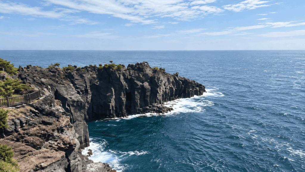
This guide sets out the official map, the real distances and walking times, and what the footing is actually like. It draws on the official Izu course guides and on the forest section I walked with overseas guests in 2025, which is where most of the practical detail below comes from.
Best for first-time visitors: a short walk to Kadowaki Suspension Bridge, either from Kadowaki Parking or from the Flower Garden side.
Best for hikers: the Picnical Course (about 3 km) or the Nature Study Trail (about 6 km).
Best footwear: broken-in shoes with decent grip. Parts of the path are lava rock, not pavement.
Visiting from Tokyo for the coastal views rather than a full hike? A private guided Izu day trip can combine Kadowaki Suspension Bridge with Mount Omuro while taking care of the transport. Check the private Izu day tour’s itinerary, flexible stops and available dates before deciding whether to travel independently. If walking the 3 km or 6 km trail is your main goal, the independent routes below are a better fit.
Which Jogasaki Coast Trail Should You Choose?
Choose by time and by what you want under your feet, not by the headline distance. If you have half a day or less and want the bridge, take one of the short approaches from the Flower Garden side or park at Kadowaki. If walking itself is the point, the Picnical Course is the classic coastal section, and the Nature Study Trail adds the quieter southern half.
The table below uses the distances published by the Ito City Tourism Association and the New York Lamp Museum & Flower Garden, which owns the Flower Garden end of the short routes. They are official approximations, not GPS measurements.
| Route | Approx. distance | Walking time | Best for | Notes |
|---|---|---|---|---|
| Kadowaki Parking to the bridge | About 180 m | About 3 min | Anyone who only wants the bridge | Shortest access; paved |
| Forest Course (from Flower Garden) | About 800 m | About 10 min | First-timers, tight schedules | One way; relatively flat |
| Coastal Walking Course (from Flower Garden) | About 1.2 km | About 20 min | Ocean views over speed | One way; rougher footing |
| Picnical Course | About 3 km | About 90 min | A half-day coastal walk | Bora Naya to the Izu Kaiyo Koen area |
| Nature Study Trail | About 6 km | About 3 hr | Fit hikers with a full afternoon | Ends near Yawatano Port |
| Both courses combined | About 9 km | About 4.5 hr | Full-day hikers | Walking time only, no stops |
Three things about those numbers matter more than the numbers themselves. The 800 m and 1.2 km figures are one way, so a return trip doubles them. The 9 km is the two courses added together, not a loop you are expected to complete. And the 4.5 hours is walking time alone; add photo stops, the bridge, the lighthouse and a rest, and a full crossing easily becomes a five- to six-hour day.
The Best Short Walk for First-Time Visitors
If the suspension bridge is the reason you are coming, you do not need to plan a hike. There are two sensible short approaches. Drivers can park at Kadowaki Parking and walk about three minutes to the bridge. Travellers coming from Izu-Kogen or the Flower Garden side can walk the 800 m forest route or the 1.2 km coastal route, both of which end at the same place.
The mistake I see first-time visitors make is treating the Flower Garden as a museum stop and the bridge as a separate destination. They are on the same path. If you are already at the Flower Garden, you are roughly ten minutes from one of the best-known views on the Izu coast, and you do not need hiking gear to get there.
Note the spelling while you are searching: official Izu materials write Picnical, not Picnic. That small difference sends a lot of people to the wrong search results and the wrong map labels.
Longer Routes for Hikers
The Picnical Course is the section most people picture when they think of Jogasaki: the bridge, the lighthouse, the black lava shelves and the waves hitting them. At about 3 km and 90 minutes it is a proper walk rather than a stroll, but it is still a half-day commitment at most.
The Nature Study Trail continues south and changes character. It is about 6 km and around three hours, and it passes Renchakuji Temple, Hashidate Suspension Bridge, the Tajima Falls observation deck and Yawatano Port before turning inland toward Izu-Kogen Station. Joining the two gives you the 9 km figure.
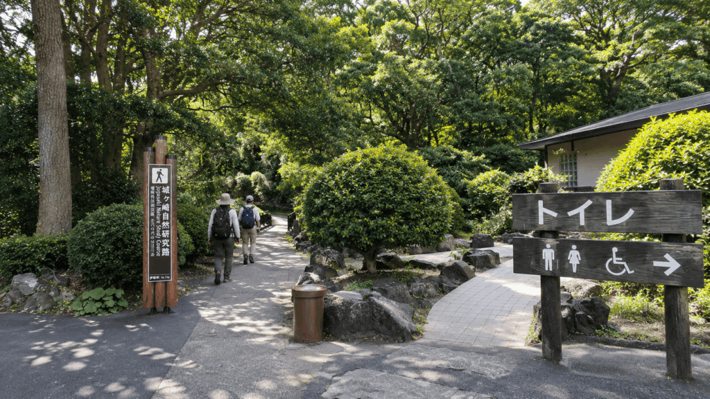
To be clear about what this article is based on: I walked the forest section from the Flower Garden side and spent time at the bridge and the shop area. I have not walked the full 9 km or the Nature Study Trail, so everything below about those sections comes from the official course guides and from patterns in other travellers’ reports, not from my own feet.
Jogasaki Coast Trail Map: How to Read the Official Route
The map worth carrying is the guide map published by the Ito City Tourism Association, which covers the Picnical Course and the Nature Study Trail on a single sheet. Use it to understand the shape of the coast: where the courses start and finish, where the bridge and lighthouse sit relative to each other, and which end of the trail connects to which station.
Use Google Maps for a different job. It is good at getting you to a station, a car park or a museum entrance. It is not reliable for the coastal footpath itself, because parts of the route run along narrow cliffside paths that do not appear as walkable roads. If Google tells you a route looks impossible or sends you onto the main road, trust the official map and the on-site signs instead.
Download the Official Jogasaki Coast Trail Map
The tourism association publishes the official Jogasaki Picnical Course and Nature Study Course guide map (PDF). Save it to your phone before you leave your hotel, since signal along the cliff sections is not something to rely on.
One caution: the PDF is an older scanned document. It is useful for the layout of the routes and the position of landmarks, but do not take prices, opening hours or bus times from it. Those need checking against the operator’s current information on the day.
Key Landmarks and Where to Start
The coast runs roughly north to south, and knowing that order solves most of the confusion. From the north: Futo Port, Bora Naya, the remains of a Bakumatsu-era gun battery, Kadokake Cape, Kadowaki Suspension Bridge, Kadowakisaki Lighthouse, the New York Lamp Museum & Flower Garden, and Izu Kaiyo Koen. South of that come Renchakuji Temple, Hashidate Suspension Bridge, the Tajima Falls observation deck and Yawatano Port, with Izu-Kogen Station inland from the southern end.
That gives you three realistic starting points. By car, Kadowaki Parking puts you three minutes from the bridge. By train, Jogasaki-Kaigan Station is about a 35-minute walk from the Kadowaki area, which surprises people who assume the station is at the coast. For the longer southern routes, start from the Izu-Kogen Station side or take the bus to the Izu Kaiyo Koen stop and walk in from there.
The habit that makes the map readable is deciding your start before you look at it. Find the bridge first, then find your station or car park, then trace only the segment between them. Reading the whole 9 km at once is what makes the map feel complicated.
The Best Short Walk to Kadowaki Suspension Bridge
Both short routes start from the New York Lamp Museum & Flower Garden side and finish at the same bridge, so the choice comes down to what you want to look at on the way. They are short enough that you can walk one in and the other back if you have an hour to spare.
| Route | Distance (one way) | Terrain | Best for |
|---|---|---|---|
| Forest Course | About 800 m, 10 min | Relatively flat, tree cover | Speed, wind, young children |
| Coastal Walking Course | About 1.2 km, 20 min | Lava rock, short climbs | Views and photography |
Forest Course: The Shorter Route
About 800 m and roughly ten minutes one way, this is the flattest and quickest way to the bridge. The path runs through trees rather than along the cliff edge, which makes it the better choice in strong wind, in light rain, or with children who will not enjoy a drop beside them.
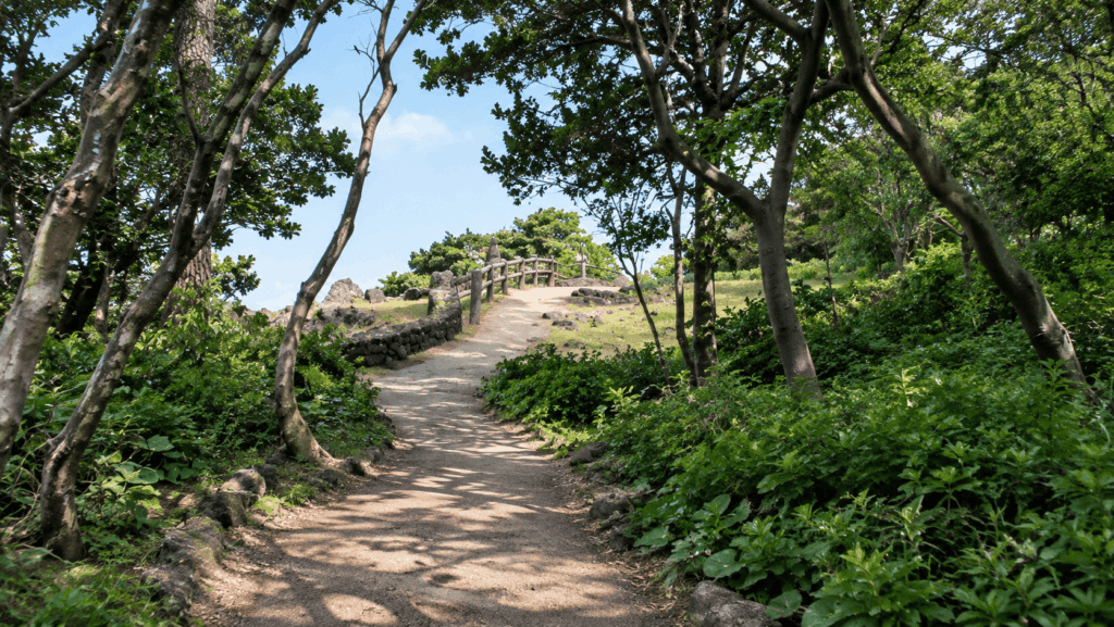
It is also the section where wildlife turns up. On the walk in with guests we came across a wild squirrel on the path, and it was the thing they photographed most that morning. Treat that as a possibility rather than a promise: squirrels are wild, the path is narrow, and standing quietly for a minute is more productive than chasing one for a photo.
Coastal Walking Course: For Ocean Views
About 1.2 km and around 20 minutes one way. This route uses the lava terrain directly, so you get the black rock shelves and the open water almost the whole way, but the surface is less even and there are short climbs and drops. It is the better half of the pair for photography and the worse half for anyone who wants a guaranteed smooth path.
I did not walk this section on that trip, so I will not describe it as if I had. What the official material and other walkers’ reports agree on is simple: the views are the reason to take it, and the footing is the reason to take your time.
Kadowaki Suspension Bridge and Lighthouse
The bridge is 48 m long and about 23 m above the water, and it is free to cross. It spans a gap between rock walls that the sea has cut into the lava, which is why the view from the middle is more dramatic than the modest height suggests. On a clear day you can see Izu Oshima offshore.
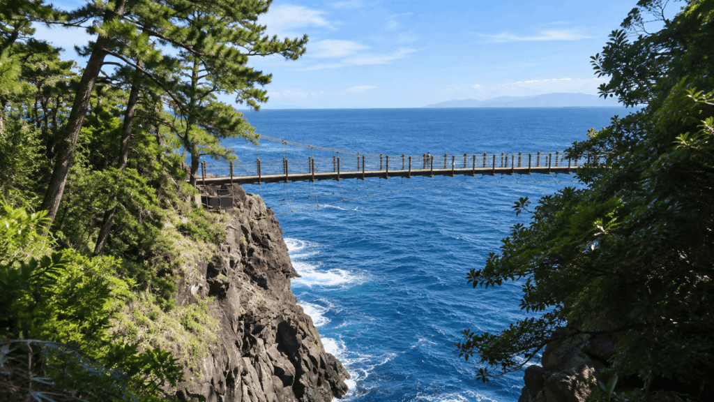
If heights are a problem, you have an option that many visitors miss: you do not have to cross. The Kadowakisaki Lighthouse stands on the near side, with a free observation deck roughly 17 m above ground, and the view back toward the bridge and along the cliffs is arguably the better photograph anyway. The lighthouse itself is 24.9 m tall and is generally open during the day, closing earlier in winter.
Kai’s tip: The wind on the bridge is stronger than it looks from the approach, and the deck moves more than first-timers expect. Put your phone in a zipped pocket or on a wrist strap before you step on, and hold the handrail with your free hand rather than trying to film while walking. If the sway bothers you, cross once without stopping, look back from the far side, and come back at your own pace.
Hiking the Picnical Course and Nature Study Trail
The two long courses are where the 9 km figure comes from, and they are genuinely different walks. The Picnical Course is the coastal showpiece. The Nature Study Trail is longer, quieter and more about the vegetation and the southern coves than about one big view.
Picnical Course: The Classic Coastal Walk
About 3 km and roughly 90 minutes, running between the Bora Naya area in the north and Izu Kaiyo Koen in the south. The bridge, the lighthouse and the shop cluster sit roughly in the middle, which is why so many people walk only this section and then turn around.
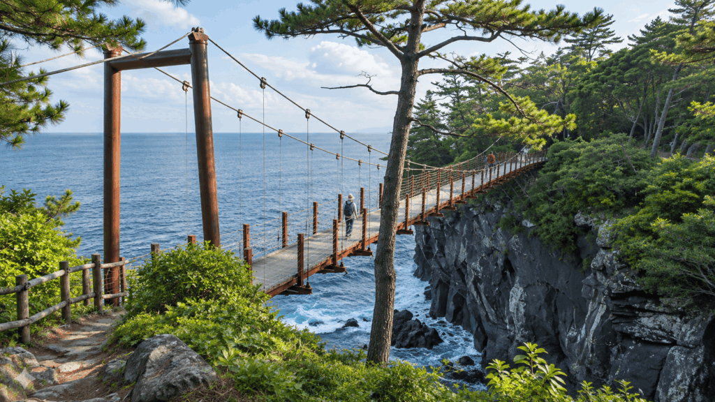
The 90 minutes is walking time. It does not include the time you will spend on the bridge, up the lighthouse, or sitting with an ice cream, and it does not include the climb back if you return the same way. Budget two and a half hours for the round trip and you will enjoy it more than if you try to hit the official number.
Nature Study Trail: The Longer Hiking Option
About 6 km and around three hours, continuing south past Renchakuji Temple, Hashidate Suspension Bridge, the Tajima Falls observation deck and Yawatano Port. From the Yawatano Port end it is roughly another 30 minutes inland to Izu-Kogen Station, which is the detail that turns a three-hour walk into a four-hour outing.
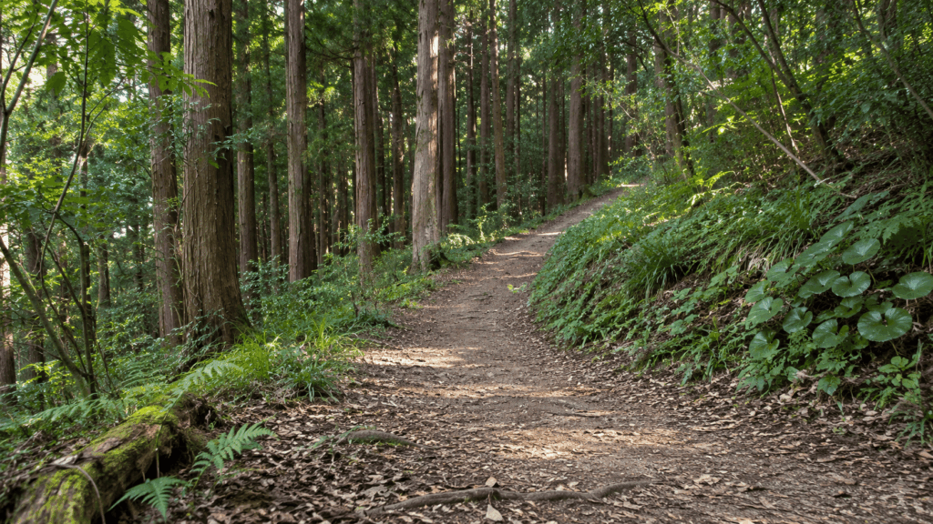
This is the section I have not walked. Reports from people who have tend to mention the same two things: stone steps and uneven sections that slow you down more than the distance suggests, and the fact that the second half is much quieter than the bridge area. Both fit the official description of a nature study route rather than a promenade.
The planning question here is your exit, not your entry. Decide before you start whether you are walking back to the bridge, finishing at Izu-Kogen Station, or arranging a pickup, because the southern end is not a place where you can improvise a taxi.
How Difficult Is the Jogasaki Coast Trail?
Difficulty here is about footing and weather, not distance. The paths are maintained and signposted, and none of the official routes require scrambling or specialist equipment. But maintained does not mean flat, and the lava terrain gives you rock shelves, stone steps and short steep sections even on the short approaches.
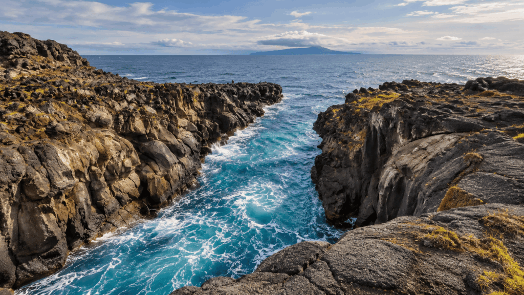
Think of it in three grades. The forest route and the car park approach are easy and suitable for almost anyone. The coastal route and the Picnical Course are moderate: fine in trainers, tiring in heat, and slower than the distance implies. The Nature Study Trail is a half-day walk that assumes you are used to being on your feet for three hours.
What Shoes Should You Wear?
Kai’s tip: “”Well maintained”” on a Japanese trail sign means the path is looked after, not that it is smooth. On the forest section I was glad I had told my guests in advance to bring broken-in trainers rather than sandals or new shoes, because the last stretch to the bridge has rock and steps that punish smooth soles. If you are doing the 3 km or 6 km routes, or it has rained recently, proper walking shoes with grip are worth the luggage space.
For the short routes, any comfortable shoe you have already walked a few kilometres in will do. Avoid flip-flops, smooth-soled fashion trainers and anything you are wearing for the first time. For the longer routes, add grip and ankle support, and expect wet rock near the water even on a dry day.
Wind, Waves and Cliff Safety
The coast faces open water, and conditions change faster than the forecast suggests. Do not climb or lean over the railings, do not walk out onto wet rock ledges for a photo, and do not rock the suspension bridge or run across it. The bridge has a handrail for a reason, and the wind can gust hard enough to make an unsecured hat or phone a genuine loss.
In strong wind or heavy rain, shorten the plan rather than pushing through. The forest route exists precisely for that situation. Sections of the coast path can also close after storms or for repair work, so check the Ito City Tourism Association or Izu Peninsula Geopark notices on the day rather than relying on a blog post, including this one.
How to Get to Jogasaki Coast Trail
The most common planning error is adding the station walk to the course time and assuming it is all one pleasant stroll. It is not. Getting to the trailhead and walking the trail are two separate legs, and on public transport the second leg is the easy one.
By Train and Bus
Jogasaki-Kaigan Station on the Izu Kyuko Line is about a 35-minute walk from the Kadowaki area. It is a small station with no taxi rank to speak of, so if you arrive expecting to be at the coast, you will be walking through a residential area first.
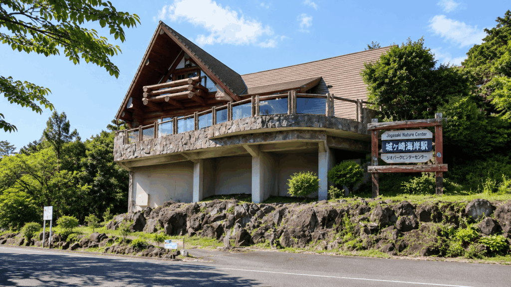
The more comfortable public transport option is the bus. From Izu-Kogen Station, take the Ocean Park bound bus from stand 2; it reaches the Izu Kaiyo Koen stop in around nine minutes, from which it is roughly a 20-minute walk to the bridge area along the coastal route. Buses also run from Ito Station, but the ride is closer to 40 minutes. Timetables and last-bus times change with the season, so check the Tokai Bus information for your date rather than planning around a number you read online.
For the return, decide early. If you walk the full 9 km you will finish at the opposite end from where you started, and the bus stop you need is not the one you arrived at.
By Car: Parking and Trail Access
Kadowaki Parking is the practical choice if the bridge is your priority: 123 cars and 3 micro buses, 15 minutes free and then 500 yen for the day, with the bridge about three minutes away on foot. Prices and capacity are the kind of detail that gets revised, so treat that as a recent figure rather than a permanent one.
If you want to walk the forest or coastal route, park on the Flower Garden side instead and walk in from there; you will arrive at the bridge from the south rather than stepping straight onto it. And if you plan to walk one way and finish at Izu-Kogen, remember that your car will be at the other end of the coast.
Best Time to Hike and Where to Rest
Early morning is the reliable answer for the bridge area. The light is better for photographs, the car park has space, and the path is quiet enough to hear the water. Late afternoon is the second-best window, though you lose the light earlier in winter and the shop may close before you finish.
June is the exception to all of this. The hydrangeas along this coast are a genuine draw, and the bridge and car park get correspondingly busy. If you are coming for the flowers, come early and expect company.
Avoiding Crowds at the Suspension Bridge
Kai’s tip: The bottleneck is not the trail, it is the last few hundred metres. On a weekend afternoon I have watched cars queue for the Kadowaki car park while the bridge itself turned into a slow-moving line of people taking the same photograph. Arriving before mid-morning changes the experience completely, and it also means you are walking back out when everyone else is still arriving.
If you cannot manage an early start, aim for the far end of the day instead and accept a shorter visit. What you want to avoid is arriving at midday on a holiday weekend with a car and a fixed schedule.
A Stop at Jogasaki View Terrace
The shop by Kadowakisaki Lighthouse, Jogasaki View Terrace, sells ice cream, soft cream and souvenirs, and it is the natural full stop after the bridge. Walking back with a soft cream while the waves hit the lava below is the part of the day guests tend to remember, more than the crossing itself.
The shop changed operator in March 2026 and is now run by the Izu Shaboten group, so opening hours and the menu are worth checking on the day rather than assuming. Bora Naya, the thatched seafood restaurant near the northern end of the Picnical Course, is the other sit-down option; it generally serves lunch, closes one day a week, and can shut early in bad weather.
Independent Hike vs Guided Walk vs Tokyo Day Tour
There are three realistic ways to do this, and they suit different people. The important thing to understand before comparing them is that a sightseeing day tour from Tokyo is not a hiking product. The listed itineraries allow roughly 40 minutes around the Jogasaki Coast and the bridge, which is enough for the view and not enough for the 3 km course, let alone 9 km.
| Option | Best for | Main advantage | Main limitation | Booking |
|---|---|---|---|---|
| Independent hike | Walkers with a free half or full day | Your own pace, any route, any start time | You manage trains, buses and the return leg | None |
| Local guided walk | Travellers who want the geology explained | Interpretation of the lava landscape and safety guidance | Fixed dates, small group, advance reservation | Required, about a week ahead |
| Tokyo sightseeing day tour | Visitors who want the view without the logistics | Transport and other sights handled in one day | Roughly 40 minutes on the coast; not a hike | Required |
For travellers based in Tokyo who want the Jogasaki Coast scenery without coordinating trains, buses and return connections, a private Izu day trip is worth comparing with a self-planned visit. It makes the most sense when the bridge and surrounding sights matter more than completing a hiking route.
Why I’d book this one
- More flexibility at Jogasaki: The private itinerary offers room to discuss spending more time at the coast rather than another attraction, subject to the operator’s arrangements.
- Fewer transport decisions: Private transport, Tokyo hotel pickup and an English-speaking driver-guide are listed, reducing the need to plan separate connections across the Izu Peninsula.
- A clear choice for sightseeing: It combines the coastal viewpoint with other Izu highlights in one day. It is not a guided hike along the 3 km Picnical Course or the full 9 km trail.
See live availability, current prices, itinerary options and cancellation terms for the private Izu Peninsula day tour. Check how much time the operator can allocate to Jogasaki before booking, especially if you want more than a brief stop at the bridge.
When to Hike Independently
Walk independently if you have the time, you are comfortable reading a map, and you actually want to be on the path rather than at the viewpoint. The routes are signed, the short options are genuinely short, and the freedom to stop for twenty minutes at the bridge is the whole point. The cost of that freedom is that you own the return journey.
When a Guided Walk or a Day Tour Makes Sense
The Izu Peninsula Geoguide Association runs a Kadowaki Suspension Bridge course of about 2.5 km and 120 minutes, meeting at the Bora Naya car park, at 3,000 yen for adults and 1,500 yen for primary school children, with reservations about a week in advance. It runs in light rain and cancels in storms, and the association asks for proper footwear rather than sandals. The English page exists, but confirm that the guide will actually be in English when you book.
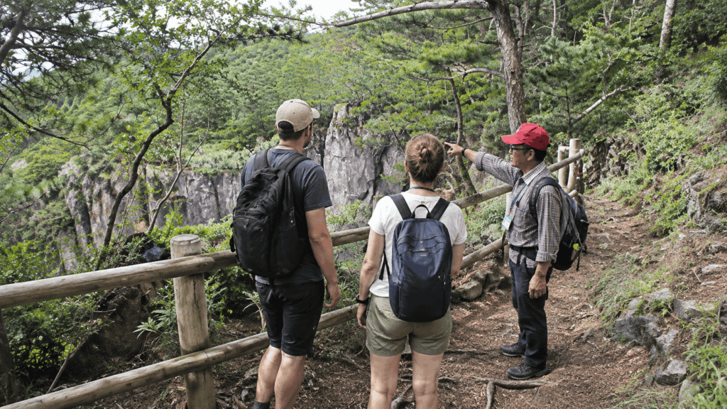
A Tokyo day tour makes sense for a different reader: someone based in Tokyo who wants the Jogasaki view plus Mount Omuro or the Izu Shaboten Zoo in a single day, with an English-speaking guide and no timetable to build. Free cancellation is typically available up to 24 hours before, and the day runs long, roughly seven in the morning to early evening. What it will not give you is a walk. If your reason for coming is the Picnical Course, book the local guide or come independently instead. If you prefer to walk independently but want something closer to the capital, check our comparison of 5 easy hikes near Tokyo by train.
Before You Hike: A Quick Checklist
- Shoes you have already walked in, with grip rather than smooth soles
- Water, even in cool weather; the cliff sections have little shade
- The official map saved offline on your phone
- Today’s wind and rain forecast, and a shorter route in mind if it turns
- Current notices from the tourism association or geopark about closures
- A decided return leg: same route back, a station, or a booked pickup
- Phone secured in a pocket or on a strap before you step onto the bridge
Frequently Asked Questions
How long is the Jogasaki Coast trail?
The signed routes add up to roughly 9 km along the coast, but that is two courses joined rather than one trail you are expected to complete. The Picnical Course is about 3 km and the Nature Study Trail about 6 km. If you only want the suspension bridge, the short approaches from the Flower Garden side are about 800 m through forest or about 1.2 km along the coast, both one way, and Kadowaki Parking puts you about three minutes from the bridge.
Is the Jogasaki Coast trail difficult?
No section requires scrambling or specialist equipment, and the paths are maintained and signposted. The difficulty comes from the surface: lava rock, stone steps and short steep sections, plus wind and spray near the water. The forest route and the car park approach are easy, the coastal route and Picnical Course are moderate, and the Nature Study Trail is a half-day walk best suited to people who are comfortable on their feet for three hours.
Do you need hiking shoes for Jogasaki Coast?
Not for the short routes. Broken-in trainers with some grip are enough for the 800 m forest path or the walk from Kadowaki Parking. For the 3 km or 6 km routes, or after rain, proper walking shoes are worth it. Avoid flip-flops, smooth-soled fashion trainers and anything you are wearing for the first time, since wet rock near the water is slippery even on a dry day.
Can you visit Kadowaki Suspension Bridge without hiking the entire trail?
Yes, and most visitors do. From Kadowaki Parking it is about a three-minute walk. From the New York Lamp Museum & Flower Garden side it is about ten minutes on the forest route or about twenty on the coastal route, both one way. The bridge is 48 m long, about 23 m above the water and free to cross, and if heights bother you, the lighthouse observation deck on the near side gives you the view without the crossing.
Can you hike Jogasaki Coast without a car?
Yes, with two separate legs to plan. Jogasaki-Kaigan Station is about a 35-minute walk from the Kadowaki area, and from Izu-Kogen Station the Ocean Park bound bus reaches the Izu Kaiyo Koen stop in around nine minutes, followed by roughly twenty minutes on foot to the bridge. The part people underestimate is the return: if you walk the full route you finish at the opposite end, and the last bus back is not something to leave to chance.
Is any part of the trail currently closed?
A section between Futamata and Bora Naya was closed for path repairs from August 2024 to the end of March 2025, and that work has finished. Storm damage and maintenance can still close short sections at short notice, so check the Ito City Tourism Association and Izu Peninsula Geopark notices for your dates. Local signage overrides anything you read online, including this article.
Final Verdict: Which Route Fits Your Trip
The right choice here is not the longest walk you can manage. It is the one that matches the time you actually have and the reason you came.
Choose the short Flower Garden route if you are a first-time visitor whose main goal is the bridge and the cliff view. Take the 800 m forest path in and, if the weather is kind and your shoes are up to it, the 1.2 km coastal path back. That is an hour of walking with the best scenery on the coast in the middle of it.
Choose Kadowaki Parking and nothing else if you are travelling with young children, have limited mobility, or are fitting Jogasaki into a day that already includes Mount Omuro or Izu Shaboten Zoo. Three minutes from the car to the bridge is not a compromise; it is the correct plan for that day.
Choose the Picnical Course if you want a real walk without giving up the whole day. Three kilometres and about 90 minutes between Bora Naya and Izu Kaiyo Koen, with the bridge and lighthouse in the middle, is the version most hikers actually enjoy. Add time for photographs and a stop at Jogasaki View Terrace.
Choose the Nature Study Trail if you have already seen the bridge, or you want the quieter southern coast and the temples and coves beyond it. Six kilometres, about three hours, finishing near Yawatano Port with roughly another 30 minutes to Izu-Kogen Station. Decide your exit before you start.
Choose the guided geology walk if you want to understand what you are looking at. The Geoguide Association’s Kadowaki course covers about 2.5 km in 120 minutes with someone explaining the lava formations, which is a different experience from walking the same ground alone. Confirm the guiding language when you book.
Choose the Tokyo day tour only if the coast is one stop on a broader sightseeing day and you are happy with roughly 40 minutes at the bridge. It solves transport and language, and it is a poor fit for anyone who wants to walk the Picnical Course or reach the southern end of the coast. If the hike is the point, do not book it.
And if you take one thing from this guide: the 9 km is an option, not an entry requirement. The bridge, the lava cliffs and the view from the lighthouse are all reachable in under half an hour of walking, which is why so many people who “”hike Jogasaki”” never actually leave the northern kilometre. For another accessible natural highlight in the region, see our guide to visiting Joren Falls.

Hi, I’m Kai. I’m a Tokyo-based travel writer, tourism industry insider, and the author of a published guidebook for international visitors to Japan. With over 10 years of professional experience at a leading Japanese tourism company, my mission is to help you skip the tourist traps and navigate Japan’s best destinations like a local. I believe the perfect day trip is like a traditional kaiseki meal: a beautiful balance of precise planning and unforgettable seasonal discovery. When I’m not out conducting field research, you’ll usually find me drafting new itineraries with one of my favorite fountain pens!